Download
1 / 34
340 likes | 365 Views
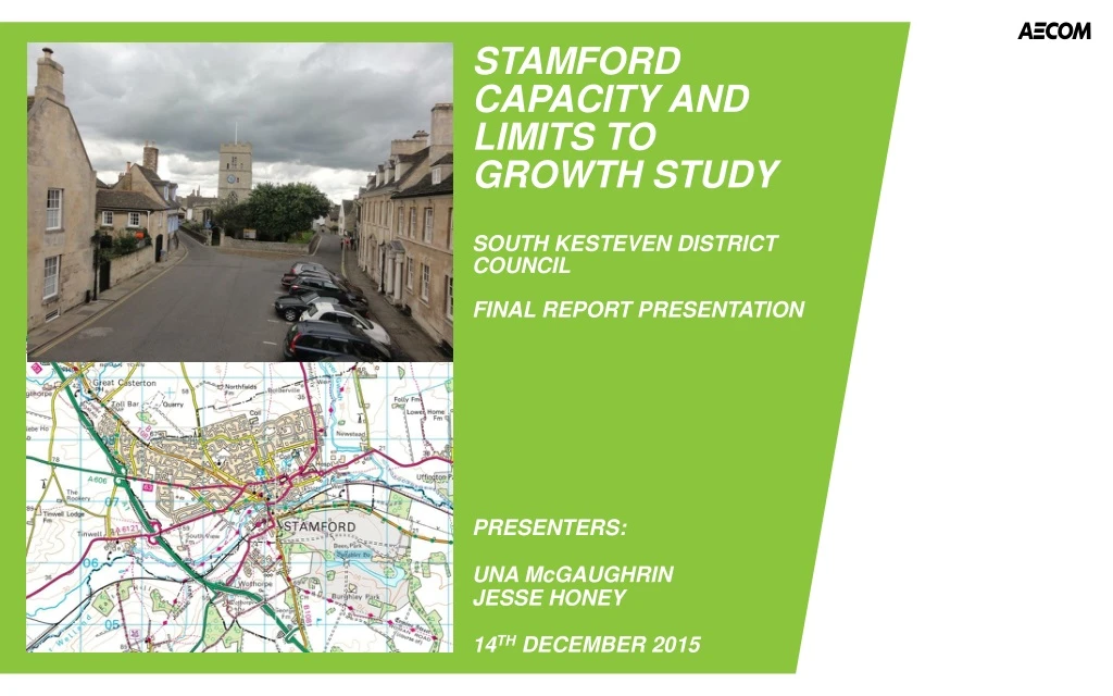
This report presents the findings of the capacity and limits to growth study commissioned for Stamford. The study assesses the suitability of land for residential and employment development, taking into consideration various constraints such as flood risk, environmental impact, agricultural land, heritage assets, and transportation. The study identifies 4,399 dwellings and 26.5 hectares for employment development. The next steps include considering the impact of development on existing infrastructure and consulting local opinions for land allocation decisions.

E N D
STAMFORD CAPACITY AND LIMITS TO GROWTH STUDYSOUTH KESTEVEN DISTRICT COUNCILFINAL REPORT PRESENTATION PRESENTERS: UNA McGAUGHRIN JESSE HONEY 14TH DECEMBER 2015
The CONTEXT • Capacity and limits to growth study commissioned for Grantham in early 2015 • Similar exercise commissioned for Stamford in summer 2015 • Aim- to determine extent of land at urban edge suitable in principle for residential and employment development • Capacity of urban/infill/brownfield sites captured through other work – this will be considered alongside the findings of this study • Both studies are just the start of the process, the next steps include consideration of the impact of development on existing infrastructure • …as well as full consultation to ensure local opinion informs decisions on allocation of land for any development
STUDY SCOPE AND OBJECTIVES • Study focuses on suitability of land for development • No upper limit or ‘target’ on extent of land • Extensions to Stamford only- not other settlements • ‘Border-blind’ approach • Opportunities assessed alongside constraints • Technical, impartial and objective assessment
consultation • Anglian Water • Historic England • Environment Agency • Highways England • Homes and Communities Agency • Lincolnshire County Council (covering infrastructure, education, highways, minerals and waste and flood risk) • Lincolnshire Local Economic Partnership • Greater Cambridge Greater Peterborough Local Economic Partnership • Natural England • Western Power Distribution.
METHOD • AECOM technical specialists contributed (transport, ground conditions, flood risk, landscape, heritage, infrastructure, economics) • Study divided into Part A (strategic considerations), followed by Part B (specific considerations) • Part A divided land at urban edge into Directions for Growth, then assessed each Direction using a traffic-light approach • Part A reduced the suitable land down to smaller areas which were assessed in more detail through Part B • Part B, informed by site visits, enabled detailed judgements on land suitability by location, resulting in drafting boundaries of suitable land
Directions for growth: Transport • Issues considered in the transport assessment included: • Configuration, capacity and quality of existing transport networks and facilities, linking potential growth areas to the town centre and adjacent communities and vice versa • Corridors and nodes presenting opportunities for extension or enhancement based on travel patterns associated with the planned growth. • Accessibility (including on foot and by cycle), public transport routes and their potential capacity and constraints, and the location of potential growth sites in terms of their ability to be served by all modes of travel, but with an emphasis on minimising travel by car. • Results of stakeholder consultation
Part a: summary of transport results • Direction A – supported by Lincolnshire CC. Impacts on A1/A606 junction and A1/Town centre with SUE already planned. Amber rating. • Direction B – supported by Highways England (HE), LCC and Greater Cambridge LEP. Green rating. • Direction C – supported by HE but not by LCC due to lack of access to the A1. Impacts on A1/A606 and A1/A43 junctions. Amber rating. • Direction D – supported by HE. LCC state that road connections from the south into Stamford town centre are poor. Amber rating. • Direction E - LCC raise concerns that there is limited vehicular access to town centre , however good access to A1. Not supported by HE. Impacts on A1/A606 junction and A1/Town centre with SUE already planned. Amber rating. • Direction F – Growth would impact on operation of A1 link and A1/A606. Not supported by HE or LCC – A1 would create a barrier with existing urban area. Amber rating. • Direction G - Less impact on town centre and enabled by minor improvements to the road network. Growth would impact on A1 link and A1/A606. Not supported by HE or LCC for same reasons as Direction F. Favourable direction of growth for the Greater Cambridge LEP. Amber rating.
PART B- OVERALL CONCLUSION • In total, 176 hectares of land considered suitable in principle for residential and/or employment development • Most appropriate indicative density on this scale is around 25 dwellings per hectare • Therefore, capacity was found for 4,399 dwellings • Capacity for 26.5 hectares of employment development
NEXT STEPS • The study sets out where Stamford COULD grow, not where it SHOULD grow • Assess conclusions alongside other studies, such as Strategic Housing Market Assessment and Employment Land Review • Test results through consultation on policy documents based on this study • Consider any other relevant political or technical information outside the scope of this study • Consider benefits of ‘clustering’ development • Seek to balance new housing with new jobs • Ensure close co-ordination with infrastructure providers to ensure funding is in place and impacts are clear over phases of development
STAMFORD CAPACITY AND LIMITS TO GROWTH STUDYSOUTH KESTEVEN DISTRICT COUNCILFINAL REPORT PRESENTATION PRESENTERS: UNA McGAUGHRIN JESSE HONEY 14TH DECEMBER 2015