Download
1 / 32
320 likes | 412 Views
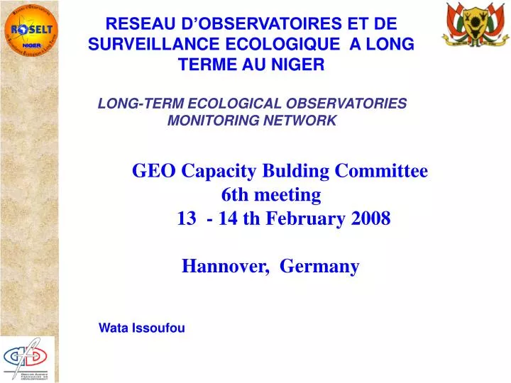
NIGER. RESEAU D’OBSERVATOIRES ET DE SURVEILLANCE ECOLOGIQUE A LONG TERME AU NIGER LONG-TERM ECOLOGICAL OBSERVATORIES MONITORING NETWORK. GEO Capacity Bulding Committee 6th meeting 13 - 14 th February 2008 Hannover, Germany. Wata Issoufou.

E N D
NIGER RESEAU D’OBSERVATOIRES ET DE SURVEILLANCE ECOLOGIQUE A LONG TERME AU NIGERLONG-TERM ECOLOGICAL OBSERVATORIES MONITORING NETWORK GEO Capacity Bulding Committee 6th meeting 13 - 14 th February 2008 Hannover, Germany Wata Issoufou
RESEAU D’OBSERVATOIRES DE SURVEILLANCE ECOLOGIQUE A LONG TERME LONG-TERM ECOLOGICAL OBSERVATORIES MONITORING NETWORK ________________________________________________________________________________________________________ Contribution à la mise en oeuvre de la convention de lutte contre la désertification en Afrique Contribution to the implementation of Convention to Combat Desertification in Africa --------------------------------------------------------------------------------------------------------------------------------------------------------------- Organes de coordination nationale : • Université des Sciences et de la Technologie Houari Boumedienne, /URBT (Algérie) • Departemento de Ciencias de Ambiente, INIDA ( Cap vert) • Department of Botany, Faculty of Science, University of Alexandria (Egypte) • Ministry of Agriculture, Pastoral Unit (Ethiopie) • Ministry of Water Resources (Kenya) • Institut d’Economie Rurale (Mali) • Division de Recherche et d’Expérimentations Forestières (Maroc) • Ministère du Développement Rural et de l’Environnement, DEAR (Mauritanie) • Ministère de l’Environnement et de la Lutte contre la Désertification (Niger) • Centre de Suivi Ecologique (Sénégal) • Institut des Régions Arides (Tunisie) Opérateur Régional ; Janvier 2001
SURVEILLANCE ECOLOGIQUE A LONG TERME LONG-TERM ECOLOGICAL MONITORING • Améliorer les connaissances sur les mécanismes, les causes, les conséquences, • et l’étendue de la désertification à travers : • Enhance knowledge on the mechanisms, causes, consequences and scope of • desertification through: • L’évolution à long terme des systèmes écologiques Thelong-term evolution of ecological systems • Le fonctionnement interactif système écologique/système socio-économiqueau niveau local The ecological/socio-economic system interactivity at the local level • La part respective et/ou synergie des causes climatiques et anthropiques sur la dégradation des terres The respective role and/or synergetic effects of climatic and man-made causes on land degradation Maigre culture du mil sur sol érodé Sparse millet crop on eroded soil Opérateur Régional ; Janvier 2001
SURVEILLANCE ECOLOGIQUE A LONG TERME LONG-TERM ECOLOGICAL MONITORING • Mettre en œuvre un système de surveillance environnementale à • long terme pour l’aide à la décision • Decision support from the implementation of a long-term • environmental monitoring system • Greffer des courts projets de recherches finalisées en réseau pour • alimenter la surveillance à long terme As a contribution to long-term monitoring, adjoining networked short-term research projects • Sur les mécanismes de désertification to desertification mechanisms • Sur desthématiques spécifiques • to specific themes • Rendre les connaissances utilisables par les gestionnaires et décideurs • du développement au niveaux local, national, sous-régional et régional Making data useable for managers and decision-makers working on development issues at the local, national, sub-regional and regional levels Opérateur Régional ; Janvier 2001
RESEAU D’OBSERVATOIRES NETWORK OBSERVATORIES • Un observatoire est un : • An observatory is • ensemble de moyens scientifiques, humains et matériels acollection of scientific, human, material resources • système organisé de collecte et de traitements des données: de la station au paysage, puis à la région écologique an organised system for data collection and processing: from the station to the landscape unit then to the ecological region • une demande de produits d’aide à la décision pour différents niveaux d’intégration spatiale a request for decision support products for various levels of spatial integration Opérateur Régional ; Janvier 2001
RESEAU D’OBSERVATOIRES NETWORK OBSERVATORIES
RESEAU D’OBSERVATOIRES NETWORK OBSERVATORIES • Suivi Monitoring : • Unkit minimum de données . à recueillir au moindre coût pour. Spatialisation A minimum set of datacollected at lowest costs for use in Spatialisattion . Extrapolation Extrapolation . Modélisation Modelling . pour valider et ajuster les prospectives. in order to validate and adjust prospects for the future. • Un système intégré de traitement de l’informationet desbases de données environnementales A integrated information processing system and environmental data bases • Diagnostic : caractérisation initiale et périodique Diagnosis initial and periodical characterisation • Prospective : évolution climatique, anthropique, changements technologiques Prospectsclimate, anthropic and technological change • Indicateurs : état, pression, réponse, impact Indicatorsstate, pressure, response, impact
Indicateurs de suiviécologique • Diversité des habitats • Composition floristique • Types biologiques • Types de distribution phytogéographique • Espèces dominantes • Productivité des stations • Indice de diversité alpha • Indice de diversité bêta • État de surface du sol • Espèces rares ? Les indicateurs sont collectés suivant un pas de temps appropriés, qui est annuel pour les indices de diversité alpha et béta.
Indicateurs définis à partir des cartes d’occupation et d’utilisation des terres Zone sahélienne caractérisée par une grande variabilité des états de surface
Exemple de la commune de Gabi (Région de Maradi) Carte d’occupation des terres en synchronique et en diachronique 1975 2006 Suivi de la dynamique des unités d’occupation des terres
Figure : Dynamique de l’occupation des terres entre 1975 et 2006 à Gabi Avec Cc : Complexe champ/jachère ; Gf : Galerie forestière ; Jach : Jachère arbustive ; Ds : Dépôt sableux colluvions (lit de rivière) ; Pa : Parc arboré à Acacia albida ; Rsub : Roche à affleurante à subaffleurante et Sar/arb : Savane arbustive à arborée
1992 1950 1975 71% 71% 12% 12% 36% 36% Nette extension des zones cultivées et des jachères Occupation des terres de 1950 à 1992 à Banizoumbou
Indicateurs de suivi de la biodiversité Exemples d’indicateurs: * Indice de diversité alpha : calculé à partir de l’indice de Shannon Figure : Évolution de l’indice de diversité alpha
Exemples d’indicateurs: * Indice de diversité béta : calculé à partir de l’indice de similitude de Sorensen Figure : Évolution de la diversité béta des 6 jachères de 2001 à 2004
Exemples d’indicateurs : * Productivité primaire des milieux (Corrélation entre descripteurs du milieu : phytomasse et pluviométrie) Figure : Évolution de la phytomasse herbacée des 6 jachères en fonction de la pluviométrie annuelle
Suivi de la dynamique de l’ensablement Exemples d’indicateurs (états de surface du sol) : (b) (a) (c) Oasis menacé d’ensablement (a), site affecté par l’ensablement (b), Sites réhabilités avec des tiges de Leptadenia pyrotechnica (c+b+e) (d) (e) Figure : Évolution des superficies restaurés de 1997 à 2006 dans la Région de Diffa
Modélisation des socio écosystèmes à partir du Système d’Information sur l’Environnement Local Chacun des pays a modélisé les socio écosystèmes pour au moins un de ses observatoires.
MODELLING / FORECASTING Integrated Environmental Information System at local scale : SIEL CPU Spatialisation Models (sm) Socio-economic Data Ecological System Data Territory of an observatory The characteristics of each type of Landscape Unit determine a level of resource production according to the type of land cover The application of a class of combined practices, on a defined space, determines a set of proportions (%) of the different types of land cover sm1 Activities centres sm2 Spatialisation Models GIS standards « Territories of modeling » Resource exploitation territories Combined Practices Units Landscape Units LU Combined practices unit CPU Weighted Thiessen criterions: sm1 ∩ Assessment of artificialisation degree sm2 Maximum interest (agricultural example) A layer of environmental conditions A layer of human activities = A relative stability in time (pluri-annual) Spatial Reference Units SRU and limitation of exploitation zone to reach satisfied “needs” sm3 of extractions Spatialisation models of extraction Balances & Indicators on resources A territory reconstructed and structured • - simple extractions areas • - LU preferences • - depending on structuring activity and SRU • seasonal variations
Installed in all countries, applied in several pilot observatories On an ArcGis platform, coupling: Spatialization models (extension) + geodatabase (Access): kit minimum
Pastoral Pastoral around peul villages Sylvicultural Agricultural with semi-intensive mixed farming & closed fields Agrricultural with dominant peanuts & short fallows Agrricultural with dominant peanuts & long fallows Agricultural with mixed farming & uncertain fallows Agricultural with intensive farming of cereals & enclosed fiields 40 landscape units on which the herbaceous and ligneous phytomasses is known for each type of land cover class southern zone of the observatory of Ferlo in Senegal 2000-2005, CSE Modelling / forecasting • EO in order : • To build input geographic data of LEIS according to standard protocols: ancillary spatialised data • to validate spatialised products resulting from modelling: ancillary spatialised data • To extrapolate synthetic indexes built at local scale to representative regions with similar biophysical & socio-economic characteristics INTERMEDIARY PRODUCTS The application of a class of combined practices, on a defined space, determines a set of proportions (%) of the different types of land cover The characteristics of each type of Landscape Unit determine a level of resource production according to the type of land cover southern zone of the observatory of Ferlo in Senegal 2000-2005, CSE Map of Landscape Units Example on sahelian agro-pastoral zone Map of the Practices Units Example on sahelian agro-pastoral zone Reproducible, comparable ( between observatories, between periods on one observatory)
INTERMEDIARY PRODUCTS Analysis per observatory Synchronic & diachronic comparison
MENZEL HABIB Total Pressure Index of multi-use on natural vegetation Agricultural pressure Bound of « governorat » road oued course N A > E Balance A < E Pastoral pressure A < E 1- Ouled Souissi 2- Jemaine 3- Aoucej 4- Errbaya 5- Segui 6- Sefiya 7- Mehamia 8- Essefette 9- Menzel Habib 10- Hajri 11- Ouled Bakir 12- Oued Zitoum 13- Jabbes 14- Zougrata 15- Ouled Khoud 16- Zeghabna 17- Ouali 18- Batem Jdary 19- Essoud 20- Lahouari 21- Fjij 22- Baten Gouzeh Forest pressure Availibility (A) < Extractions (E) Source: Institut des Régions Arides (IRA). BD SIEL Menzel Habib (2001-2004). Contribution: IRA, IRD – US Désertification. Auteur: Hélène Fonta – IRD – 2006 A > E Balance A < E Average value: 15 Average value: 14 Average value: 5 Ferlo 2000-2005 (Senegal) CSE Dantiandou 1991-1995 (Niger) ME/LCD Menzel Habib 2001-2004 (Tunisia) IRA FINAL PRODUCTS : SPATIALIZED INDEX OF HUMAN PRESSURE ON VEGETATION SPECIFIC ANALYSIS PER OBSERVATORY Diagnosis 2001-2004 : Example of Menzel Habib, Tunisia, IRA COMPARISON BETWEEN VARIOUS SITUATIONS
< 5 < 5 No No risk risk ]5 ]5 – – 15] 15] Very Very weak weak risk risk ]15 ]15 – – 25] 25] weak weak risk risk ]25 ]25 – – 50] 50] Medium Medium risk risk ]50 ]50 – – 75] 75] Strong Strong risk risk ]75 ]75 – – 100] 100] Very Very strong strong risk risk > 100 > 100 Risk Risk maximum maximum FINAL PRODUCTS : SPATIALIZED INDEX OF HUMAN PRESSURE ON VEGETATION The risk intensifies in potential agricultural areas Projection of demographic trends: SCENARIO 1 Population * 2 A potential risk of degradation of vegetation cover ….relatively low (< 20) regarding to the maximum (100) in average on the whole territories of observatories …with specific zones on which the risk is very high, according to different levels of participation of human or biophysical causes The risk blends whatever the areas Reduction of pressures on resources : SCENARIO 2 Stopover of wood extraction, and population stabilization DIAGNOSIS 1991-1995 PROSPECTIVES year 2004 event horizon The risk increases and overruns on unfavourable areas for agriculture Projection of demographic trends & drought : SCENARIO 3 Phytomass / 2 & Population *2 Example with a zoom on the territory of Dantiandou, Niger, ME/LCD, IRD
OBSERVATION SYSTEM Contribution to the decision making process National device • National scientific organisations • Public technical services • Ministries in charge of environment Long lasting Local device Local stakeholders of natural resources management Harmonisation Contribution to the understanding of mechanisms Regional device • International scientific organisations • Coordination bodies involved within AME A combination of monitoring, modelling & forecasting of environmental information, with interrelated devices at different scales In order to produce, manage & diffuse useful information : MdWeb
OSS & IRD involvment within Observation system in Africa With ROSELT scientific partners, based on ROSELT/OSS observatories In Drylands ROSELT / DOSE : new collaboration agreement with OSS CP OASIS / CGIAR : preproposal In Africa AMESD E-DN: Working group drylands Observation systems IES of JRC/ISPRA : new agreement collaboration : monitoring of the LC – LU dynamics, env. modelling, sharing & dissemination of env. inf…
Partenariat divers pour le renforcementdes capacités • GEOSS • OSS • IRD • AGRHYMET(Convention) • Institutions nationale en charge de l’environnement et de la GRN • Projets et Programmes (protocoles) • Institutions de recherche et de formation: formations modulaires sur la base des guides méthodologiques mises au point.
Perspectives 2007-2008 Mise en place du Centre National de Suivi Ecologique et Environnemental (CNSEE) dont la mission sera entre autres de coordonner la mise en œuvre du Dispositif d’Observation et de Suivi Environnemental (DOSE) comportant: • Le Dispositif National de Surveillance Environnementale (DNSE) • Le Dispositif d’Alerte Précoce Environnementale (DAPE) • Un Dispositif de suivi de l’impact des projets et programmes issus des conventions post- Rio.