Download
1 / 53
541 likes | 599 Views
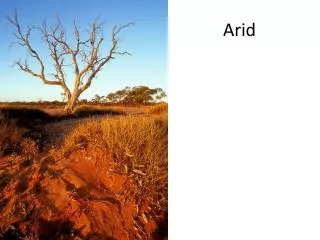
A level Cambridge module on Arid and Semi-Arid environments

E N D
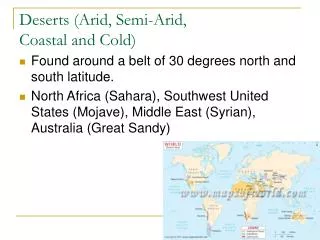
Caused by the subtropical High pressure belt and the cold Benguela current • The Namib is a coastal desert and the Kalahari is inland. • High humidity in the coastal Namib results in the formation of FOG • Ocean currents lower temperatures in summer so it has a small seasonal temperature range.
The deserts in North America are caused by: • The subtropical high pressure belt • The cold Californian current • Rocky mountains which creates a rain shadow.
The Atacama desert is caused by the cold Peruvian current • Humidity is high and fog is common in the Atacama desert • The Patagonia desert is created because it is in the rain shadow of the Andes mountains.
These deserts are caused by continentality and rain shadow of the Himalayan Mountains • They also experience extreme high pressures in winter and in this season, they are extremely cold. This is due to their high altitude and their great distance from the sea.
Caused by the subtropical High pressure belt and by the coldocean currents on the west coast. • The Great dividing range also creates a rain shadow affect on the western parts of Australia resulting in the formation of deserts.
TYPES OF WEATHERING THAT TAKES PLACE IN A DESERT • Weathering is the break up of rocks. • In desert regions because there is very little water, weathering tends to be superficial – confined to the surface • Weathering is greater in Semi Arid areas because semi arid regions have a slightly higher precipitation. • Weathering can be broken up into Mechanical (physical) weathering and chemical weathering • Mechanical weathering – break up of rock without changing its chemical composition. • Chemical weathering – break up of rock by changing its chemical composition.
PHYSICAL WEATHERING A) THERMAL FRACTURE Break up of rocks caused by heat. During the day rocks expand due to heat and at night they contract This expansion and contraction causes the rocks to break up. Rocks are not very good conductors of heat so during the day only the surface of the rocks are heated and expand and during the night only the surface contracts. This causes the surface layers to peel away like an onion and this is called EXFOLIATION.
The break up of larger rocks into smaller rocks is called BLOCK DISINTEGRATION The break up of rocks into smaller particles is called GRANULAR DISINTEGRATION
B) FREEZE THAW There are several deserts e.g. Gobi where temperatures fall below freezing point. Water in the pores and cracks of the rock expand when frozen and this can shatter the rocks.
C) SALT WEATHERING (SALT CRYSTALIZATION) • Arid environments have lots of salt in them for the following reasons • Some rocks already have salt in them • Rain water has salt, when it evaporates its leaves the salt behind • Ground water has salt and when it is drawn to the surface be capillary action, it leaves the salt behind. • Salt left behind as the remains of former lakes or seas • In coastal salt flats – sea water has salt. • Endorheic drainage basins – rivers flow into these drainage basins when they evaporate, they leave the salt behind. The salt is carried by water into the cracks and pores of the rocks. Here salt crystals grow and start to break up the rock
CHEMICAL WEATHERING Chemical weathering generally occurs when water is available in desert environments. Chemical weathering is limited in deserts because there is very little water. a) Oxidation – when iron in rocks take up additional oxygen and turn to rust b) Hydration – occurs when rocks containing calcium sulphates take up water and expand.
With the aid of examples, assess the extent to which ocean currents are the cause of aridity. [20]
EROSIONAL AND DEPOSITIONAL FEATURES CREATED BY WIND IN A DESERT • Wind erosion is strong in a desert for the following reasons: • The surface lacks moisture, soil and organic matter which binds the soil together • Very little vegetation to slow the wind down • Winds are often very strong • There are two types of wind erosion in a desert • ABRASION – impact of soil and rock particles hitting other rocks • DEFLATION – loose particles are picked up by the wind and carried away. • Sand particles are carried by the wind by TRACTION, SALTATION, and SUSPENSION
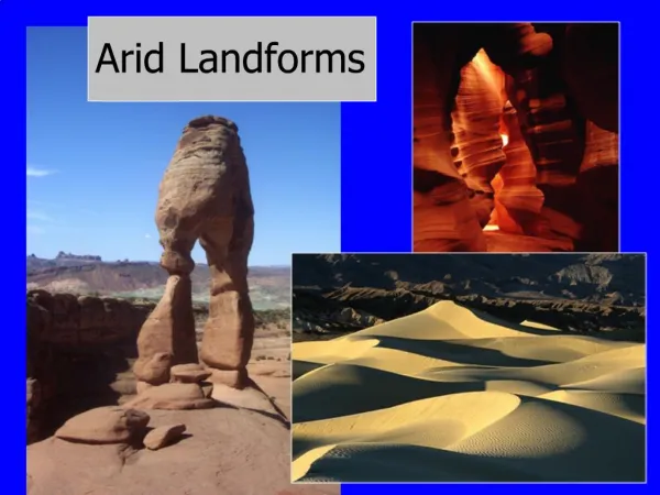
DESERT LANDFORMS CREATED BY ABRASION A) ZEUGEN –MUSHROOM/PEDESTAL ROCKS Zeugens are mushroom shaped rocks that have been created by abrasion. Wind picks up the sand and blasts it against the rocks The sand blasting effect is concentrated in the lower levels of the rock near the ground hence the bottom part of the rock is eroded faster than the top creating the mushroom shaped rock.
B) YARDANGS Horizontal ridges that range in size from very small to large They are formed by abrasion The softer rock around the more resistant rock is removed by abrasion. The lie in the direction of the prevailing winds Yardang’s are associated with only one type of rock
c) DEFLATION HOLLOWS/DESERT PAVEMENTS https://www.youtube.com/watch?v=kH-W_2w1WzI
Sandy deserts are called ERGS Stony deserts are called REGS
DESERT LANDFORMS CREATED BY DEPOSITION • Sand covers about a quarter of the worlds deserts. • Sand dunes are landforms created by the deposition and movement of sand in a desert. • There are deferent types of sand dunes • Barchan • Akle dunes • Seif dunes • Star dunes • Dunes are also created by obstacles that trap the sand • Nebkha • Wind-Shadow dune • Lunette • https://www.youtube.com/watch?v=O0QiSqeCst4
BARCHAN DUNES Small crescent formed were the supply of sand is limited. Where there is more sand, these dunes join to form a barchanoid ridge
Nebkha Wind shadow dune
EROSION AND DEPOSITION FEATURES CREATED BY WATER IN A DESERT Three types of rivers can be found in an arid environment 1. EXOGENOUS RIVERS – rivers that are formed in high rainfall areas outside the desert but flow across it, e.g. The river Nile which is created by heavy rains in the ETHIOPIAN HIGHLANDS 2. ENDORPHEIC RIVERS – rivers that flow into inland lakes such as the river Jordan flowing into the dead sea. 3. EPHEMERAL RIVERS – rivers that only flow after a rain storm. Sudden rain storms in a desert, create fast flowing rivers which carry large amount of sediment with it.
SALT LAKES/PLAYAS • Landlocked body of water that has a high concentration of salt and other dissolved minerals. • When a salt lake dries up, it becomes a PLAYA • SOLUTION - underground limestone is dissolved • TECTONIC COLLAPSE • WIND EROSION – • The extensive playas in SW USA are fossil lake basins of the PLEISTOCENE PLUVIALS. • Low laying salt flats are called SABKHAS • SABKHAS are formed from salt deposited by the sea or from water drawn up from just below the surface by capillary action.
ALLUVIAL FANS As the river flows through the river valley generally in the mountains and it comes to flat land, it deposits its load in the shape of a fan, called an ALLUVIAL FAN The size of the fan depends on the volume of the river and the rock type. Easily eroded rock will form a larger fan. E.g. Alluvial fan in Greenland When the alluvial fans coalesce they create BAJADAS – sometimes called the piedmont zone
PEDIMENT Gently sloping rock surface covered by gravel. Pediments form in two ways Retreat of a hill slope over time – pedimentation Lateral Planation https://www.youtube.com/watch?v=ij5yjMMh1ZM
INSELBERGS An isolated, steep sided hill is called an INSELBERG. Inselbergs can form in two ways Scarp recession Previous climatic conditions – If there was a period of warm and humid weather in the arid areas, chemical weathering occurred on the joints in the rock. Further erosion removed the weathered rock, leaving behind the inselberg.
Fig. 10.1 is a photograph which shows landforms in Death Valley, USA. • (a) With the use of a diagram, describe the landforms shown in Fig. 10.1. [4] • (b) Explain the role of water in the formation of two of the landforms described in (a) [6]
Lesson objects • To understand what past climates are • To understand how past climates shape the desert landscape. • To know what a soil profile is • To be able to identify a soil profile in a desert environment
VOCABULARY • Pluvial – wet period in climate history • Scree – lose material that accumulates at the bottom of the scarp slope. • Soil profile – vertical section through the soil • Soil horizon – horizontal layers within a soil profile • Aridisols – dry soils in a desert environment • Biomass – total volume of organic material in the soil • Deflocculating – dispersal of salt particles • O horizon – organic horizon • A Horizon – zone through which organic material is transferred by water to the lower layers of the soil. This process is called leaching (zone of illuviation) • B Horizon – zone where the organic material accumulates (zone of eluviation) • C horizon – partially decomposed parent material • Bedrock – parent rock
PAST CLIMATES Wet periods in history are called PLUVIALS • There were pluvial in the SAHARA DESERT 12000 to 5000 years ago • There is evidence of pluvial in the past • Ancient shorelines which show that lakes used to be much larger than they are now e.g. Lake Chad
River valleys that were cut by rivers that are no longer there e.g. valley’s found in the south eastern Sahara desert
Fossilized soils which can only be found in wet conditions e.g. LATERITES in large parts of Australia
Animals and plant remains found in desert areas where these animals would not survive today.
Evidence of previous human occupation e.g. Roman grain production in parts of Tunisia which is now desert.
These is also evidence of stronger winds and drier conditions in the past. • Sand dunes in deserts which have become stable suggests that they were formed in the Pleistocene when wind speeds were stronger and conditions were drier.
There is also evidence of colder conditions in deserts • In western USA there is evidence of colder conditions in the past in the existence of relict frost screes – slopes of rock shattered by climates colder than today
CHARACTERISTICS OF SOILS IN ARID AND SEMI ARID AREAS • Little chemical weathering means that the soil is thin and lack soil horizons • Little vegetation so there is little biomass or humus in the soil • They have a low clay content because minerals are not broken down to a great extent • The soils are salty • - Salty soil in deserts causes the soil to become infertile and impermeable. • - Salts cause deflocculating of soil particles which causes the soil to become impermeable and the air necessary for plant growth cannot enter • - salt prevents plants from absorbing water into their roots • - Salts are poisonous to many plants • Surfaces of the soils are impermeable • Soils are stony because the finer particles have been blown or washed away leaving behind a stone pavement called regs or HAMMADA in North Africa. • Hard crust called DURICRUST FORMS – Duricrust can be calcrete formed from Calcium Carbonate or Gypcrete formed from calcium sulphate . This crust makes root development very difficult.
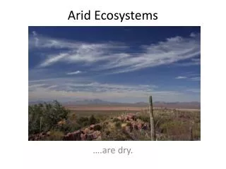
VEGETATION IN ARID AND SEMI-ARID ENVIRONMENTS • CHARACTERISTICS OF VEGETATION FOUND IN ARID AND SEMI-ARID ENVIRONMENTS • Low biomass • Adapted to low rainfall conditions • Adapted to salty soils • Low range of species • Limited nutrient cycling – movement of nutrients from the soils to the roots to the plant • and back to to the soil • PLANTS NEED WATER FOR THE FOLLOWING REASONS: • Support plant tissue growth • Water is the medium through which nutrients enter the plant • Water is needed for photosynthesis
Spines and thorns act as leaves to reduce water loss – evapotranspiration • Waxy stems in-order to retain water • Bark is thick to prevent plant from collapsing when it dries out • Roots are deep or spread out laterally over a large surface to absorb maximum ground water • Ephemeral plants die in the dry season but their seeds remain dormant. E.g. Rose of Jericho • E.g. Aloe Ferox in southern Africa. ADAPTION OF PLANTS TO ARIDITY XEROPHYTES
PHREATOPHYTES • Have deep tap root systems that can reach down to the water table. • They commonly grow near lakes, stream channels or springs. • e.g. Wild palm trees in Morroco