Download
1 / 37
380 likes | 548 Views
USDA Forest Service Forest Inventory and Analysis (FIA). MRLC Land Characterization Partners Meeting Nov. 7-8, 2000. OUTLINE. Federal mandates that FIA more effectively use remote sensing FIA Business needs from satellite data Classification detail Classification accuracy

E N D
USDA Forest ServiceForest Inventory and Analysis(FIA) MRLC Land Characterization Partners Meeting Nov. 7-8, 2000
OUTLINE • Federal mandates that FIA more effectively use remote sensing • FIA Business needs from satellite data • Classification detail • Classification accuracy • Geographic priorities • Information needed by FIA Management Team
Federal mandates that FIA more effectively use remote sensing • 1998 Farm Bill • White House Office of Science and Technology, Committee on the Environment and Natural Resources • RAND Corporation review of forest monitoring conducted by federal agencies • FIA Staff Director Rich Guldin http://fia.fs.fed.us/library.htm - Papers
Improve consistency of data and process using a top down approach • Consistent data is like a common language • Centralized data collection, documentation and dissemination • Decentralized analyses and decision making • Economies of scale
FIA Business needs from satellite data • Stable, dependable and economical production of accurate and consistent forest cover and land use maps • Cover entire USA every 3 to 10 years • Adherence to Federal Geographic Data Committee (FGDC) standards
FIA Business needs from satellite data • Automated image processing algorithms that require little human intervention • Product consistency and accuracy • Cost reduction • Timeliness • Diversity of geospatial products • Henry Ford analogy
FIA Business needs from satellite data • Improve accuracy of FIA statistics • Improve statistical efficiency through stratification on forest v. nonforest cover • Improve statistical estimates for small geographic areas (e.g., counties) using remotely sensed ancillary data
FIA Business needs from satellite data • Improve timeliness of statistics in annualized FIA • 10% - 15% of field plots re-measured each year • Remotely sensed data “refreshed” every 3 to 5 years • This is a goal, not an absolute design requirement • Could use change detection to update forest/nonforest in a 10-year MRLC product
FIA Business needs from satellite data • Change detection • Keep forest/nonforest map current to maintain FIA statistical efficiency through stratification • 2005 update to 2000 landcover map • Better identify spatial patterns of change in broad landscapes
FIA Business needs from satellite data • Change detection • Improve accuracy of FIA statistical estimates for • Timber removals • Reforestation • Afforestation
FIA Business needs from satellite data • Help provide 30-m/1:24,000 products to FIA customers • User-friendly data base for GIS analyses • Attractive maps for distribution • Spatial analysis tool box (internal and external users)
FIA Business needs from satellite data • Characterize context surrounding each FIA field plot that are not easily measured in field • Landscape fragmentation • Size and shape of forest stand • Distance to roads, surface waters, other land uses (important components of wildlife habitat)
FIA Business needs from satellite data • Substitute satellite data for 1:40,000 NAPP • Reduce cost of FIA stratification with Phase 1 plots (1-km grid) • Continue to provide imagery for navigation by field crews • 15-m pan-sharpened Landsat 7 • 10-m pan-sharpened SPOT • Superimpose ancillary geospatial data (DLG, DEM, topos., etc.) • Downloadable to field crews (federal, state, contractors)
FIA Business needs from satellite data • Implementation schedule • Prototype products available for 10% -20% of USA by September 2002 • Production system functional by September, 2003
FIA Business needs from satellite data • New remotely sensed products in the future • Net primary productivity or photosynthesis rates • Tree mortality • Indicators of drought, acidic deposition, or pest attack • Boundaries between different forest stands • Indicators of human infrastructure (e.g., individual buildings)
FIA Business needs from satellite data • Developers’ tools to implement a variety of spatial models with centralized database • Linkages to other geospatial databases (e.g., Census Bureau) • Sharing geomatic models • Facilitate local improvements to national map products • Accuracy • Classification detail
Minimum spatial resolution • 1-km pixel for global/national assessments • 250-m to 30-m pixel for regional assessments • FIA definition of forest requires 30-m scale • Special assessment needs require 30-m scale (e.g., riparian management zones) • Functionality request: • change spatial scale of data to balance assessment needs with technology
Classification detail • Might need separate MRLC products for forest cover and timberland use • Forest v. nonforest (most valuable for statistical efficiency through stratification)
Classification detail • FIA definition for forest uses • 10% stocking, which can be applied with field data but not directly with remotely sensed data • At least 1-acre and 120-foot wide • Includes non-stocked clearcuts and seedling/sapling stands • Accuracy of remotely sensed classifications need to be high, but not necessarily 100%
Classification detail • FIA definition for nonforested land use includes • Urban and suburban areas with tree cover • tree stocking less than 10% • Pasture with tree cover • Rangeland
Classification detail • Broad forest types (global/national assessments) • Softwoods • Bottomland hardwoods • Upland hardwoods • Mixed hardwoods and softwoods
Softwood forest White-red-jack pine Spruce-fir Longleaf-slash pine Loblolly-shortleaf pine Douglas-fir Hemlock-Sitka spruce Ponderosa pine Western white pine Lodgepole pine Larch Fir-spruce Redwood Upland hardwood forest Oak-hickory Maple-beech-birch Aspen-birch Western hardwoods Bottomland hardwoods Oak-gum-cypress Elm-ash-cottonwood Oak-pine Woodland Chaparral Pinyon-juniper Classification detailMore specific cover types
Classification detail • Open v. closed stands • Non-timber land use (e.g., urban with forest cover) • Special categories • Forested wetlands • Mesquite • Krummholtz
Classification detail • National Forest System needs for Map Product 2 (Forest Planning) • Cover Type • 30-35 categories of forest • 6-10 categories of grass/forb/shrub types • 6 non-vegetated categories (rock, snow/ice, etc.) • Stand Size Class (5 categories) • Stand Crown Closure Class (4 categories)
Classification detail • National Forest System needs for Map Product 2 (less detailed ) • Cover Type • 9 categories of forest • 4 categories of grass/forb/shrub types • 5 non-vegetated categories (rock, snow/ice, etc.) • Stand Size Class (2 categories) • Stand Crown Closure Class (3 categories)
Classification detail • Need to agree on detailed description • Classification rules for each category • Devil is in the details
Classification Accuracy • Forest v. nonforest 90% to 99% accuracy • Needed for stratification efficiency • Inaccuracies caused by FIA field-definition of forest included with usual classification error • No formal FIA accuracy standards for more detailed categorizations • Known accuracy relative to FIA field data
Classification Accuracy • National Forest System (Montana, Idaho) Map Product 2 (most detailed) • 60-65% overall for cover types • at least 40% for any individual class • 40% overall for stand size class • 60%-70% for stand density classes
Classification Accuracy • National Forest System (Montana, Idaho) Map Product 3 (less detailed) • 75% overall for cover types • at least 65% for any individual class • 75% overall for stand size class • 75% for stand density classes
Timeliness • Less than 5% net change in forest cover since date of imagery • stratification efficiency • Less than 5 years old is desirable
Registration Accuracy • Sufficient to link 1-acre FIA field plots to 30-m pixels
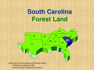
Maine Iowa Indiana Minnesota Missouri Wisconsin Utah Arizona Colorado Oregon Alabama Virginia Georgia Kentucky South Carolina Tennessee Geographic prioritiesForest/non-forest mask September 2002
Arkansas Louisiana Tennessee Texas Pennsylvania Michigan Puerto Rico Hawaii Geographic prioritiesForest/non-forest mask September 2003
Information needed by FIA • Cost to FIA for Part II of MRLC
Information needed by FIA • Timing of coverage • Will MRLC land characterizations always be 5 to 15 years out of date? • Can MRLC incorporate re-characterization or change detection in between 10-year MRLC cycle?
Information needed by FIA • Classification detail • Potential role of FIA in determining detail of classification system • What decisions have already been made • What is on the table? • Need a thorough review of detailed classification descriptions and rules • Can MRLC produce map of forest cover optimized to FIA definitions of forest land use? • Consistency of MRLC and FGDC standards?