Download
1 / 44
440 likes | 472 Views
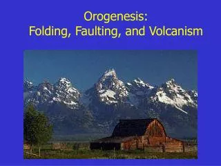
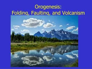
Explore the dynamic geological processes of folding, faulting, and volcanic activity, including plate boundaries, seismic waves, earthquake cycles, and volcanic types. Discover how these phenomena shape the Earth's surface.

E N D
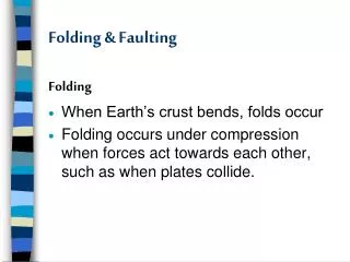
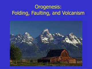
Folding • response to compression or shear
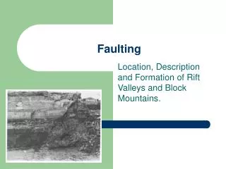
Faulting • Definition: fractures where some type of displacement (movement) has occurred. • Three types • normal • reverse/thrust • transform (strike-slip) Carmel Valley Fault, CA
Landforms - Normal Faulting • Fault escarpment Owens Valley, CA Sierra Nevada, CA Grand Tetons, WY
Normal Faulting • Horst and graben (“hill” and “grave”) • Death Valley/ Panamint Ranges
San Andreas fault System • How long is it? About 600 miles (1000 km) • Relative motion of the Pacific Plate? @ 2 inches (5 cm) northwest per year. (We’ll be off the coast of San Francisco in 12 million years!)
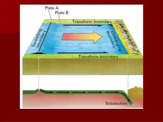
Transform Plate Boundary • Features: • shallow, linear rift valleys Carrizo Plain, central CA • San Andreas Lake (Crystal Springs Reservoir) • - looking south along fault • - San Francisco water supply • - geology vegetation
Temblor Range Dragon’s Back Transform Plate Boundary • Activity: • shallow to moderate earthquakes • little to no volcanism Carrizo Plain, CA (view to the east)
The Geography of Earthquakes • Globally: primarily at plate boundaries • Intraplate earthquakes do occur!
The Geography of Earthquakes • USA: 1977-1997 earthquake events • USA: every state except ND, FL
Earthquakes • Earthquakes are the shaking or vibration of the ground as a result of rocks suddenly breaking along a fault. • Focus (hypocenter) = rupture point • Epicenter = point on surface above focus • Foreshocks • Aftershocks
Process: the earthquake cycle (elastic rebound theory) • Earthquakes are a ‘release of energy’ in the form of a seismic wave (vibrates the crust). • Plate movement strain builds rocks “locked together” (frictional bond) • Rocks bend hit limit --> rupture/break • Cycle repeats ”start-stop” motion along fault
Seismic Waves • Some of the waves that are generated by an earthquake travel within the earth and other travel along the surface. • Waves traveling within the earth are known as body waves. • Surface waves cause the most damage to buildings during an earthquake.
Surface Waves • Surface waves can set up liquefactionin alluvium. This is where the most extensive damage to buildings occurs. • Liquefaction: wavelike, almost liquid, rolling of surface • Alluvium: fine material deposited by water over many years.
Measuring Earthquakes • seismograph: records the vibrations of the crust (Richter Scale) • seismogram: tracing record • Modified Mercalli Scale (I-VII)measures damage
Major California Earthquakes • Fort Tejon, 1857 - 8.0 magnitude • San Francisco, 1906 - 7.9 magnitude • 1933 Long Beach - 6.3 magnitudeDestroyed Glendale College Buildings! • San Fernando, 1971 - 6.6 • Northridge, 1994 - 6.7 • Hector Mine, 1999 - 7.1
Fort Tejon, 1857 California’s largest ever! • TIME: January 9, 1857 • LOCATION: about 72 km (45 miles) northeast of San Luis Obispo • MAGNITUDE: Mw 8.0 (approx.) • TYPE OF FAULTING: right-lateral strike-slip • FAULT RUPTURED: San Andreas fault • LENGTH OF SURFACE RUPTURE: about 360 km (225 miles) • MAXIMUM SURFACE OFFSET: about 9 meters (30 feet)
The Geography of Volcanism • Three major zones of volcanic activity • convergent plate boundaries • divergent plate boundaries • hot spots
Volcano Classification • active: has erupted in recorded history. (Kilauea, Hi, Mt. Etna, Italy, Mt. Lassen) • dormant: has not been seen to erupt in history, but shows evidence of recent activity. (Mammoth Mtn, CA or Crater Lake, OR) • extinct: no sign of recent or historic activity (Mt. Kilimanjaro, East Africa)
Volcanoes: Explosive • Composite cones (stratovolcano) • pointed, steep-sided, tall volcanoes • “Composite”: layers of pyroclastics and lava (mostly felsic) • Explosive and dangerous; found in subduction zones
Landforms: Explosive Arenal, Costa Rica
Hot Spots • Isolated columns of hot magma rising slowly within the aesthenosphere (mantle). • Melts overlying crust, “burning a hole through” • Can be underneath continents or ocean plates.
Landforms: Effusive • Shield volcanoes • large, rounded volcanoes with a gentle slope • central vent • flat terrain (or can not build up dome) • constructed by a series of basalt flows over time.
Hot Spots • Loihi • building, but still 1000 m below surface • will eventually replace the Big Island
The Geography of Volcanism • Volcanism primarily submarine. • several thousand volcanoes are continental (about 600 are active) • over 50,000 in the Pacific ocean alone
(Selected) Major Historic Eruptions • Krakatoa (1883), Indonesia • eruption obliterates an entire group of islands, leaving a submerged caldera. • blast heard for thousands of miles • ash reaches mesosphere (80km / 50 mi) • tsunami’s kill about 40,000 people
Mammoth Lakes • part of Long Valley Caldera • Eruption 760,000 years ago • 500 x more material ejected than Mt. St. Helens!
Mammoth Mtn next? • Active, moving magma at about 3 km depth • 1200 tons of CO2 per day coming up through the soil tree kills • earthquake swarms • little surface deformation • Classification? dormant