Download
1 / 26
260 likes | 338 Views
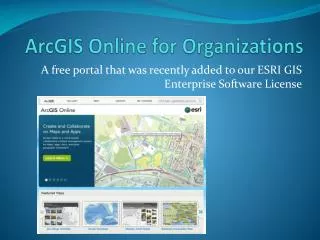
Learn how communities utilize ESRI's ArcGIS Online functionality within their existing GIS workflow. Explore subscription levels, map development, content publication, and workflow incorporation.

E N D
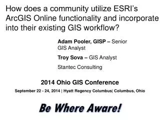
How does a community utilize ESRI’s ArcGIS Online functionality and incorporate into their existing GIS workflow? Adam Pooler, GISP – Senior GIS Analyst Troy Sova – GIS Analyst Stantec Consulting 2014 Ohio GIS Conference September 22 - 24, 2014 | Hyatt Regency Columbus| Columbus, Ohio
Agenda 1ArcGIS Online Subscription Account Levels 2Develop Community Specific Maps 3Publish Content to Community Account 4Incorporate into GIS Workflow 5Questions / Comments
ArcGIS Online Subscription Account Levels ArcGIS Online can provide department wide access to GIS info. without purchasing Multiple ArcGIS Desktop Licenses. 1
User Types by Privileges • Types of Users • Three different types (No additional cost by type) • Administrator– User privileges to maintain/modify organization’s ArcGIS Online Account and all users within the organization • Publisher – User privileges to Add/Remove (publish) Content to online account, such as web maps, layers, services, etc. • Viewer – User privileges given to only view organization posted data/maps. • Usually the best choice for personnel not trained in GIS.
Subscription Account Levels • Entitlement (No Extra Charge) • Every ArcGIS Desktop License – 100 Credits each • Administrative User Provided • 12-Month Annual subscription • Additional Named Users • Specifically contact ESRI Regional Representative • Varying Levels – Amount of Users • Purchase 1,000 Service Credits at a time (Good for 2 years) • In 2014 the first Five (5) Seats/Users – Level 1 Package Deal (each year) • Cost = $2,500* (*Price may vary by region) • 2,500 credits
Credit Usage and Groups • Approx. Usage (Depends on file size, type, etc.) • Map Tile Generation – 1 credit per 1,000 tiles generated • Feature Service – 2.4 credits stored per 10 MB / month • Tile/Data Storage - 1.2 credits stored per 1 GB / month • Service credits are consumed when you use certain services in Esri'scloud. • http://www.esri.com/software/arcgis/arcgisonline/credits • Groups • Separate Group for each Department • One Viewer login can be used for multiple computers – reducing the amount of users • Only Data related to that Department
Stormwater Department Development/Planning
98% Use a powerful statement or statistic to support your presentation.
Develop Community Specific Maps What kind of information does a Community’s GIS Program/Department want to disseminate throughout the organization or even out to general public? 2
Potential Maps • Goals • Define Audience • How will user view/interact with GIS Data? • Define Themes when creating Service Features • Start with ArcGIS Desktop • Themes • Community Boundary • Planning/Zoning • Recreation/Natural Areas • Trash and Snow Routes
Recreation/Natural Areas Service Feature Creation Steps • ArcGIS Desktop • Create General Layout by • Setting Scale Dependencies • Apply symbology • Only include data for specific theme and do not include base map layers. • Run Data through the Analyze Tool and Share as a Service • Update according to “Errors” and “Warnings” • Certain symbols are only stored on ArcGIS Online, the full suite of ArcGIS symbols is currently not available.
Analyze Map Tool (Two Options) • Goals • Validates data • Confirms symbology
Recreation Areas Pre Service Feature Validation Layout Recreation Areas Post Service Feature Validation Layout
File – Share As Choose method Choose Connection and Create Name
Choose Capabilities • Tiled vs. Feature Access Include Description Choose Sharing Method Click Publish Start-up ArcGIS online through Web Browser
Configure Web Map • Base Map • First – Open “New Map” on ArcGIS Online • Second – Choose a base map (standard is Topographic) • Third – Non-standard base map layer (Landsat Imagery) • Service Features • Add Layer from “My Content” or from organization’s Content • Add Layer from File – Stand alone shapefile not specific to one map theme
Standard Base Map Load Base Map by Searching for Layers on ArcGIS Online
Configure Web Map • Layer Names / Notes / Labels • Layer Names can be modified for better clarification. • Add specific Notes or points of interest to the Web Map. • Labels – Set in ArcMap Desktop do not come through into ArcGIS Online – Add Labels to the Web Map itself • Use Navigation Tools • Specific Bookmark/location for Users to find • Search for address or driving directions
98% Use a powerful statement or statistic to support your presentation.
Incorporate into GIS Workflow ArcGIS Online provides a powerful tool for turning silo GIS databases into cooperative interaction within multiple departments. 4
Advantages • Easily Disseminated • Display GIS data/maps through multiple departments. • Logon to ArcGIS Online account anywhere with an internet web browser. (Google Chrome, Firefox preferred) • The web maps can even be turned into a public access. • Cost • Reduces need for Costly ArcGIS Desktop Licenses or SDE/Enterprise Licenses • GIS Experience not necessary • Costly Training/Certifications
Future Uses • Mobile • The ArcGIS Online platform can then be used as a field collection process. • Used within vehicle laptops or Tablets/GPS Receivers. • ArcGIS Marketplace • https://marketplace.arcgis.com/ • Free Applications by ESRI • Field Collectors