Download
1 / 45
450 likes | 462 Views
Explore the primary energy sources that drive atmospheric processes and learn about the characteristics of the troposphere, jet streams, and desert formation.

E N D
What is the primary energy source that produces the differential heating that causes air masses to move across the landscape? Human global energy Water flow energy Internal heat energy of Earth Nuclear energy Solar energy
What is the primary energy source that produces the differential heating that causes air masses to move across the landscape? Human global energy Water flow energy Internal heat energy of Earth Nuclear energy Solar energy
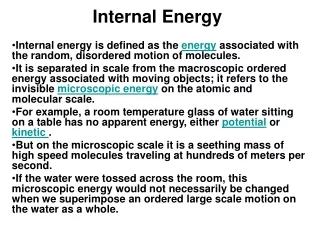
In the figure, the change in water phases water shown are a result of ______. • kinetic energy from water accelerating. • sensible heat measured by a thermometer. • potential energy being stored. • latent heat being absorbed or released. • any type of heat energy.
In the figure, the change in water phases water shown are a result of ______. • kinetic energy from water accelerating. • sensible heat measured by a thermometer. • potential energy being stored. • latent heat being absorbed or released. • any type of heat energy.
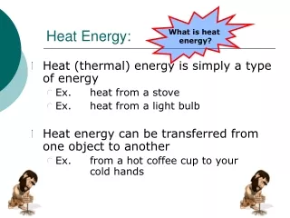
The heat-transfer process of convection is important in • transfer of heat between thin layers of air in contact with Earth’s surface. • transfer of atmospheric heat in thunderstorms. • very few processes of the atmosphere. • transfer of energy by radiation. • None of the answers are correct.
The heat-transfer process of convection is important in • transfer of heat between thin layers of air in contact with Earth’s surface. • transfer of atmospheric heat in thunderstorms. • very few processes of the atmosphere. • transfer of energy by radiation. • None of the answers are correct.
Which of the following would generally have the lowest albedo? White sand beaches Clouds Coniferous woodlands Snow covered mountain peaks Oceans and seas
Which of the following would generally have the lowest albedo? White sand beaches Clouds Coniferous woodlands Snow covered mountain peaks Oceans and seas
Relative humidity normally increases at night because the sunlight during the day reduces water vapor. it usually rains at night. there are less clouds present at night. more water evaporates into the atmosphere at night. it is usually cooler at night and cold air has the capacity to hold less water vapor than warm air.
Relative humidity normally increases at night because the sunlight during the day reduces water vapor. it usually rains at night. there are less clouds present at night. more water evaporates into the atmosphere at night. it is usually cooler at night and cold air has the capacity to hold less water vapor than warm air.
What is the defining characteristic of the troposphere? Decrease in temperature with increasing altitude Increase in temperature with increasing altitude More ozone present than the upper atmosphere Very few clouds present None of the answers are correct.
What is the defining characteristic of the troposphere? Decrease in temperature with increasing altitude Increase in temperature with increasing altitude More ozone present than the upper atmosphere Very few clouds present None of the answers are correct.
The subtropical midlatitude deserts of the world (Sahara, Arabian, Mojave, etc.) are a result of • solar heating. • cool ascending air masses. • dry descending air masses. • subtropical jet stream. • heated ascending air masses.
The subtropical midlatitude deserts of the world (Sahara, Arabian, Mojave, etc.) are a result of • solar heating. • cool ascending air masses. • dry descending air masses. • subtropical jet stream. • heated ascending air masses.
What is a jet stream? Overall flow of air into a region that cause the air to pile up and increase atmospheric pressure Westerly winds that encircle the globe and play an important role in creating severe weather Deflection of the wind to the right or the left caused by the rotation of the Earth Unstable air that causes turbulence Residue from airline traffic
What is a jet stream? Overall flow of air into a region that cause the air to pile up and increase atmospheric pressure Westerly winds that encircle the globe and play an important role in creating severe weather Deflection of the wind to the right or the left caused by the rotation of the Earth Unstable air that causes turbulence Residue from airline traffic
Which situation would result in the fastest jet stream flow? Colliding air masses with temperatures of • 80 degrees F and 100 degrees F • 30 degrees F and 50 degrees F • 60 degrees F and 65 degrees F • 60 degrees F and 80 degrees F • 60 degrees F and 90 degrees F
Which situation would result in the fastest jet stream flow? Colliding air masses with temperatures of • 80 degrees F and 100 degrees F • 30 degrees F and 50 degrees F • 60 degrees F and 65 degrees F • 60 degrees F and 80 degrees F • 60 degrees F and 90 degrees F
The deflection of winds shown in the figure is a result of • the Polar jet stream. • the Coriolis effect. • thunderstorms. • diverging surface winds. • All of the answers are correct.
The deflection of winds shown in the figure is a result of • the Polar jet stream. • the Coriolis effect. • thunderstorms. • diverging surface winds. • All of the answers are correct.
In general, what indicates how severe a thunderstorm will become? Water vapor in the air Heat produced during the day Dry air mass above a moist air mass Vertical wind shear Cloud size
In general, what indicates how severe a thunderstorm will become? Water vapor in the air Heat produced during the day Dry air mass above a moist air mass Vertical wind shear Cloud size
Which is not a characteristic of a Supercell thunderstorm? Larger than an MCS or a squall line Defined by the presence of a mesocyclone Extremely violent Breeding ground for most large tornadoes Most damaging type of severe thunderstorm
Which is not a characteristic of a Supercell thunderstorm? Larger than an MCS or a squall line Defined by the presence of a mesocyclone Extremely violent Breeding ground for most large tornadoes Most damaging type of severe thunderstorm
Tornadoes are more common in the United States than in any other location on Earth due to increased development in the Southwest United States, contributing to increased heat island effect. Tornado Alley being located in the United States. most EF4 and EF5 tornadoes occurring in North America. the United States having just the right combination of weather, topography, and geographic location. None of the answers are correct – tornadoes are not more common in the United States.
Tornadoes are more common in the United States than in any other location on Earth due to increased development in the Southwest United States, contributing to increased heat island effect. Tornado Alley being located in the United States. most EF4 and EF5 tornadoes occurring in North America. the United States having just the right combination of weather, topography, and geographic location. None of the answers are correct – tornadoes are not more common in the United States.
The storm tracks shown in the figure are named for the person that discovered them. geographic origin or direction of prevailing high winds. associated jet stream. largest historic blizzard. amount of wind chill associated with them.
The storm tracks shown in the figure are named for the person that discovered them. geographic origin or direction of prevailing high winds. associated jet stream. largest historic blizzard. amount of wind chill associated with them.
What was not an impact of the Great Northern Ice Storm of 1998? Demonstrated society’s dependence on electricity Many death’s were contributed to loss of heat Demonstrated society’s increasing reliance on “just-in-time” delivery of products Heavy rains south of the front caused severe mountain flooding Heavy snowfall trapped many people in their homes
What was not an impact of the Great Northern Ice Storm of 1998? Demonstrated society’s dependence on electricity Many death’s were contributed to loss of heat Demonstrated society’s increasing reliance on “just-in-time” delivery of products Heavy rains south of the front caused severe mountain flooding Heavy snowfall trapped many people in their homes
What was not an impact of the 2003 European heat wave? Temperatures were cooled at nighttime due to clear skies during the day Drought conditions cut power exports in half due to lack of cooling water Alpine glaciers lost up to 10 percent of their volume The urban heat island effect contributed to raising the air temperature 13 degrees F above normal in Paris Stagnant air allowed air pollutants to accumulate and form photochemical smog
What was not an impact of the 2003 European heat wave? Temperatures were cooled at nighttime due to clear skies during the day Drought conditions cut power exports in half due to lack of cooling water Alpine glaciers lost up to 10 percent of their volume The urban heat island effect contributed to raising the air temperature 13 degrees F above normal in Paris Stagnant air allowed air pollutants to accumulate and form photochemical smog
In the figure, the temperature profile demonstrates the difference in temperature during the day. due to cloud cover. during a thunderstorm. due to the urban heat island effect. during the 1995 Chicago heat wave.
In the figure, the temperature profile demonstrates the difference in temperature during the day. due to cloud cover. during a thunderstorm. due to the urban heat island effect. during the 1995 Chicago heat wave.
What is nota benefit of severe weather? Lightening as the primary ignition source for natural wildfires. Toppling dead and diseased trees to be recycled in the soil. Producing large amounts of rain in a relatively short time. Build snowpack for continual supply of water during drier months. Aesthetic value of snowfall, cloud formations, and lightening displays.
What is nota benefit of severe weather? Lightening as the primary ignition source for natural wildfires. Toppling dead and diseased trees to be recycled in the soil. Producing large amounts of rain in a relatively short time. Build snowpack for continual supply of water during drier months. Aesthetic value of snowfall, cloud formations, and lightening displays.
What are steps we can take to reduce the death and damage associated with severe weather? Become complacent and ignore warnings. Issue more warnings for severe weather. Shut down all electric and waste-water systems. Use mitigation techniques and be prepared. None of these would help reduce death and damage.
What are steps we can take to reduce the death and damage associated with severe weather? Become complacent and ignore warnings. Issue more warnings for severe weather. Shut down all electric and waste-water systems. Use mitigation techniques and be prepared. None of these would help reduce death and damage.
What is not a mitigation technique? Shutting down all electric and waste-water systems. Establish community shelters and safe rooms for tornado protection. Developing and installing warning systems. Ensuring universal hazard insurance is available. Using a combination of landline telephone, cell phone, voice-over-Internet, multi-frequency radio, and satellite communication links.
What is not a mitigation technique? Shutting down all electric and waste-water systems. Establish community shelters and safe rooms for tornado protection. Developing and installing warning systems. Ensuring universal hazard insurance is available. Using a combination of landline telephone, cell phone, voice-over-Internet, multi-frequency radio, and satellite communication links.