Download
1 / 77
770 likes | 793 Views
Explore the environmental initiatives in Hawaii including preservation of rare species, water scarcity, acid rain, and climatic effects on the unique island ecosystem.

E N D
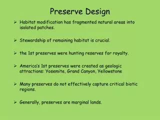
Watershed Honouliuli Preserve • Has dark fertile lands that stretch from the waters of Pearl • Harbor to the summit of the Wai`anae Mountains • 70 rare and endangered plant and animal species
West Maui Mountains Watershed • Biologically diverse and pristine in the islands • Threatened by invasive species like insects and plant diseases
Acid Rain in Hawaiian Isles is caused by emissions from eruptions
Kapunakea Preserve • Has 24 species of rare plants, including four endangered species • Has only known kauila tree of its kind on Maui
Watershed Lana’i Forest and Watershed Partnership • Ensures the future supply of water for the island of Lana`i, • Protect the health of near-shore waters, fisheries and beaches
The hydrologic cycle on an oceanic island is one of constant motion and transformation. As water changes form through evaporation, condensation, melting and freezing, energy is released and absorbed, linking water to the environment's larger energy cycle The Hawaiian islands are geologically youngest in the southeast and oldest in the northwest. Climatic EffectsThe Hawaiian islands are near the northern margin of the tropics, and because of the prevailing northeast tradewinds and the buffering effect of the surrounding ocean, air temperature at a given location in Hawaii is generally equable. At the Honolulu International Airport, for example, the warmest month of the year is August, which has a mean temperature of 80.5 degrees Fahrenheit, and the coolest month is February, which has a mean temperature of 72.0 degrees Fahrenheit. Air temperature can vary greatly from one location to another in Hawaii. The air temperature in the eight-island group can range from about 95 degrees Fahrenheit at sea level to below freezing at the top of some peaks on the island of Hawaii. In the geologic past, these peaks have been glaciated
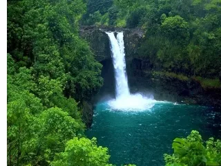
Northeasterly tradewinds are present about 85 to 95 percent of the time during the summer months (May through September), and 50 to 80 percent of the time during the winter months (October through April). The tradewinds are occasionally interrupted by large-scale storm systems which pass near the islands. The southwestern parts of some islands receive most of their rainfall from these severe storms, which produce a relatively uniform spatial distribution of precipitation. In general, the northeastern, or windward sides of the islands are wettest (fig. 34). This pattern is controlled by the orographic lifting of moisture-laden northeasterly tradewinds along the windward slopes of the islands. The winds blow across open ocean before arriving at the islands; when the moisture-laden air mass rises over the mountains, the moisture condenses as precipitation. Maximum rainfall occurs between altitudes of 2,000 and 6,000 feet above sea level, but exact amounts vary depending on the form, location, and topography of each island. Above 6,000 feet, precipitation decreases and the highest altitudes are semiarid. High mountain areas are dry because the upslope flow of moist air is prevented from penetrating above altitudes of about 6,000 to 8,000 feet by a temperature inversion. Areas that are leeward (southwest) of mountain barriers are generally dry because air is desiccated during its ascent over an upwind orographic barrier. This is known as the rain-shadow effect.
Orographic Precipitation As this air rises up the mountain cliff, it suddenly contacts a colder air mass. Its moisture condenses resulting in rainfall. This is called the Orographic Precipitation. Though the outer margin of the Windward Oahu receives only about 75-100 mm (3-4 in) of rain per year, the ridge crest of the Koolau Mountains receive 380-500 mm (15-20 in) per year. Occasional severe winter storms release large amounts of rain that cause flooding that can severely impact the Windward Oahu.
Orographic Precipitation The Koolau Mountain Chain forms a topographic ridge with sharp cliffs, Pali, perpendicular to the prevailing NE trades. As the trades winds encounter the ridge-cliffs, their moisture-laden air is forced upward suddenly and swiftly. This updraft is so strong near the Nuuanu Pali where the highway crosses the cliff that it sometimes creates an "upside down waterfall". The wind blows water from existing falls upward during many days of the year (Carlquist, 1980). During rainfall this updraft may even make raindrops appear to fall upward. “Liquid Sunshine’ on the leeward Oahu is similar ly caused by the orographic precipitation.
On Kauai, the island summit receives more than 435 inches of average annual rainfall (1916-83). West Maui has a small area where average annual rainfall is greater than 355 inches. Average annual rainfall is greater than 275 inches on the northeastern parts of Maui and Oahu, and greater than 235 inches on the northeastern part of the island of Hawaii. Because the island of Lanai is in the rain shadow of Maui and Molokai, it receives much less rain than the larger islands. Most of the southwestern coastal areas of all islands receive less than 40 inches of rain annually; the island of Hawaii has areas at high altitudes that receive less than 20 inches. Two rainfall seasons are typical-a wet season during the winter months from October through April and a dry season during the summer months from May through September. An exception is the western side of the island of Hawaii, where summer months are wettest because of a thermally driven sea breeze.
Evapotranspiration, which is the loss of water to the atmosphere by the combination of transpiration of plants and direct evaporation from land and water surfaces, is a major component of the hydrologic budget of the islands. In the Honolulu area of Oahu, for example, actual evapotranspiration was estimated to be about 40 percent of the total water (rainfall plus irrigation) falling on or applied to the ground surface during 1946-75. Pan evaporation is the main measurement used in Hawaii to assess the amount of water loss by evapotranspiration. Over the open ocean, the estimated annual pan-evaporation rate is 65 inches. As with precipitation, pan-evaporation rates in Hawaii are related to topography. At altitudes between 2,000 and 4,000 feet, where humidity is high and sunlight intensity is reduced because of clouds, pan-evaporation rates are reduced to as low as 25 percent of the open-ocean rate. In the leeward coastal areas, wind carrying dry, warm air increases annual pan-evaporation rates to as much as 100 inches. At the summits of Mauna Kea and Mauna Loa on the island of Hawaii, annual pan-evaporation rates exceed 70 inches because of clear skies and dry air. The amount of recharge available to enter the aquifers on an annual basis is about equal to average annual precipitation minus water losses (average annual runoff and evapotranspiration). Runoff is directly related to rainfall, topography, soil type, and land use, and ranges from less than 5 to as much as 200 inches per year. Runoff typically averages about 10 to 40 percent of the average annual precipitation, but is greater than average where precipitation is high and slopes are steep and where precipitation falls on less-permeable land surfaces. Runoff is less than average where low amounts of precipitation fall on gentle slopes or where precipitation falls on highly permeable soils or rocks. Streams generally are small and have steep gradients, and many flow only immediately after periods of rainfall. Some streams, however, receive water from aquifers and have perennial flow.
On young, high mountains such as the Big Island's, clouds drop their precipitation before they are pushed to the highest elevations, leaving the upper reaches dry and desert-like. On older, eroded islands such as O`ahu and Kaua`i, rainfall is heaviest on the windward slopes and mountain peaks, allowing lush vegetation to cover even the highest ridges. A relatively flat island such as Ni`ihau has very little rainfall because it lacks the high elevation slopes. Without the slopes, winds cannot push moist air upwards to produce clouds and precipitation.
Geological History of Windward Oahu The difference between the leeward and windward sides of the Koolau Range is striking. The long, gentle slopes of the leeward Honolulu side terminate in vertical cliffs 0.8 km (0.5 mi) high on the windward side. This cliffline, or Pali, extends for 32 km (20 mi) along the windward side of Oahu. The character of the cliff changes northward along the Pali due to two different agents of erosion. Massive sea cliffs in some places are formed by wave erosion. Vertical walls in other places are formed by stream erosion.
Sources of Surface Water - Streams The landforms of surface water drainage basins reflect the geologic age and stream erosion in different parts of the Hawaiian Islands. Watersheds are typically small. Of the streams gauged on Oahu, 80 percent have drainage areas smaller than 13 sq. km (5 sq. mi. or 3200 acres). The relief of the watershed land and the stream channel is steep, especially in the headwaters. Stream channels are short and lack storage, and at times of heavy rain they are liable to flash floods. Many streams are nearly perennial in mountainous areas where orographic rain occurs daily. Streams that traverse dry lowland and coastal plains tend to lose water as it seeps into the porous soil. Stream water is usually tapped by diversion in rainy headwater areas and transported long distances from the watershed. Stream water quality is generally lower than that of groundwater in terms of turbidity, nutrients, and coliform, especially during wet weather periods. Outside of the forest reserve headwater areas, urban and agricultural activities introduce pollutants such as traces of pesticides and heavy
Large volumes of runoff can also transport very large quantities of sediment. Sediment load varies with the amount and rate of rainfall. The seven streams were estimated to average 1.8 x 10⁵ kg (200 tons) of terrigenous sediment per day, with an average annual yield of 6.6 x 10⁷ kg (73,000 tons) (Jones et al., 1971). Fan (1973) estimated that one of the larger streams alone in flood carried 8.9 x 10⁶ kg (9800 tons) of sediment per day. Channelization of streams and removal of vegetation for urban and agricultural development have increased freshwater runoff and erosion in the bay.
Precipitation 2,000 Million Gallons average Daily MGD Evaporation 500 MGD Plant Transpiration and 500 MGD Soil Moisture Runoff to ocean 500 MGD Percolation to Groundwater 500 MGD Oahu Water Budget
Water Supply 371 Million Gallons average Daily MGD Evaporation MGD Plant Transpiration and MGD Soil Moisture Runoff to ocean MGD Percolation to Groundwater MGD Kauai Water Budget
Precipitation 325 Million Gallons average Daily MGD Evaporation MGD Plant Transpiration and MGD Soil Moisture Runoff to ocean MGD Percolation to Groundwater 145 MGD Lahiana Water Budget