Download
1 / 25
250 likes | 365 Views
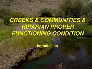
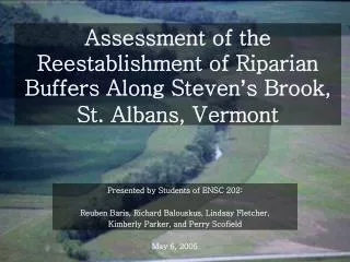
Assessment of the Reestablishment of Riparian Buffers Along Steven ’ s Brook, St. Albans, Vermont. Presented by Students of ENSC 202: Reuben Baris, Richard Balouskus, Lindsay Fletcher, Kimberly Parker, and Perry Scofield May 6, 2005. Problem Statement.

E N D
Assessment of the Reestablishment of Riparian Buffers Along Steven’s Brook, St. Albans, Vermont Presented by Students of ENSC 202: Reuben Baris, Richard Balouskus, Lindsay Fletcher, Kimberly Parker, and Perry Scofield May 6, 2005
Problem Statement • Development encroachment on riparian forests along Stevens Brook, west of Downtown St. Albans, has resulted in increased stream and stream corridor degradation: • Impact on water quality • Increased stream bank erosion • Increased sediment loading
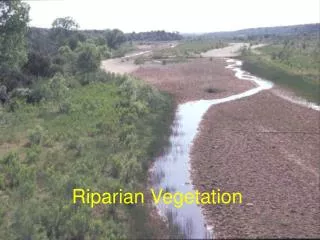
Site Description • Split between agriculture land and urban development • Associated issues • Lawns • Crops • Sediment deposition, bank stability, etc… • Where to go now?
Background • Riparian zones are of concern • Development has decreased effective ecological functions • Long history of farming • Move toward incentive programs in agriculture areas
Goals • Identify areas of risk • Assess the probable impact of the reestablishment of riparian buffers • Predict the effectiveness of these buffers to aid: • Reduction of sediment load • Bank stabilization • Improvement of water quality • Make recommendations about the probability of reestablishment of riparian buffers
Objectives • Identify areas of Steven’s Brook that have reduced or removed riparian forests • Assess level of risk of identified areas • Utilize GIS capabilities • Assess feasibility and likelihood of reestablishment
Urban Determined potential for a buffer. Looked at two sites with potential. Gained perspective from Staci Pomeroy. Agriculture Looked to assess areas with buffers in place. Approaches 1. Site Visit
Approaches 2. GIS
Urban characteristics • Roughly 8,000 citizens • 2.0 square miles • Highly centralized urbanization in downtown area
Urban Characteristics • Highly manipulated through urban reaches • Flow restrictions and channelization • Pavement and grass right up to stream • 9.47 acres of urban land use in 300 ft buffer. 1375 ft of riverbank.
Urban Buffer • 44% of this area is on hydrogroup C soils. 600 ft of riverbank. • This further compounds impervious area issues • 16% of the urban area is both on C hydrogroup soil and occurs on steeper slopes. 219 ft river bank • These are areas of most concern on the stream
Agriculture Characteristics • Over 32,000 acres of agricultural land used primarily for dairy production • Agriculture fields are flush against riverbanks • Increased loading into Steven’s Brook http://www.water.ncsu.edu/watershedss/info/rcwp/vtprof.html
Agricultural Buffer • 12.55 acres of agricultural land use in 300 ft buffer. 1823 ft riverbank • 61% of this area is on C or D hydrogroup soils • 42% of the 12.55 acres is on these impervious hydrogroup soils and on high slopes. 750 ft riverbank
Agricultural Buffer • Roots hold soil in place and absorb water -help prevent eroding banks and landowners from losing valuable agricultural land • Plant help trap sediments -help prevent degrading drinking water, and filling of lakes and wetlands • Needed on farmland due to the harsh impacts agricultural practices -runoff; pesticides, fertilizers, sediment • Benefits to landowners, the general public, and of course the environment
Recommendations Urban Buffer Focus on hydrogroup C, with highest slopes Work with landowners (individually) Install 30-40ft buffers where possible Agricultural Buffer Focus on hydrogroup D, with highest slopes Farmer incentive programs Education Cooperation with Fish and Wildlife Service
Constraints Urban • Because of development, buffer width is confined to pervious areas • Landowner cooperation • Some LOVE their lawns Agriculture • Long history of farming • Economic loss….incentives enough? • Effectiveness in the eyes of farmers • education
Constraints • Interest of landowners was not gauged • Spatial analysis and recommendations done on coarse scale • 25mx25m grid size • 300 ft buffer unrealistic • Who’s responsible? • Maintenance
Conclusion • St. Albans offers two distinct possibilities for riparian buffer installation • Prioritizing reaches at the highest risk for stream degradation is step one • Gauging landowner interest and education must follow