Download
1 / 48
490 likes | 691 Views
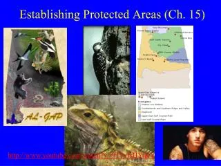
Establishing Protected Areas (Ch. 15). http://www.youtube.com/watch?v=9T1vfsHYiKY. Establishing Protected Areas (Ch. 15). Essential: ex situ not long-term solution Global land surface: 12.5% protected (6% strictly protected). Good news: Protection growing (Fig. 15.1).

E N D
Establishing Protected Areas (Ch. 15) http://www.youtube.com/watch?v=9T1vfsHYiKY
Establishing Protected Areas (Ch. 15) • Essential: ex situ not long-term solution • Global land surface: 12.5% protected (6% strictly protected). Good news: Protection growing (Fig. 15.1)
Levels of Protection • IUCN system (levels I to VI)
Levels of Protection • IUCN system • I) Strict reserves/wilderness areas. Undisturbed & well protected. 2 million sq. km
Levels of Protection • IUCN system • II) National parks. No resource extraction. 4 million sq. km. #1 in area! • III) National landmarks and monuments. Small areas with unique natural features. 190,000 sq. km
Levels of Protection • IUCN system • IV) Managed reserves. Some harvesting allowed (ex; wildlife refuges). 2.5 million sq. km • V) Protected landscapes/seascapes. Traditional uses (orchards, grazing, etc.). 1 million sq. km SCB: Bon Secour NWR Sept. 2012
Levels of Protection • IUCN system • VI) Managed protected areas. Sustainable production. 3.5 million sq. km. #2 in area!
New protected areas created by: • 1) Government. Usually national (regional or local too)
New protected areas created by: • 2) Non-Governmental Organizations (NGOs) • Ex, Nature Conservancy (Box 16.1) • Buys land, conservation easements (legal restrictions on land use) • U.S.: >6 million ha • Outside U.S.: 50 million ha SCB: Oct. 2012
New protected areas created by: • 3) Customs native people • Ex, Madagascar spiny forest—Mahafaly people. Taboo (moral restriction) to destroy plants/animals Who am I?
New protected areas created by: • 4) Biological field stations: Universities • Ex, University California Reserves • 34 reserves: 130,000 acres.
Main Steps to Create New Areas • 1) Identify species or communities with highest priority • 2) Identify areas to meet priorities • 3) Link new areas to network.
Setting priorities • Distinctiveness: rarity/endemism, taxonomic status • Endangerment: degree of threat • Utility: present or potential value to people. Who am I?
Step 1: Setting priorities • Distinctiveness • Rarity/endemism, taxonomic uniqueness • Tuatara!Rhynchocephalian (“beak-head” reptile)
Step 1: Setting priorities • Endangerment: high! • Utility: ecotourism
Region Example • Western Ghats/Sri Lanka (hotspot!) Hotspot review!
Community Example • Western Ghats/Sri Lanka • Distinctiveness: Lots endemic plants • Endangerment: Logging, fires, overharvest, fragmentation • Utility: Watershed value, forest products
Main Steps to Create New Areas • 1) Identify species or communities with highest priority • 2) Identify areas to meet priorities • 3) Link new areas to network.
Step 2: Identifying areas • 1) Species approaches • Focal species: impetus for protection of area • Ex: Flagship species--charismatic megafauna • Ex: Indicator species--associated with endangered community Who am I?
Step 2: Identifying areas • Ex, red-cockaded woodpecker (RCW) • Federally endangered • Nests old pines (loblolly or longleaf) • Snake predation: drill resin wells • Indicator old pine forests.
Step 2: Identifying areas • Species approaches • Value as “umbrella species:” cast protective shadow over all in habitat
Step 2: Identifying areas • 1) Species approaches • 2) Diversity indicators: better-known groups used • Exs, Important Bird Areas (IBAs) and Important Plant Areas (IPAs) Note: EBA=IBA and CPD=IPA
Step 2: Identifying areas • Diversity indicators • Species richness (+ rarity) Fig. 15.7: Darker areas with more species and more % rare species
Step 2: Identifying areas • Diversity indicators • Hotspots: Covered earlier! (Endemism + threat level)
Step 2: Identifying areas • 1) Species approaches • 2) Diversity indicators • 3) Community/ecosystem approaches • 1) Protect self-sustaining unit • 2) Protect ecosystem services • 3) Economically defensible (value ecosystem services). A list!!
Step 2: Identifying areas • Ex: Identify by C:P ratio • Ratio area Converted: area Protected Low priority High priority
Step 2: Identifying areas • Wilderness: Little human impact, low density • Large mammals can survive • Problem developing countries: magnet for people. Population growth twice global rate!
Getting info • Time short, areas not surveyed previously • Solution 1: Rapid biodiversity assessment teams. • Conservation International: RAP (Rapid Assessment Program) RAP expert Slim Shady
Getting info • Programs for: • Terrestrial • Freshwater (AquaRAP) • Marine (Marine Biodiversity Analysis) • Similar idea: Biodiversity Blitz (BioBlitz) NY City!
Getting info • Solution 2: Use ecological principles. • Select unique habitats/communities, cover entire elevational range, etc. (Indonesia: Irian Jaya). New Guinea: 2nd largest island in world
Main Steps to Create New Areas • 1) Identify species or communities with highest priority • 2) Identify areas to meet priorities • 3) Link new areas to network.
Linking to the network • Main topic Ch. 16 • Gap analysis: determine effectiveness ecosystem and community conservation.
Gap analysis steps Step 1! • 1) Data • 2) Conservation goals • 3) Overlay existing areas: find gaps • 4) Identify new areas • 5) Acquire new areas, develop management plans • 6) Monitor new areas (goals met?)
Gap analysis • Uses Geographic Information System (GIS) techniques • Map layers: soils, vegetation, rare species, protected areas, etc. • Alabama Gap Analysis Project • HQ AU (Dr. Barry Grand).
Concepts:4 R’s of Network Design • Representation: Include all conservation units • Resiliency: Large enough, well-protected for future • Redundancy: Protect >1 area each type • Reality: Funds and political support to acquire and manage areas A list!!
Design Issues • Major issues (Fig. 16.1) • 1) Number? • 2) Size? • 3) Shape? • 4) Linkage? • 5) Management?
Design Issues: Number • Few reserves/more reserves? Fig. 16.1
Design Issues: Size • Large or small? Fig. 16.1 Why?
Design Issues: Size • Large better • Fig. 16.2: African parks/protected areas Assume MVP= 1000 animals
Design Issues: Size • Large better • Fig. 16.3: Extinction rates US/Canada parks (animals) Fig. 16.3 Lesson: inverse relation size and extinction rate! Genetic drift: Solution?
Design Issues: Size • Management! • Ex, genetic drift minimized by moving organisms between reserves. So is small useless?
Design Issues: Size • Small can be helpful • Ex, 1999 study Australian woodlands • Plots 50 m square contained native insect species • Conclusion: Mix better than large only Fig. 16.1
Size: General recommendations • 1) Make big • Large populations • Great habitat diversity • Intact ecosystems Fig. 16.1
Size: General recommendations • 2) Create buffer zone at edge (reduce external threats)
Size: General recommendations 3) Acquire entire ecosystems (can protect) Fig. 16.1 Ex: Watershed: all water exiting area goes to same place.
Design Issues: Shape • Regular or irregular? • Fragmented or unfragmented? Fig. 16.1
Design Issues: Shape • Minimize edge (make round) • Reduces edge effect • Protects core (maximizes distance edge to center reserve) Fig. 9.1