Download
1 / 29
290 likes | 428 Views
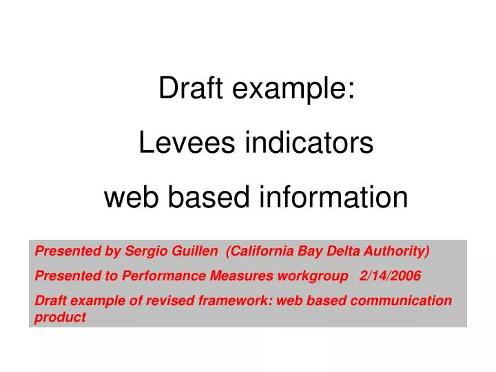
Draft example: Levees indicators web based information. Presented by Sergio Guillen (California Bay Delta Authority) Presented to Performance Measures workgroup 2/14/2006 Draft example of revised framework: web based communication product. outcomes.

E N D
Draft example: Levees indicators web based information Presented by Sergio Guillen (California Bay Delta Authority) Presented to Performance Measures workgroup 2/14/2006 Draft example of revised framework: web based communication product
outcomes Levees: Cause and effect, driver and outcome indicators – prototype website Web structure: 2. Cause and effect page 3. Conceptual model 4. Resources at Risk 11. Land surface elevation 12. Levee stability 18. Habitat 19. Water force on levees 13. Soil characteristics 5. Population 6. Property 14. Seepage and tunneling 7. Agricultural Resources 15. Erosion 8. Infrastructure 16. Physical encroachments 9. Ecosystem 17. Earthquakes 10. Water supply
System scale: Delta Levee System Integrity Drivers and outcomes: cause and effect Erosion Levee maintenance / enhancement Physical encroachments Population growth earthquakes subsidence Drivers Structural integrity of levee Flood events Land use Sea level rise Levee system conceptual model Link to Delta Risk Management Strategy Link to map: island-specific evaluation Resources at risk Risk of failure Habitat benefits Emergency response Outcomes Base level protection: KIM Levee Quality Population Property Infrastructure Ecosystem Water supply Acres / lineal feet of habitat enhancement Island habitat protected by levees Response to breaks / boils Loss of resources Cost of responses Flexibility of infrastructure in emergencies Potential Metrics
Conceptual model for Delta Levee Systems Hazard = (Resources at risk) * (“predictable” risk + “unpredictable” risk) (high water events) (accidents, encroachments, earthquakes) A stable, well-maintained levee provides greater protection. Levee height Levee height Resources at risk Resources at risk Water force on levees Water force on levees Land surface elevation Land surface elevation Levee stability Levee stability Habitat Habitat People Property Agriculture Infrastructure Ecosystem Water supply Subsidence Land Use Drainage mgmt Soil mechanics Seepage Erosion Physical encroachments Earthquakes Impacts Benefits Sea level rise High flow events Tidal action Waves Channel configuration • Delta levees are not designed and constructed for flood control. • Most levee failures have occurred because of seepage and tunneling. • Building levees can reduce habitat.
Conceptual model for Sacramento – San Joaquin River Delta Levee Systems Resources at Risk: Introduction: The Sacramento- San Joaquin River Delta is a unique and valuable resource and an integral part of California’s water system. It receives runoff from over 40 percent of the State’s land area including flows from the Sacramento, San Joaquin, Mokelumne, Cosumnes, and Calaveras Rivers. The Delta is home to more than 400,000 people (1990 census), supports agricultural and recreational activities, provides habitat for many species of fish, birds, mammals and plants; and is the focal point for the water distribution system throughout the state. The Delta covers 738,000 acres interlaced with hundreds of waterways. Much of the land is below sea level and relies on more than 1,000 miles of levees for protection against flooding. The purpose of this overview is to provide a summary of the resources in the Delta that are at risk due to flooding, particularly those that might be affected by levee failure. Resources will be characterized in much greater depth in the analysis that will be provided by the Delta Risk Management Strategy. Partial excerpts from the Delta Atlas Sacramento-San Joaquin Delta • Categories of Resources at risk in the Delta: • People • Property • Agricultural Resources • Infrastructure • Ecosystem • Water Supply
Conceptual model for Delta Levee Systems Hazard = (Resources at risk) * (“predictable” risk + “unpredictable” risk) (high water events) (accidents, encroachments, earthquakes) A stable, well-maintained levee provides greater protection. Levee height Levee height Resources at risk Resources at risk Water force on levees Water force on levees Land surface elevation Land surface elevation Levee stability Levee stability Habitat Habitat People Property Agriculture Infrastructure Ecosystem Water supply Subsidence Land Use Drainage mgmt Soil mechanics Seepage Erosion Physical encroachments Earthquakes Impacts Benefits Sea level rise High flow events Tidal action Waves Channel configuration • Delta levees are not designed and constructed for flood control. • Most levee failures have occurred because of seepage and tunneling. • Building levees can reduce habitat.
Conceptual model for Sacramento – San Joaquin River Delta Levee Systems Resources at Risk: People Population on Delta islands (1990) People at risk: According to the 1990 census, approximately 410,000 people live in the legal Delta. Most of those people live in the uplands on the periphery of the Delta, but there are significant populations on six islands: Andrus-Brannan, Bethel, Byron, Grand, Hotchkiss, and New Hope. The map shows population distribution as of the 1990 census. This graphic of population distribution does not address the non-island areas of the Delta, which have major population centers, including Stockton, Antioch, Brentwood, Rio Vista, and parts of Sacramento. Links: From the Delta Atlas: http://rubicon.water.ca.gov/delta_atlas.fdr/daindex.html Table 3. Population Growth in Delta Communities, 1980-1990 Table 4. Population Characteristics for Delta Communities Table 5. Population Characteristics for Delta Islands Source Delta Atlas: data from 1990 census
Conceptual model for Delta Levee Systems Hazard = (Resources at risk) * (“predictable” risk + “unpredictable” risk) (high water events) (accidents, encroachments, earthquakes) A stable, well-maintained levee provides greater protection. Levee height Levee height Resources at risk Resources at risk Water force on levees Water force on levees Land surface elevation Land surface elevation Levee stability Levee stability Habitat Habitat People Property Agriculture Infrastructure Ecosystem Water supply Subsidence Land Use Drainage mgmt Soil mechanics Seepage Erosion Physical encroachments Earthquakes Impacts Benefits Sea level rise High flow events Tidal action Waves Channel configuration • Delta levees are not designed and constructed for flood control. • Most levee failures have occurred because of seepage and tunneling. • Building levees can reduce habitat.
Conceptual model for Sacramento – San Joaquin River Delta Levee Systems Resources at Risk: Infrastructure Delta islands with significant infrastructure: state or federal highways, major transmission lines, railroads. Infrastructure at risk With its key central location in the state, the Delta is crossed with critical infrastructure connections. Some of these include: state and federal highways, county roads, ship channels, railroad lines, power transmission lines, and underground gas fields and storage areas. The map shows some islands in blue with major infrastructure connections, such as state and federal highways, railways and power transmission lines. Other islands may also have infrastructure such as gas fields, county roads, and utilities. Links: Delta Atlas: Federal and State Highways County Roads Providing Delta Access Islands Requiring Ferry Access Railroads Power Transmission Lines Underground Gas Storage Areas Source: Delta Atlas
Conceptual model for Delta Levee Systems Hazard = (Resources at risk) * (“predictable” risk + “unpredictable” risk) (high water events) (accidents, burrowing animals, arthquakes) A stable, well-maintained levee provides greater protection. Levee height Levee height Resources at risk Resources at risk Water force on levees Water force on levees Land surface elevation Land surface elevation Levee stability Levee stability Habitat Habitat People Property Agriculture Infrastructure Ecosystem Water supply Subsidence Land Use Drainage mgmt Soil mechanics Seepage Erosion Physical encroachments Earthquakes Impacts Benefits Sea level rise High flow events Tidal action Waves Channel configuration • Delta levees are not designed and constructed for flood control. • Most levee failures have occurred because of seepage and tunneling. • Building levees can reduce habitat.
Conceptual model for Sacramento – San Joaquin River Delta Levee Systems Resources at Risk: Water Supply Delta Islands critical for protecting the state’s water supply from excessive salinity. Water Supply More than 2/3 of the state’s water supply is routed through the Delta estuary. The fresh water flows from the Sacramento, San Joaquin systems mix in the Delta, with some of that water being diverted to the large pumps for the federal Central Valley Project (U.S. Bureau of Reclmation) and the State Water Project. (Department of Water Resources). The islands and channels of the Delta provide conveyance for the freshwater to the pumps, and combined with the river flows, help to keep the salinity from the bay from entering the pumps. The current structure of the Delta is critical to support the conveyance of fresh water, particularly from the Sacramento River system, to the pumps in the south Delta that provide most of the water for Central Valley agricultural irrigation, as well as municipal and industrial supplies for much of southern California. Many major water development facilities are dependent on Delta waterways and levees. As shown in the figure, these include State Project facilities: the California Aqueduct, the Harvey O. Banks Delta pumping plant, and the North and South Bay Aqueducts. Major federal water facilities for the Central Valley Project include the Tracy pumping plant, the Delta-Mendota canal, and the Contra Costa Canal. Also show is the East Bay Municipal Utility District Aqueduct (pipeline) that crosses low-lying Delta islands and is protected by levees. (Excerpt from the Delta Atlas) The Delta Flood Protection Act of 1988 identified 8 islands in the western Delta that are critical for protecting water quality at the pumps. This is because the 8 islands are adjacent to major Delta channels in an area where fresh and salt waters mix. The 8 islands (as shown in figure X) are: Sherman Island, Twitchell Island, Bradford Island, Webb Tract, Jersey Island, Bethel Island, Hotchkiss Tract, and Holland Tract. Links: Delta atlas
Conceptual model for Delta Levee Systems Hazard = (Resources at risk) * (“predictable” risk + “unpredictable” risk) (high water events) (accidents, burrowing animals, earthquakes) A stable, well-maintained levee provides greater protection. Levee height Levee height Resources at risk Resources at risk Water force on levees Water force on levees Land surface elevation Land surface elevation Levee stability Levee stability Habitat Habitat People Property Agriculture Infrastructure Ecosystem Water supply Subsidence Land Use Drainage mgmt Soil mechanics Seepage Erosion Physical encroachments Earthquakes Impacts Benefits Sea level rise High flow events Tidal action Waves Channel configuration • Delta levees are not designed and constructed for flood control. • Most levee failures have occurred because of seepage and tunneling. • Building levees can reduce habitat.
Land surface elevation Original land surface Natural water table levee subsidence Drainage ditch Altered water table due to drainage management Conceptual model for Sacramento – San Joaquin River Delta Levee Systems Land Surface Elevation Land use and drainage management on the islands influence the amount of subsidence and how far the islands are below sea level. Much of the Delta is below sea level, creating a need for levees to prevent the land from flooding. Over time, subsidence has caused the land surface to become further and further below the water level, creating a need for bigger, stronger levees to keep the water out. Since the land is below the natural water table, a series of ditches and pumps have been installed on the interior of the island to draw down and maintain the water level so that the interior of the island can remain “dry”. If the drainage system was not operated, eventually the islands would fill up with water until they reached the natural water level – roughly equivalent to the water level in the river. The land use and drainage management on the islands have contributed to subsidence. As the highly organic soils and peat are drained and exposed to air, they become “oxidized” – and are decomposed by naturally occurring soil bacteria. This oxidation, or decomposition can be a major contributor to subsidence in highly organic soils, but is not an issue in mineral soils. Agriculture and other types of land use may contribute to subsidence by enhancing the oxidation process, or other types of soil erosion such as wind erosion. The amount of subsidence due to soil oxidations versus erosion (such as wind erosion) is unknown. It is expected to be variable from island to island depending on amount of organic material in the soil, type of crop, agricultural practices and other factors. Keeping the water table higher so that the soil stays wet may slow the oxidation process. Crops such as rice may decrease oxidation processes and subsidence rates relative to other crops such as cotton or grapes. In addition, the islands that have a lot of peat are also subject to “sinking” due to additional weight. Peat can be somewhat buoyant and has been shown to sink with increased loads. In some cases, when placing material (such as fill dirt) on top of peat, it can sink such that there is no increase in land surface elevation from the additional material. • Links: • Maps from the Delta Atlas: • Thickness of Organic Materials • Land Surface Below Sea Level • Lowest Surface Elevations • Irrigation Diversions • Agricultural Drainage Returns
Conceptual model for Sacramento – San Joaquin River Delta Levee Systems Land Surface Elevation
Conceptual model for Delta Levee Systems Hazard = (Resources at risk) * (“predictable” risk + “unpredictable” risk) (high water events) (accidents, borrowing animals, earthquakes) A stable, well-maintained levee provides greater protection. Levee height Levee height Resources at risk Resources at risk Water force on levees Water force on levees Land surface elevation Land surface elevation Levee stability Levee stability Habitat Habitat People Property Agriculture Infrastructure Ecosystem Water supply Subsidence Land Use Drainage mgmt Soil mechanics Seepage Erosion Physical encroachments Earthquakes Impacts Benefits Sea level rise High flow events Tidal action Waves Channel configuration • Delta levees are not designed and constructed for flood control. • Most levee failures have occurred because of seepage and tunneling. • Building levees can reduce habitat.
Levee Stability Diagram Levee Erosion Water level Erosion Soil characteristics Water force on levee Seepage Physical encroachments Land Earthquakes Conceptual model for Sacramento – San Joaquin River Delta Levee Systems Levee Stability Levee Stability: Soil characteristics Seepage & tunneling Erosion Physical encroachments Earthquakes • Levee stability: • Levee stability is dependent on the characteristics of the material that make up the levee and its ability to withstand the forces of the water pressure. Seepage and tunneling, erosion, and physical encroachments on the levee are all ways that reduce the ability of the levee to withstand the force of the water and cause levee failure. Earthquakes are a concern because they can cause the levee material to become weaker, but they can also cause liquefaction and settling of the earth under the levee – causing levee failure. A stable foundation and continuing levee maintenance are important for maintaining adequate levee stability. • Delta levees are not designed and constructed for flood control • Most levee failures have occurred because of seepage and tunneling. Links:
Conceptual model for Delta Levee Systems Hazard = (Resources at risk) * (“predictable” risk + “unpredictable” risk) (high water events) (accidents, borrowing animals, earthquakes) A stable, well-maintained levee provides greater protection. Levee height Levee height Resources at risk Resources at risk Water force on levees Water force on levees Land surface elevation Land surface elevation Levee stability Levee stability Habitat Habitat People Property Agriculture Infrastructure Ecosystem Water supply Subsidence Land Use Drainage mgmt Soil mechanics Seepage Erosion Physical encroachments Earthquakes Impacts Benefits Sea level rise High flow events Tidal action Waves Channel configuration • Delta levees are not designed and constructed for flood control. • Most levee failures have occurred because of seepage and tunneling. • Building levees can reduce habitat.
Seepage and tunneling Tunneling in cracks Tunneling in sand layer Sand layer Conceptual model for Sacramento – San Joaquin River Delta Levee Systems Levee Stability: Seepage and Tunneling Seepage and tunneling: Seepage and tunneling have been the most common cause of levee failures in the system. Seepage occurs when the water seeps through the tiny soil pores and finds its way into some bigger cracks. Once the water enters some of the larger cracks, the water meets less resistance and may start moving enough to entrain some of the surrounding soil particles, carrying them away and making the crack bigger. This starts a process of “tunneling” where a tiny crack becomes larger and larger as the water starts moving through it and carrying the surrounding soil particles away with it. Eventually the crack widens to the point where the water comes rushing through the levee and crumbles the entire structure. Another type of seepage and tunneling can occur underneath the foundation of the levee rather than through the levee. In some places, there may be a sand layer in the soils below the levee foundation. Because the sand lacks cohesion, water infiltration may cause tunneling in the sand layer. This can cause “boils” to come up on the land side of the levee and may eventually undermine the levee foundation causing failures. This type of tunneling may be more common in the eastern Delta and tributaries where historic sand layers have been deposited from previous river migrations.
Conceptual model for Sacramento – San Joaquin River Delta Levee Systems Levee Stability: Seepage and Tunneling Levee Seepage Repairs: Seepage Berm Slurry Wall 19
Conceptual model for Delta Levee Systems Hazard = (Resources at risk) * (“predictable” risk + “unpredictable” risk) (high water events) (accidents, burrowing animals, earthquakes) A stable, well-maintained levee provides greater protection. Levee height Levee height Resources at risk Resources at risk Water force on levees Water force on levees Land surface elevation Land surface elevation Levee stability Levee stability Habitat Habitat People Property Agriculture Infrastructure Ecosystem Water supply Subsidence Land Use Drainage mgmt Soil mechanics Seepage Erosion Physical encroachments Earthquakes Impacts Benefits Sea level rise High flow events Tidal action Waves Channel configuration • Delta levees are not designed and constructed for flood control. • Most levee failures have occurred because of seepage and tunneling. • Building levees can reduce habitat.
Conceptual model for Sacramento – San Joaquin River Delta Levee Systems Levee Stability: Erosion Erosion Erosion processes can cause loss of material from the levees. On the land side, rainfall and runoff can wash away material from the levees. On the water side, the river’s velocity as it flows downstream can cause erosion, as can any wave action. Wave action can come from natural sources such as wind and storms, or it can be caused by human activities such as boat waves. Tides can cause water levels to fluctuate and can also cause erosion on the water side of levees. Some materials that make the levee more resistant to erosion include: vegetation, geotextiles, and riprap. Pictures???
Conceptual model for Sacramento – San Joaquin River Delta Levee Systems Levee Stability: Erosion 13
Conceptual model for Delta Levee Systems Hazard = (Resources at risk) * (“predictable” risk + “unpredictable” risk) (high water events) (accidents, burrowing animals, earthquakes) A stable, well-maintained levee provides greater protection. Levee height Levee height Resources at risk Resources at risk Water force on levees Water force on levees Land surface elevation Land surface elevation Levee stability Levee stability Habitat Habitat People Property Agriculture Infrastructure Ecosystem Water supply Subsidence Land Use Drainage mgmt Soil mechanics Seepage Erosion Physical encroachments Earthquakes Impacts Benefits Sea level rise High flow events Tidal action Waves Channel configuration • Delta levees are not designed and constructed for flood control. • Most levee failures have occurred because of seepage and tunneling. • Building levees can reduce habitat.
Earthquakes may cause liquefaction of the soils underneath the levee. Levee Conceptual model for Sacramento – San Joaquin River Delta Levee Systems Levee Stability: Earthquakes Earthquakes: A large seismic event in the Delta is unlikely, but the consequences of such an event would be large. A Bay area earthquake may affect Delta levees and also impair emergency response if most resources are needed for critical problems in the Bay area as a result of the earthquake. The basic problem is that many Delta levees are built on layers of spongy peat which can liquefy under earthquake conditions. The waves generated by the earthquake can either by magnified or dampened as they pass through the peat layers, depending on whether the period of the shaking matches the period of the overlying layers. If the periods match, liquefaction occurs and undermines the foundation of the levees. There is nothing that can be done to prevent this liquefaction. It is not known whether liquefaction in the Delta could be in isolated areas or would be widespread. Link: Delta Seismic Risk Report
System scale: Delta Levee System Integrity Drivers and outcomes: cause and effect Erosion Levee maintenance / enhancement Physical encroachments Population growth earthquakes subsidence Drivers Structural integrity of levee Flood events Land use Sea level rise Levee system conceptual model Link to Delta Risk Management Strategy Link to map: island-specific evaluation Resources at risk Risk of failure Habitat benefits Emergency response Outcomes Base level protection: KIM Levee Quality Population Property Infrastructure Ecosystem Water supply Acres / lineal feet of habitat enhancement Island habitat protected by levees Response to breaks / boils Loss of resources Cost of responses Flexibility of infrastructure in emergencies Potential Metrics
Delta Levee System Integrity: System wide indicators and performance measures Outcome: Indicators of base level protection: KIM and RKIM Introduction: The program is to assist reclamation districts achieve a base level of protection – identified as the PL84-99 standard. The PL84-99 standard is a design standard for levees to protect agricultural land from a 100-year flood event (a flood event with a probability of 1% in any given year). On Delta islands, a certain amount of material is needed to bring the levees up to the height and width needed to meet the standard. KIM stands for kilo-inch mile and is a simplified measure of the volume of material needed to bring the levees up to the right height and width to meet the standard. RKIM is short for Risk KIM and adds a “weighting” factor that puts more emphasis on levees that are most prone to flood events. RKIM multiplies KIM by the probability of failure due to high water events. This is not real data – for illustration purposes only. Target: KIM and RKIM = 0 when all Delta levees meet standard – prevent risk of overtopping from 100-year flood • Links: • Description of KIM and RKIM metrics • Information about PL84-99 standard • Map of KIM and RKIM values for each Delta Island Summary: KIM data is calculated from elevation data from ariel surveying and high resolution LIDAR imaging. RKIM also considers the levee height in relation to flood events and uses the probability of overtopping as a multiplicative factor. Baseline values for KIM and RKIM will be developed in 2006, with the results of the 2005 LIDAR survey.
Existing levee 16’ +1.5’ 100 year flood Inches needed 2:1 slope 3:1 to 5:1 slope Delta Levee System Integrity: System wide indicators and performance measures Explanation: PL84-99 Standards for levee protection
KIMs needed to meet standard miles inches Existing levee KIM = kilo-inch miles KIM = inches to meet standard height x miles of levee/ 1000 Delta Levee System Integrity: System wide indicators and performance measures Outcome: Metrics of base level protection: KIM and RKIM Levee height for PL84-99 standard If a levee meets the standard, the KIM value = 0 RKIM = Risk x KIM RKIM = Probability of an island flooding x material needed to meet standard 100 yr flood 1 yr flood KIM KIM 100 yr flood If a levee meets the standard, the RKIM value = 0, but that does not mean it has no risk! 1 yr flood
Delta Levee System Integrity: System wide indicators and performance measures Outcome: Resources at risk : Trends over time Introduction: The risk of Delta islands flooding put resources at risk – including the people, property, and businesses on the island, but also including the risk of disruption to infrastructure such as railroads, transmission lines and aqueducts that serve other parts of the state. Water supplies for over 23 million people and xx acres of agriculture are also at risk if Delta islands fail such that salty sea water comes too far into the Delta and contaminates the water at the pumps. This indicator gives a relative evaluation of whether the resources that are at risk of flooding are increasing or decreasing. Resources at risk from Delta island flooding This is not real data. For illustration purposes only. Summary: • Links: • People • Property • Agricultural Resources • Infrastructure • Ecosystem • Water Supply