Download
1 / 10
100 likes | 207 Views
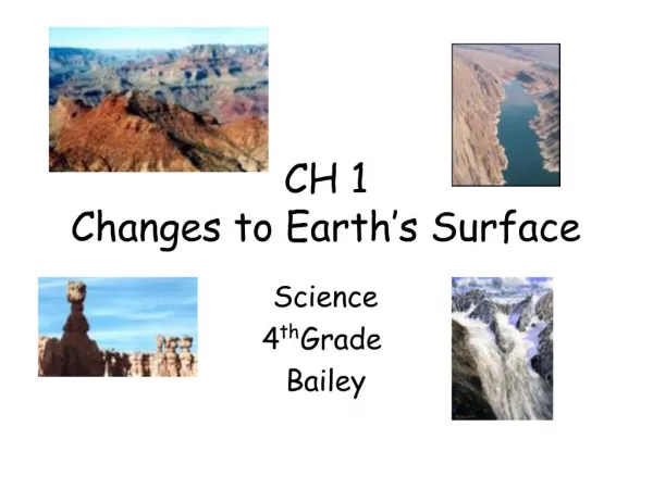
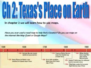
Ch 2: Texas's Place on Earth. In chapter 2 we will learn how to use maps. Have you ever used a road map to help find a location? Do you use maps on the internet like Map Quest or Google Maps?. What is the difference between relative and absolute location?

E N D
Ch 2: Texas's Place on Earth In chapter 2 we will learn how to use maps. Have you ever used a road map to help find a location? Do you use maps on the internet like Map Quest or Google Maps?
What is the difference between relative and absolute location? What is the relative location of Royse City? Using relative location could you give some one directions to Royse City from Rockwall? Ch 2.1: Finding Locations Absolute location uses a geographic grid system to pinpoint locations. The grid system is a set of imaginary parallel lines that intersect at right angles. Latitude lines run east to west and are parallel to the equator. Longitude lines run north to south and are perpendicular to the equator.
Symbol for degree: ° Symbol for minute: ‘ Symbol for second: “ 32° 97’ N 96° 33’ W Latitude: 32.97 N, Longitude: 96.33 W The geographic grid system uses special units of measurement called degrees to identify the coordinates. To make measurements even more exact, geographers divide degrees into 60 equal parts called minutes. Each minute, in turn, can be divided into 60 equal parts called seconds. Degrees and minutes are used to show most locations. Seconds are used only when it is necessary to find a very small place, such as a building or a city block. What is the approximate location of Parker, Texas?
The Geographic Grid System divides the earth into half spheres called hemispheres. The Northern and Southern hemispheres are divided at the equator which is at zero degrees latitude. The Eastern and Western hemispheres are divided along the Prime Meridian which is at zero degrees longitude. Which Tropic do we live closest to? Special Parallels are the tropics and circles of the globe. Their position is determined by the path of the sun across the sky. The tropic parallels mark the farthest north or south that the Sun passes at high noon. At higher latitude than the Arctic and Antarctic circles there are days with where the sun never rises or sets.
Ch 2.2: Understanding scale and projections Would it be difficult to find something on a map of Royse city if the map were the same size as Royse City? To reduce the size of maps compared to the earth they are drawn to scale. Map scale is the relationship between a distance on a map and the actual distance it represents.
Map makers or cartographers, face the problem of representing our round planet on a flat map surface. The difficulty is distorting the scale when converting the shape. Next time you peel an orange lay the skin out flat on the table and see which projection it looks most similar too. Conic Of all the types of map projections on this page, which do you think keeps the most accurate scale?
Ch 2.3: Exploring different kinds of maps In general maps indicate direction, distance, and location. Maps have features like the title, scale, key, and compass rose to help you read them. A B Maps can show much more than how to get from one place to another. There are many different kinds of maps. They are usually grouped into two main categories: general-purpose maps and special purpose maps. Which map is the political map? How do you know it is?
Maps are designed to tell where places are located and a little bit about what these places are like. One type of general-purpose map is a physical map. Physical maps show the topography of an area such as its mountains, valleys, rivers, and lakes. These maps, also called topographic or elevation maps, often have different shades of color to show differences in elevation. Another common type of general-purpose map is a political map. Political maps show boundaries that people have created such as those between counties, states, and countries. The general-purpose maps found in your classroom most likely are physical-political maps. These maps show some political units such as cities, counties, states, or countries as well as key physical features such as rivers, bays, and mountain ranges. What country is this a physical-political map of? Physical-Political Map
What is the average precipitation in Dallas? What city gets over four feet of rain a year? Special-purpose maps—sometimes called thematic maps—show information about a specific topic. Military maps, natural resource maps, precipitation maps, historical maps, and city street maps are just a few examples of special-purpose maps. Each shows how something—such as average annual precipitation—is distributed within an area.
Ch 2 Vocabulary THESE VOCABULRY WORDS WILL BE ON YOUR TEST!!! BE CERTAIN THAT YOU KNOW THEM!!! latitude the location north or south of the equator longitude the location east or west of the prime meridian hemisphere one half of the earth, divided by the equator into northern and southern halves or by the 0° and 180° meridians into eastern and western halves equator the imaginary line at 0° latitude that divides the earth into a northern half, the Northern Hemisphere, and a southern half, the Southern Hemisphere prime meridian the imaginary line at 0° longitude scale the relationship between a distance on a map and the actual distance it represents cartographer a person who makes maps projection the transfer of an image of a curved surface onto a flat surface physical map a general-purpose map that shows the natural features of an area topography the physical features of the earth’s surface and their relationship to one another in terms of location and elevation political map a general-purpose map that shows recognized boundaries in an area physical-political map a general-purpose map that shows both the topography and recognized boundaries of an area legend an explanation of a map’s symbols and scale