Download
1 / 45
460 likes | 603 Views
Rainfall and River Forecasts. The Processes and Products. Jeff Dobur , NWS Peachtree City, GA Michael Moneypenny , NWS Raleigh, NC. River Forecast Centers. River Gages and Forecasts. River Forecasts – How are they created?. Basic Forecast Process. Basin Watershed. Observed

E N D
Rainfall and River Forecasts The Processes and Products Jeff Dobur, NWS Peachtree City, GA Michael Moneypenny, NWS Raleigh, NC
River Forecast Centers
River Forecasts – How are they created? Basic Forecast Process Basin Watershed Observed Precipitation Future Precipitation Upstream Flow SAC-SMA Model Rain to Runoff Unit Hydrograph Runoff to Flow Basin Local Flow Total Flow (cfs) River Gage Rating Curve Stages to Flows Forecaster Modification Forecast To WFO
The U.S. Geological Survey Performs Flow Measurements at Each Forecast Point
To Produce Rating Curves Volume of Flow is Converted to Stage
River Forecast Points The NWS Surveys Each Site to Determine Impacts
NC Flood InundationMapping Networkhttp://fiman.nc.gov • Available for sites other than NWS Forecast Points • Need to request a Login & Password
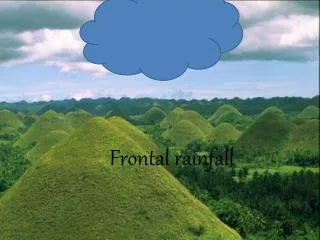
Factors Impacting Rainfall Distribution in Landfalling and Evolving Tropical Cyclones Tropical Storm Alberto • Storm track and location • Time of day – core rainfall overnight/ outer band rainfall during day • Storm size – the bigger the storm, the more it rains at any given spot • Storm motion – slower moving storms typically produce more rain at any given spot • Nearby synoptic-scale features (i.e. fronts) • Heaviest rainfall usually occurs along and 75 miles either side of the storm track • Different with every system
It’s all about interactions!Forecasting Schematic for Heavy Events
Hanna interacted with a cold front and upper level disturbance shifting the rainfall swath left of track. Tropical Storm Hanna 72 83
MMEFS Multi Meteorological Model Ensemble Forecast System What is MMEFS? Short-term Hydrologic Ensemble Forecasts generated from using the QPF values from the associated meteorological model ensemble data.
MMEFS Multi Meteorological Model Ensemble Forecast System How does MMEFS work? Hydrologic Model Meteorological Precipitation (QPF) Ensembles Forecast Streamflow Ensembles No Forecaster Intervention
MMEFS Multi Meteorological Model Ensemble Forecast System Why do we have MMEFS ? Uncertainty • our inability to know for sure • risk
MMEFS Multi Meteorological Model Ensemble Forecast System Why do we have MMEFS? Reservoirs? Estimating Past Rainfall? Stage to Flow Relationship? Uncertainty in River Forecasting What’s Upstream? River Gage Observations? Future Rainfall? Extreme Forecasts?
MMEFS Multi Meteorological Model Ensemble Forecast System Why do we have MMEFS? Reservoirs? Estimating Past Rainfall? Stage to Flow Relationship? Uncertainty in River Forecasting What’s Upstream? River Gage Observations? Future Rainfall? Extreme Forecasts?
MMEFS Multi Meteorological Model Ensemble Forecast System Why do we have MMEFS? Uncertainty in River Forecasting Future Rainfall? MMEFS attempts to capture the uncertainty in both time and magnitude of the future precipitation and its influence on hydrologic response.