Download
1 / 40
400 likes | 630 Views
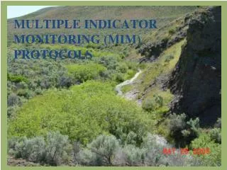
Multiple Indicator Monitoring (MIM) Protocols. Stubble ht, 2. bank alteration, 3. woody browse, 4. greenline veg , 5. woody species height, 6. bank stability, and 7. woody regeneration – on the greenline. 8. Greenline-to-Greenline 9. substrate – in the x section, and 10. residual depth.

E N D
Stubble ht, 2. bank alteration, 3. woody browse, 4. greenline veg, 5. woody species height, 6. bank stability, and 7. woody regeneration – on the greenline 8. Greenline-to-Greenline 9. substrate – in the x section, and 10. residual depth
Setting Up the DMA For a representative or critical DMA to be useful, livestock must have access to the stream. The DMA should be randomly located within the selected complex. After the DMA is selected, a permanently marked reach is established.
Reach Length • The reach extends at least 110 meters (361 feet) along the stream. • Longer reaches may be needed on larger streams (over 5.5 meters or 18 feet of greenline-to-greenline, or bankfull width). For such streams, the reach should be approximately 20 times the greenline-to-greenline (GGW) width, or two meander wavelengths (approximately 20 times the bankfull width - Gordon et al. 2004), if the bankfull width indicators are present. • A stream reach with an average GGW or bankfull width of 8.3 meters would be 8.3 X 20, or 166 meters in length.
Reach Markers • Permanently mark the lower and upper ends of the reach with reach markers. • Place the lower marker on the left-hand side (looking upstream) and the upper marker 110 meters upstream (further if a longer reach is used). • The marker should be located at least 2 meters away from the top of the bank. • Reach markers should be made of securely capped or bent over larger-diameter rebar or similar material.
REFERENCE MARKER • Used as a reference point to help relocate the DMA. • Should be located well away from the Transect (at least 100 feet if a post that attracts livestock is used). • Use steel posts, a marked post in a fence line, a marked tree or unique rock, or other natural feature, or • GPS location (UTM or latitude-longitude) for both the reference marker, and the reach markers. • Sketch the monitoring setup
PLANT LIST Develop a plant list and record species codes for the site. The Data Entry Module contains a complete list of plant species codes and a worksheet for recording plant codes applicable to the DMA. Also refer to the plants table in Appendix H for appropriate plant species codes.
Final Thoughts on Pre-work/ stratification and DMA Selection Don’t rush into Monitoring w/MIM! Spend an appropriate amount of time and effort on determining existing and potential conditions, stratification, objective setting, and DMA selection Document your DMA selection rationale The “Ready, Fire, Aim” sequence does not work
Systematic Procedures Photos (4 photos minimum) Locate Coordinates using GPS coordinates, upper and lower markers and reference markers Select only those monitoring indicators that are needed to answer monitoring questions (you do not have to collect all 10 metrics at each DMA!)
50 cm 20 cm 12.5 cm 20 cm 1 2 3 4 5 1 inch or 2 cm Systematic Procedures 4. Monitoring Frame • 2 side-by-side Daubenmire quadrats • Subdivided into 4 equal parts (5 Lines) • Handle used to measure stubble height
Systematic Procedure • 5. Sample Interval • Typical DMA is 110 meters (361 feet) • Usually at least 80 samples (40 each side) • Interval 2.75 meters (9 feet) • Shorter interval 2 meters provide 55 samples each side • Measuring the Sample Interval • A typical measuring rod in 2 meters and may be used to measure the interval • Interval may be stepped. Determine the length of your step, must be consistent.
Stream Flow Systematic Procedure • 7. First Sample • Determine a random number between 1 and 10 • Step that number of steps up stream and place frame on left hand side (up stream) • Center bar on greenline
Located by pacing ▲ ▲ Flow Systematic Procedure • Monitoring the DMA • Sample entire length of DMA, Both sides • When the end is reached, measure the distance from last plot to marker, cross to the other side measure the remaining part of the plot interval, measure the remaining distance, place the frame and continue downstream to the lower marker
Systematic Procedure 9. Sample Size • After completing 80 + samples with an inadequate number of samples • Determine from the sample size predictor the number needed • Divide the DMA length by the number of samples needed, begin measuring the determined interval from lower marker • Place the frame and obtain data • Measure the interval to the next sample location place the frame on the opposite bank • Alternate from side-to-side for the length of the DMA
1. Greenline Vegetation Composition • Develop a species list • Plant codes, species, groupings, etc. • Record herbaceous vascular plants (perennial) • Amount of foliar cover • Exclude bare ground, litter, duff • Record woody species understory • Cover of seedlings not considered overstory
1. Greenline Vegetation Composition • Record woody species overstory • Use height class table to record height • Rooted in or overhanging plot • Record embedded rock and anchored wood • Rock > 15cm or anchored wood is recorded • Record grouped plants • Group plants with less than 10 percent foliar cover (mesic forbs early MFE, mesicgraminoids MG)
Woody Species Overstory • Woody Species Overstory • Record all woody plant species rooted in or overhanging the quadrat. • If any part of the plant occurs over the quadrat it is counted. • Foliar cover is not used • 2 species = 50% per species • 3 species = 33% per species • Total plant composition (understory + overstory) less than or = 200%
2. Wood Species Height Determine the tallest part of each woody species that has cover OVER the quadrat.
3. Streambank Alteration • What is MIM Streambank Alteration? • The number of lines on the plot that intercept hoof prints, hoof shears – disturbances caused by trampling. • 5 lines per frame – one sample • At least 80 samples per site – total of 400+ lines • % Streambank Alteration = the proportion of the 400+ lines that intercept hoof prints/shears
MIM Bank Alteration 80+ plots -400 Samples
Proper Use of Bank Alteration As a short-term indicator of disturbance effects on bank stability and vegetation Any value assigned as a trigger to move livestock or as a measure of grazing use is a “guideline” which must be able to change through time (See Cowley 2002) Thus a “Term and Condition” should incorporate an adaptive process.
Bank Alteration and Bank Stability As bank alteration goes down, then bank stability goes up.
Amount of Alteration that streambanks can repair annually depends upon: • Stream gradient • Streambed material composition, • Streambank soil composition, • Vegetation cover and type • Channel geometry, • Flow rate and timing, and • “. . . concentrated impacts under rotation systems can cause sufficient woody plant or streambank damage in a single season or year that recovery might take several years. Therefore, the best approach is to limit grazing stress to the site’s capability for annual recovery.” (Clary and Kruse 2004)
McHaley Creek Nick Stiner, Malheur NF Bank Stability 100% Dominant greenline vegetation: CANE Bank alteration: 28% Stubble height: 4.2”
EF Deer Creek Dominant Vegetation POPR– 65% MFE – 22% JUBA – 12% SCMI – 3% % Hydric – 19% Sept. 2008 Bank alteration: 24% Bank stability: 51% June 2009 Bank alteration: 4% Bank stability: 67% June 2009 October 2009 Bank alteration:1% Bank stability: 70% Nick Stiner, Malheur NF – Fall 2009
LOWER LONG TOM CREEK Bank Alteration = 77% Bank Stability = 2% % Hydric Herbaceous = 10%
A Rational Approach to Bank Alteration Criteria and Standards • Existing Condition: Compare existing condition to a reference (best method) • Bank Stability (%): • Bank Cover (%): • Hydric herbaceous vegetation (%) • (closer these are to reference the higher the allowable level of bank alteration) • Channel Type: • > gradient = higher allowable level • > particle sizes = higher allowable level
The Confidence Interval • Any criteria requires consideration of the precision of the measurement. • CI for Streambank Alteration • 32 tests • Maximum – 11% • Minimum - .5% • Average – 6% • Using the CI: • Set trigger at allowable level minus 6% • Set standard at allowable level plus 6% • e.g. If allowable level is 20%, trigger might be set at 14%, and term and condition set at 26%.
Block detached from streambank Fracture 4. Streambank Stability • Stream scour line up to the edge of the floodplain. • What kind of bank is it? • Erosional or Depositional • Is the bank covered? • Covered or Uncovered • Is it stable? Fracture Slump Slough Eroding Absent
5. Stubble Height Determine “key” species ahead of time. Measure key species nearest the quadrat handle. Using handle, record average leaf length to nearest inch (centimeter). If key species does not occur, then leave cell blank.
6. Woody Species Age Class 0.42 meter (1 frame width) GREENLINE
6. Woody Species Determine frame placement Distinguish individual plants Determine age class Record woody root sprouting and rhizomatous species Record low growing shrubs
8. Substrate Composition Beginning with the 2nd plot, collected every other GGW transect (20 times) Measure median diameter of 10 particles at each transect (200 particles total) May use gravelometer or ruler
9. Woody Species Browse • 2 meters (1 meter either side of greenline) x length between sample points (2.75 meters) • Evaluate first available woody plant (A). Repeated for each key woody species (B and C). • May want to use a 2 meter “stick” to be centered on greenline.
10. Residual Stream Depth • Begin at downstream marker and move upstream • Record depth at riffle crest • Record depth at pool bottom • Record tape distance