Download

1 / 72
720 likes | 909 Views
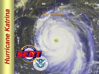
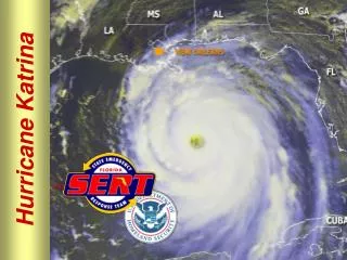
Hurricane Katrina. Tropical Storm Katrina [the early days]. http://www.ssd.noaa.gov/PS/TROP/DATA/RT/FLOAT/VIS/20.jpg. Katrina’s Path. www.wunderground.com/hurricane/at200512.asp. http://www.stormtracker.noaa.gov/stormtracker-katrina.htm. Hurricane Katrina to hit New Orleans?.

E N D
Tropical Storm Katrina [the early days] http://www.ssd.noaa.gov/PS/TROP/DATA/RT/FLOAT/VIS/20.jpg
Katrina’s Path www.wunderground.com/hurricane/at200512.asp
Hurricane Katrina to hit New Orleans? • NEW ORLEANS, Louisiana (CNN) -- A solemn New Orleans Mayor Ray Nagin ordered mandatory evacuations Sunday as his city faced its worst fear -- the threat of a direct hit from a major hurricane that could swamp the low-lying city. August 28, 2005
By mid-morning Sunday, Katrina was a Category 5 hurricane with maximum sustained winds near 175 mph. It was expected to make landfall Monday morning. Category 5 is the most intense category on the Saffir-Simpson scale of intensity. Officials are particularly concerned about New Orleans because about 70 percent of the city is below sea level. The city essentially sits in a bowl, protected by a series of levies that keep the Mississippi River waters out. Nagin warned that Katrina's expected storm surge -- which could top 28 feet -- would likely topple those levies.
The last hurricane to score a direct hit on New Orleans was Hurricane Betsy, a Category 2 with 105 mph winds when it came ashore in 1965. Betsy killed more than 70 people, its storm surge overflowing the levees and reaching the eaves of many buildings. The levees are higher now, but Katrina is a stronger storm -- as strong as 1969's Hurricane Camille, which grazed New Orleans when it came ashore in Mississippi and killed more than 250 people. "After Betsy these levies were designed for a Category 3," said Sheriff Jeff Hingle of Placquemines Parish, just southeast of New Orleans. "You're now looking at a Category 5. You're looking at a storm that is as strong as Camille was, but bigger than Betsy was size-wise. These levies will not hold the water back. So we're urging people to leave. You're looking at these levies having 10 feet of water over the top of them easily." • http://www.cnn.com/2005/WEATHER/08/28/katrina.neworleans/index.html/
Evacuating Before the Hurricane HitsDiamond Fowler of California drags her bag, as she and her family walk to the Louisiana Superdome Sunday [August 28, 2005]. http://www.cnn.com/2005/WEATHER/08/28/hurricane.katrina/index.html Video “Worst Case Scenario”
NOAA HURRICANE HUNTER PILOT CAPTURES KATRINA AT HER MEANEST Sept. 1, 2005 — NOAA hurricane hunter aircraft conducted ten long flights into and around the eye of Hurricane Katrina. Lt. Mike Silah got to see Hurricane Katrina up close and personal, especially when she was an extremely dangerous Category Five storm in the Gulf of Mexico. The day before the powerful and destructive storm made landfall on the USA Gulf Coast, Silah snapped a series of images capturing the eyewall of Katrina.
NOAA Hurricane Hunters www.hurricanes.noaa.com
Eyewall on August 28, 2005, a day before it hit the U.S. Gulf Coast www.hurricanes.noaa.com
Swirling clouds of the eyewall at Category 5. www.hurricanes.noaa.com
The eyewall of Katrina [Category 5]; note the swirling clouds. www.hurricanes.noaa.com
Canal Street in New Orleans is empty except for the debris of thrown trees as Hurricane Katrina pounds the Crescent City on Monday, Aug. 29, 2005. August 29, 2005Katrina hits New Orleans www.nola.com
Floodwaters surround a car in Uptown New Orleans early Monday, Aug. 29, 2005 as high winds and rain batter the Louisiana coast as Hurricane Katrina makes landfall. AP/Dave Martin www.nola.com
Blair Quintana, right, and Patrick Lampano seek shelter in a doorway in the French Quarter of New Orleans as Hurricane Katrina pounds the Crescent City on Monday, Aug. 29, 2005.AP/Dave Martin www.nola.com
The waters of Lake Pontchartrain surge over a road early Monday, Aug. 29, 2005 in Lacombe, La., as Hurricane Katrina moved ashore about 100 miles away.AP Photo/Mari Darr-Welch www.nola.com
A downed tree rests on a truck as winds from Hurricane Katrina began to increase Monday, Aug. 29, 2005 in Lacombe, La.AP Photo/Mari Darr-Welch www.nola.com
Hurricane Katrina pounds New Orleans early Monday, Aug. 29, 2005. St. Louis Cemetery is in the foreground.AP Photo/Dave Martin www.nola.com
High winds and rain pound the Louisiana Superdome as Hurricane Katrina makes landfall along the Louisiana coast on Monday, Aug. 29, 2005. Officials report that part of the roof of the Superdome, which is housing some 10,000 evacuees, is leaking.AP Photo/Dave Martin www.nola.com
Charles Anslum rides his bike through downtown Morgan City, La., as Hurricane Katrina makes landfall Monday, Aug. 29, 2005.AP Photo/David J. Phillip www.nola.com
Waves crash against a boat washed onto Highway 80 as Hurricane Katrina hits the Gulf Coast Monday, Aug. 29, 2005 in Gulfport, Miss.AP Photo/John Bazemore www.nola.com
Valence St. in Uptown New Orleans, following Katrina.Chris Mercadel/New Orleans www.nola.com
Cadiz St. in Uptown New Orleans, following Katrina.Chris Mercadel/New Orleans www.nola.com
A SUV is surrounded by downed trees in Walker.Andrew Gross www.nola.com
Hurricane Katrina flooded yards on Hastings Street in Metairie.Alice Keife www.nola.com
New Orleans residents are rescued by helicopter from the floodwaters of Hurricane Katrina Wednesday, Aug. 31, 2005 in New Orleans. AP Photo/David J. Phillip www.nola.com
Two residents take refuge on their rooftop after the hurricane caused severe flooding in New Orleans. www.cnn.com
Hurricane Damage • http://www.weather.com/newscenter/tropical/?from=wxcenter_news
http://www.weather.com/newscenter/tropical/?from=wxcenter_newshttp://www.weather.com/newscenter/tropical/?from=wxcenter_news
An SUV is crushed by fallen bricks after Hurricane Katrina hit New Orleans Monday. www.cnn.com
Cars are almost submerged in this parking lot in Mobile, Alabama, caused by a storm surge. www.cnn.com
Water flows over a levee on the Inner Harbor Navigation Canal in New Orleans, Louisiana, August 30.Officials say the New Orleans levee system wasn't built to withstand a storm of Katrina's size.Photograph by Smiley N. Pool/Dallas Morning News/Corbis http://news.nationalgeographic.com/news/2005/09/0902_050902_katrina_levees.html
Damage from broken Levees • http://www.weather.com/newscenter/tropical/?from=wxcenter_news
http://www.weather.com/newscenter/tropical/?from=wxcenter_newshttp://www.weather.com/newscenter/tropical/?from=wxcenter_news
http://www.weather.com/newscenter/tropical/?from=wxcenter_newshttp://www.weather.com/newscenter/tropical/?from=wxcenter_news
SLIDESHOWS • http://www.weather.com/newscenter/tropical/?from=wxcenter_news
New Orleans Before… http://www.nasa.gov/vision/earth/lookingatearth/gulfcoast_flood.html
New Orleans After Flooding http://www.nasa.gov/vision/earth/lookingatearth/gulfcoast_flood.html
New Orleans residents wait to be rescued from the floodwaters of Hurricane Katrina Wednesday, Aug. 31, 2005 in New Orleans. AP Photo/David J. Phillip www.nola.com
Urgent URGENT - WEATHER MESSAGE NATIONAL WEATHER SERVICE NEW ORLEANS LASunday, Aug. 28, 2005 at 6:56 PM MOST OF THE AREA WILL BE UNINHABITABLE FOR WEEKS...PERHAPS LONGER. AT LEAST ONE HALF OF WELL CONSTRUCTED HOMES WILL HAVE ROOF AND WALL FAILURE. ALL GABLED ROOFS WILL FAIL...LEAVING THOSE HOMES SEVERELY DAMAGED OR DESTROYED. THE MAJORITY OF INDUSTRIAL BUILDINGS WILL BECOME NON FUNCTIONAL. PARTIAL TO COMPLETE WALL AND ROOF FAILURE IS EXPECTED. ALL WOOD FRAMED LOW RISING APARTMENT BUILDINGS WILL BE DESTROYED. CONCRETE BLOCK LOW RISE APARTMENTS WILL SUSTAIN MAJOR DAMAGE...INCLUDING SOME WALL AND ROOF FAILURE. HIGH RISE OFFICE AND APARTMENT BUILDINGS WILL SWAY DANGEROUSLY...A FEW TO THE POINT OF TOTAL COLLAPSE.
Hurricane Katrinaand its aftermath. An interdisciplinary, critical inquiry.
Flooding the French Quarter A city built below sea level is sustained by a complex system of dams serving as a buffer against storm surges and the wetlands of the Mississippi Delta.