Download
1 / 15
160 likes | 338 Views
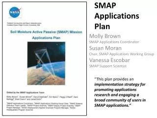
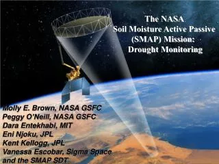
The NASA Soil Moisture Active Passive (SMAP) Mission: Drought Monitoring. Molly E. Brown, NASA GSFC Peggy O’Neill, NASA GSFC Dara Entekhabi, MIT Eni Njoku, JPL Kent Kellogg, JPL Vanessa Escobar, Sigma Space and the SMAP SDT. Science Objectives.

E N D
The NASA Soil Moisture Active Passive (SMAP) Mission: Drought Monitoring Molly E. Brown, NASA GSFC Peggy O’Neill, NASA GSFC Dara Entekhabi, MIT Eni Njoku, JPL Kent Kellogg, JPL Vanessa Escobar, Sigma Space and the SMAP SDT
Science Objectives SMAP will provide high-resolution, frequent-revisit global mapping of soil moisture and freeze/thaw state to enable science and applications users to: • Understand processes that link the terrestrial water, energy and carbon cycles • Estimate global water and energy fluxes at the land surface • Quantify net carbon flux in boreal landscapes • Enhance weather and climate forecast skill Freeze/thaw state • Develop improved flood prediction and drought monitoring capability
Value of Soil Moisture Data to Weather and Climate New space-based soil moisture observations and data assimilation modeling can improve forecasts of local storms and seasonal climate anomalies NWP Rainfall Prediction Seasonal Climate Predictability Predictability of seasonal climate is dependent on boundary conditions such as sea surface temperature (SST) and soil moisture – soil moisture is particularly important over continental interiors. Difference in Summer Rainfall: 1993 (flood) minus 1988 (drought) years Buffalo Creek Basin Observed Rainfall 0000Z to 0400Z 13/7/96 (Chen et al., 2001) Without Realistic Soil Moisture Observations 24-Hours Ahead High-Resolution Atmospheric Model Forecasts Prediction driven by SST and soil moisture Prediction driven just by SST With Realistic Soil Moisture High resolution soil moisture data will improve numerical weather prediction (NWP) over continents by accurately initializing land surface states (Schubert et al., 2002) -5 0 +5 Rainfall Difference [mm/day]
Instruments: Radiometer: L-band (1.4 GHz) V, H, 3rd & 4th Stokes parameters 40 km resolution Moderate resolution soil moisture (high accuracy ) Radar: L-band (1.26 GHz) VV, HH, HV polarizations 3 km resolution (SAR mode); 30 x 5 km resolution (real-aperture mode) High resolution soil moisture (moderate accuracy) and Freeze/Thaw state detection Shared Antenna 6-m diameter deployable mesh antenna Conical scan at 14.6 rpm Constant incidence angle: 40 degrees -- 1000 km-wide swath -- Swath and orbit enable 2-3 day global revisit Orbit: -- Sun-synchronous, 6 am/pm, 680 km altitude -- 8-day exact repeat Mission Operations: --3-year baseline mission -- Launch in November 2014 Measurement Approach
Instrument Overview Spun instrument assembly Radiometer is spun-side mounted to reduce losses Radar is fixed-mounted to reduce spun inertia • Radiometer • Provided by GSFC • Leverages off Aquarius radiometer design • Includes RFI mitigation (spectral filtering) • Common 6 m spinning reflector • Enables global coverage in 2-3 days • Spin Assembly and Reflector Boom Assembly have extensive heritage • Radar • Provided by JPL • Leverages off past JPL L-band science radar designs • RFI mitigation through tunable frequencies & ground processing
SMAP Data Products Table (Publicly Available) * Mean latency under normal operating conditions. Latency defined as time from data acquisition by instrument to availability to designated archive. The SMAP project will make a best effort to reduce these latencies.
Algorithm Evaluation In Progress Using SMAP End-to-End Science Simulation Testbed L1C_S0_Hi-Res Radar Backscatter Product (1-3 km) L1C_TB Radiometer Brightness Temperature Product (36 km) L3_SM_A/P Combined Soil Moisture Product (9 km) L2_SM_A Radar Soil Moisture Product (3 km) L2_SM_P Radiometer Soil Moisture Product (36 km)
Level 4 Soil Moisture and Carbon Simulated Products Level 4 Soil Moisture (Surface and Root Zone estimates) Mean Daily Net CO2 Exchange Volumetric Soil Moisture (%)
L4_SM inputs and outputs L4_SM product • 9 km, 3-hourly globaloutput with 7-day latency • Surface soil moisture (≡ top 5 cm) • Root zone soil moisture (≡ top 1 m) • Research output • surface and soil temperatures (input to L4_C) • sensible, latent, and ground heat flux • runoff, baseflow, snowmelt • surface meteorological forcings (air temperature, precipitation, …) • error estimates (generated by assimilation system) In units of m3m-3 and percentiles SMAP inputs Brightness temperature (L1C_TB, 36 km) Radar soil moisture (L2_SM_A, 3 km) Freeze-thaw state (L3_F/T_A, 3 km) Ancillary data inputs Land model parameters Surface meteorology (incl. observation-corrected precip) Land assimilation parameters L4_SM algorithm
SMAP Mission requirements: global coverage with an accuracy of <0.04 cm3/cm3 in soil moisture for the region with less than 5 kg/m2 vegetation water content having ~9 km spatial and 3 days temporal resolution.
SMAP Applications • A primary goal of the SMAP Mission is to engage SMAP end users and build broad support for SMAP applications through a transparent and inclusive process • Toward that goal, the SMAP Mission: • formed the SMAP Applications Working Group • currently over 300 members • open to everyone, register at http://smap.jpl.nasa.gov/science/applicWG • SMAP Applications Plan available on the SMAP website • (Contact: molly.brown@nasa.govorsusan.moran@ars.usda.gov ) • SMAP Cal/Val Plan (draft) in preparation, incorporating recent inputs from: • SMAP Cal/Val Working Group activities (In Situ Testbed, Core Sites) • Workshop tentatively scheduled for May 2011 in Oxnard • Coordination with other international programs and missions (CSA, SMOS, Aquarius) • (Contact: T. Jackson - tom.jackson@ars.usda.gov)
SMAP Applications SMAP Applications Program Objectives • Assess current applications benefits and requirements for SMAP products • Develop a community of end-users • Target partners who can work with the SMAP project • Provide information about SMAP to the broad user community
SMAP Applications • During the Pre-Launch period, we have three levels of users: • Early Adopters – those who have signed Memorandum of Agreements with NASA, extensive access to SMAP testbed data and assistance from the SMAP SDT • Community of Practice – those who are interested in SMAP, participate in workshops, access early SMAP test products when released • Community of Potential – those who have not yet engaged with the SMAP project, but may be interested once data is available • 2nd SMAP Applications Workshop will be held on October 14-15, 2011 at USDA headquarters, Washington DC
7 Early Adopter Projects • Transition of NASA SMAP research products to NOAA operational numerical weather and seasonal climate predictions and research hydrological forecasts Contact: Dr. Xiwu Zhan, NOAA-NESDIS-STAR • Implementation of monitoring of SMAP soil moisture and brightness temperature at ECMWF Contact: Dr. Lars Isaksen, Dr. Patricia de Rosnay, Data Assimilation section, ECMWF • SMAP for Crop Forecasting and Food Security Early Warning Applications Contact: Dr. Amor Ines, Dr. Stephen Zebiak, International Research Institute for Climate and Society (IRI), The Earth Institute at Columbia University • Soil Moisture Monitoring in Canada Contact: Dr. Catherine Champagne, Agriculture and Agri-Food Canada, Ottawa, ON Canada • Estimating and mapping the extent of Saharan dust emissions using SMAP-derived soil moisture data. Contact:Dr. Hosni Ghedira, Masdar Institute (Masdar.ac.ae) United Arab Emirates, • Assimilation of SMAP active and passive data in the Canadian Land Data Assimilation System (CaLDAS) Contact: Dr. Stephane Belair, Meteorological Research Division, Environment Canada • US National Cropland Soil Moisture Monitoring using SMAP Contact: Dr. Rick Mueller, Dr. Zhengwei Yang, USDA NASS
Summary • SMAP provides high-resolution and frequent-revisit global mapping of soil moisture and freeze/thaw state that has: • Science value for Water, Carbon and Energy Cycles • Applications benefits in Operational Weather, Flood & Drought Monitoring, other areas • Addresses priority questions on Climate and Climate Change • NOAA, DoD, USDA, others are actively engaged with SMAP to develop an Applications Plan for using SMAP data after launch • Science Definition Team has international participation: Canadian, British, Australian, French & Italian representatives • SMAP will take advantage of precursor data from ESA’s SMOS mission • SMOS radiometer-derived soil moisture at 40 km resolution will aid in SMAP algorithm development and global RFI assessment and mitigation • CSA is partnering with SMAP for science, Cal/Val, and Applications development