Download

1 / 18
360 likes | 1.02k Views
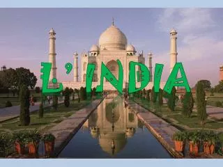
Geography Chapter of class 6 .<br>Includes Key Terms , Proper and Brief Introduction with Pictures and Defines .

E N D
INDIA : THE COUNTRY • Area: 3.28 million sq. Km • North-South (Kashmir toKanyakumari): 3200 km • East-West (Arunachal Pradesh toKutchch): 2900 km • Population: 1.15 billion (second most populous country) • Landforms: mountains, desert, plains, plateau, coastline and islands. • Diversity in landforms, climate, vegetation, wildlife, language and culture.
Peninsula • It is a piece of land that is surrounded by water on three sides. • Eg. India, Colaba in Mumbai, Florida in USA, Mexico etc. • They are sometimes called as "half islands".
Locational Setting • Northern and eastern hemisphere. • South-North: 804'N to 37 0 6'N (latitudes) • West-East: 6807'E to 97 025'E (longitudes) • Tropic of Cancer passes through the centre of India • Longitudinal extent of 29 0 causes a wide difference of 2 hrs in local times in Gujarat and Arunachal Pradesh. • Standard Meridian of India: 82030’E. • Time on this meridian is Indian Standard Time.
Neighboring countries of India • Pakistan • China • Nepa • Bhutan • Bangladesh • Myanmar • Afghanistan • Sri Lanka • Maldives
Political and administrative divisions • 28 states. • 7 union territories. • New Delhi is the national capital. • Rajasthan is the largest state in terms of area. • Goa is the smallest state in terms of area. • The states are further divided into districts.
Physical Divisions The Himalayas: • Marks the northern borders ofIndia • Him+alaya means 'the abode of snow’ • Divided into 3 parallel ranges: • Northernmost range "Great Himalaya" or "Himadri", havingthe world's highest peaks. • "Middle Himalya" or "Himachal" famous for its many hill stations. • The southernmost range"Shiwalik" with low peaks which merges into the plains.
Physical Divisions The Northern Indian Plains: • Lie to the south of the Himalayas. • Level and flat • Formed by alluvial deposits ofthe Ganga, Brahmaputra, Indus and its tributaries. • Provide fertile land for cultivation and population.
Physical Divisions The Great Indian desert • Western part of India. • Dry, hot and sandy stretch of land. • It has very little vegetation because of lack of moisture and unfavourable weather conditions. • Hence, it supports very little population.
Physical Divisions The Peninsular Plateau : • Triangular in shape • Relief is highly uneven • Aravali hills borders it on the northwest side. • The Vindhyas and the Satpuras are the important ranges. • West flowing rivers draining into Arabian Sea are Narmada and Tapi
Physical Divisions • Western and Eastern Ghats mark the western and eastern sides. • Western Ghats are continuous but the Easter Ghats are broken and uneven. • The plateau is rich in minerals like coal and iron-ore.
Physical Divisions The Coastal plains: • Plains found to the west of Western Ghats and East of Eastern Ghats. • Western coastal plains are narrowwhile the eastern ones are much broader. • There are many east flowing rivers like Mahanadi, Godavari, Krishna and Kaveri which drain into the Bayof Bengal. • They form fertile deltas at theirmouths.
Physical Divisions The Island Groups: • Two groups of islands are part of the Indian Union. • Lakshadweep Islands are located in the Arabian Sea. • They are coral islands located off the coast of Kerala.The Andaman and Nicobar islands lie to the southeast of the Indian mainland in the Bay of Bengal. • This group of islands were badly affected in the disastrous tsunami of 2004.
Kaveri – Brahmaputra Delta • It forms the largest delta in the world, known as the Sunderban Delta. • The delta is triangular in shape. • It is an area of land formed at the mouth of the river, where the river enters into the sea.