Download
1 / 87
870 likes | 890 Views
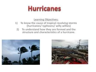
Learning Objectives. Describe the weather conditions that create, maintain, and dissipate cyclones. Explain why it can be difficult to forecast cyclone behavior. Locate several geographic regions at risk for hurricanes and extratropical cyclones.

E N D
Learning Objectives • Describe the weather conditions that create, maintain, and dissipate cyclones. • Explain why it can be difficult to forecast cyclone behavior. • Locate several geographic regions at risk for hurricanes and extratropical cyclones. • Give examples of the effects of cyclones in coastal and inland areas.
Learning Objectives, cont. • Recognize linkages between cyclones and other natural hazards. • List the benefits derived from cyclones. • Describe adjustments that can minimize damage and personal injury from coastal cyclones. • Propose prudent actions to take for hurricane or extratropical cyclone watches and warnings.
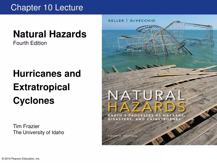
Hurricane Sandy • Seven days from formation to landfall • Landfall just south of New York City • Storm had swelled to largest Atlantic hurricane on record • “Superstorm Sandy” • Great size, atypical path, merged with an arctic cold front • No longer hurricane-force winds upon landfall, but was second most expensive storm to strike the United States • Damage in the United States • Triggered intense snowstorms resulting in power outages • Large waves and heavy wind and rain caused flooding and coastal erosion
10.1 Introduction to Cyclones • An area or center of low pressure with rotating winds • Counter-clockwise in Northern Hemisphere • Clockwise in Southern Hemisphere • Tropical or extratropical • Based on origin and core temperature • Characterized by intensity • Sustained wind speeds and lowest atmospheric temperature
10.1 Introduction to Cyclones, cont. • Tropical Cyclones • Form over warm tropical or subtropical ocean water (5°–20° latitude) • Have warm central cores • Tropical depressions, tropical storms, hurricanes • High winds, heavy rain, surges, and tornadoes • Derive energy from warm ocean water and latent heat • Extratropical Cyclones • Form over land or water in temperate regions (30°–70° latitude) • Associated with fronts and cool central cores • Strong windstorms, heavy rains, surges, snowstorms, blizzards • Most do not produce severe weather • Derive energy from temperature contrasts along fronts
Classifying Cyclones • Scientific classification and description have roots in regional names • Nor’easter • Extratropical cyclone that moves along northward along East Coast U.S. • Hurricanes • Tropical cyclones in Atlantic and eastern Pacific Oceans • Typhoons • Tropical cyclones in Pacific Ocean west of International Dateline and north of the equator • Cyclones • Tropical cyclones in Indian Ocean • Saffir-Simpson Scale classifies hurricanes based on wind speed
Naming Cyclones • Only a small percentage given names • Extratropical storms are sometimes named after their origins • Tropical storms and hurricanes given names established by international agreement through World Meteorological Organization • Named once winds exceed 63 km (39 mi.) per hour • Names assigned sequentially each year from list for each origin • Male/female names alternated • Names are reused every 6 years • Names of big storms are retired (example: Katrina)
10.2 Cyclone Development and Movement • Tropical and extratropical cyclones differ in their • Characteristics • Development • Most of both form, mature, and dissipate independently • Some tropical cyclones transform into extratropical cyclones • Weaken over land or cooler seawater at higher latitudes
Tropical Cyclones • General term for large thunderstorm complex • Rotating around an area of low pressure • Formed over warm tropical or subtropical ocean water • Go by a variety of names based on • Intensity • Location
Tropical Cyclones, cont. • Tropical disturbance • Typically 200 to 600 km (120 to 370 mi.) • A organized mass of thunderstorms persisting for > 24 hours • Associated with elongated area of low pressure (trough) • Has a weak rotation due to Coriolis effect • Formed by • Lines of convection similar to squall lines • Upper-level low pressure troughs • Cold front remnants • Easterly waves of converging and diverging winds • Atlantic Ocean hurricanes
Tropical Cyclones, cont. • Tropical Depression • Tropical disturbance wind speeds increase and begins to spin • A low pressure center is formed • Tropical Storm • Winds increase to 63 km (39 mi.) per hour • Storm is given a name • Wind speeds are not at hurricane strength, but rainfall can be intense
Tropical Cyclones, cont. • Hurricanes • Not all tropical storms develop into hurricanes • Classified when winds reach 119 km (74 mi.) per hour • Environmental conditions • Thick layer of warm ocean water • At least 26 degrees C (~80 degrees F) • Extend to depth of 46 m (~150 ft) • Steep vertical temperature gradient • Atmosphere must cool quickly with increasing altitude • Weak vertical wind shear • Strong winds aloft prevent hurricane development
Tropical Cyclones, cont. • Hurricane structure • Rain bands • Clouds that spiral inward around center • Counterclockwise in Northern Hemisphere • Increase in intensity towards the center of the hurricane • Eyewall • Innermost band of clouds • Contain the greatest winds and rainfall • Hot towers can develop within the eyewall 6 hours before a storm intensifies • Eye • Area of calm at center of the hurricane • Narrow at surface and wider at top • Diameters range from 5 to more than 60 km (3 to more than 37 mi.)
Tropical Cyclones, cont. • Typical hurricane behavior • Warm, moist air spirals upward around eyewall • Air rises, condenses as clouds and releases latent heat • Latent heat encourages additional warm moist air to rise • Upward rotation draws air from eye, causing dry air to sink back into center • Upward rotation also causes air to flow out the top of the storm concentrated in exhaust jets • Allows additional warm air to feed bottom of the storm
Tropical Cyclones, cont. • Movement of hurricanes • Controlled by the Coriolis effect and steering winds • In Northern Hemisphere storms deflect to the right • Track west in trade winds and curve northwest and then northeast • Hurricanes can make a loop • In North Atlantic, steered by Bermuda High • As hurricane moves over land, it loses energy (warm water) • Can become extratropical cyclone
Extratropical Cyclones • Necessary conditions • Strong temperature gradient at surface • Strongest along cold, warm or stationary fronts • Strong upper level winds provided by jet stream • Polar jet stream • Subtropical jet stream • Relationship with jet streams • Large high-pressure ridges and low-pressure troughs cause jet streams to bend producing waves or meanders • May also split around isolated high-pressures and reunite • Cyclones often develop in curves or divergences in jet streams
Extratropical Cyclones, cont. • Bending or splitting can cause the polar jet stream to dip south and the subtropical jet stream to flow northeast • The southern branch of a split polar jet stream in the Pacific Ocean brings warm moist air out of the tropics • West Coast forecasters refer to the flow of warm moist air as the Pineapple Express, because of its origin near Hawai’I • Nor’easters form when bends of the polar and subtropical jet streams begin to merge off the southeastern coast of the United States
The Pineapple Express Feeding Moisture toWest Coast Extratropical Cyclone
Extratropical Cyclones, cont. • Development • Low-pressure center develops along frontal boundary • Cold front on southwest, warm front on east • Conveyor belt of cold air circulates counter-clockwise • Warm air is wedged to the east • Conveyor belt of warm air rises on the southeast side creating a comma • Conveyor belt of dry air aloft feeds the cyclone from behind the cold front • Cold front wraps around the warm front, causing an occluded front develop trapping warm air aloft • Cold air completely displaces the warm air, pressure gradient weakens and storm dissipates
10.3 Geographic Regions at Risk for Cyclones • Most serious threat in North America • Eastern contiguous United States • Puerto Rico • Virgin Islands • U.S. territories in the Pacific Ocean • They are a lesser threat to Hawai’i and Atlantic Canada • On the Pacific coast, hurricanes strike Baja California and the west coast of the Mexican mainland
10.3 Geographic Regions at Risk for Cyclones, cont. • Most hurricanes that affect East and Gulf Coasts form off the western coast of Africa • They take one of three tracks • West toward East coast of Florida, sometimes passing over Caribbean • Move out into the Atlantic Ocean to the northeast • Westward over Cuba and into the Gulf of Mexico to strike the Gulf Coast • Westward to the Caribbean and then northeastward skirting the East Coast • May strike the continent from central Florida to New York
10.3 Geographic Regions at Risk for Cyclones, cont. • Northwest Pacific is much more active than North Atlantic • Indian Ocean is also a very active hurricane zone • South Atlantic and southeast Pacific, rarely have hurricanes because of cold ocean water • Hurricanes do not form close to the equator because of the absence of the Coriolis effect
10.3 Geographic Regions at Risk for Cyclones, cont. • Hurricanes in generally develop in summer and early fall • North America’s official season is June 1 to November 30 • Season is January to April in Southern Hemisphere • Region at risk for extratropical cyclones is far greater than for hurricanes • Winter windstorms in Pacific Coast • Winter snow Sierra Nevada, Rocky Mountains and east • Spring and summer thunderstorms and tornadoes in United States and Canada
10.4 Effects of Cyclones Effects • Tropical and extratropical cyclones claim many lives and cause enormous property damage • Both produce flooding, thunderstorms, and tornadoes • Extratropical create snow storms and blizzards • Three additional effects of cyclones are especially damaging • Storm surge • Causes greatest damage from hurricanes • Contributes to 90 percent of all hurricane-related fatalities • High winds • Heavy rains
Storm Surge • Local rise in sea level resulting from storm winds • Can be > 3 m (10 ft.) • Because of spinning, surge is greatest in right quadrant of storm as it makes landfall • Height is greatest near time of maximum winds • Height is also greater if landfall coincides with high tide
Hazard Greatest in Right Forward Quadrantof Atlantic Hurricanes
Storm Surge, cont. • Largest effect from stress exerted by wind on water • Fetch refers to the area over which the wind blows • Larger fetch results in larger storm surge • Smaller effect from low atmospheric pressure in storm pulling up on water surface • Also depends on shape of coastline • Continual increase in sea level as storm approaches • Overwash can create washover channels, isolating one area from another
High Winds • Storm surge is generally more deadly but wind damage is more obvious • Described by Saffir-Simpson Scale • Usually decrease exponentially with landfall • Some hurricanes transition to extratropical cyclones that maintain or increase the wind speeds • Strongest recorded winds in United States from extratropical cyclone • Responsible for strong winds in blizzards and tornadoes
Heavy Rains • Average hurricane produces trillion gallons of water each day • Rainfall from cyclones can cause inland flooding • Flooding affected by: • Storm’s speed • Land elevation over which the storm moves • Interaction with other weather systems • Amount of water in soil, streams, and lakes prior to storm
10.5 Linkages between Cyclones and Other Natural Hazards • Coastal erosion • Some of the fastest rates during the landfall of cyclones • Some sand replaced during fair-weather conditions • Other sand is removed entirely • Flooding • Saltwater from storm surge • Freshwater from heavy rains • Mass wasting • Heavy rains can cause devastating landslides and debris flows
10.5 Linkages between Cyclones and Other Natural Hazards, cont. • Other types of severe weather • Tornadoes, severe thunderstorms, snowstorms, and blizzards • Hurricanes may generate downbursts and tornadoes • Directly linked to climate change in coastal areas • Global sea rise • Effect of cyclones making landfall will become more severe • Storm surges will be able to penetrate farther inland