Download

1 / 12
120 likes | 137 Views
This article explores the capabilities of Mars orbiters like Odyssey, MRO, and Mars Express in supporting future missions by identifying and characterizing landing sites, analyzing atmospheric and surface environments, and providing critical data for safe landing and operations.

E N D
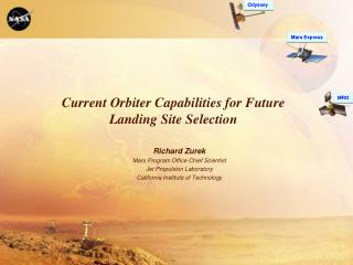
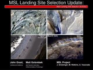
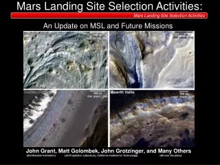
Odyssey MRO Mars Express Current Orbiter Capabilities for Future Landing Site Selection Richard Zurek Mars Program Office Chief Scientist Jet Propulsion Laboratory California Institute of Technology
Proposed* Mars Mission Architecture Odyssey MRO Mars Express *Proposed Missions Operational 2018 2013 2011 2016 2020 & Beyond 2009 2001-2007 ESA—NASA ExoMars Trace Gas Orbiter* MAVEN* Aeronomy Orbiter Phoenix (completed) Possible NASA-ESA Joint Mars Initiative ESA—EDLDemonstrator* NASA—ESA Rovers* (Astrobiology/ Sample Return Cache) Mars Science Laboratory MER Pre-decisional - For Planning and Discussion Purposes Only
Orbiter Support for Future Missions • Orbital Information is critical to future missions landing on Mars in the following ways: • Identification, Characterization, and Certification (for safety) of landing sites • Characterization of atmospheric environments for EDL • Characterization of surface environments for landed operations • MER, PHX and MSL have all benefited fromsuch data • Future landers now proposed include the ExoMars 2016 EDM and a 2018 Dual Rover missions • Large areas of the planet have been covered at increased spatial resolutions, with some coverage continuing to expand • Major assets for providing additional critical data are currently: ODY, MEX, MRO • 2016 EMTGO data would arrive late in the process for any launch in 2018 Pre-decisional - For Planning and Discussion Purposes Only
Observation Attributes MARCI CRISM-Survey Thousands of small area exposures CRISM CTX Stratigraphic relationships of layers with aqueous minerals Required for Site Certification & Morphologic Detail HiRISE MGS ODY MEX Wavelength Surface Spatial Scale 1 km 300 m 100 m 30 m 10 m 3 m 1m 0.3 m MRO Visible Visible - Near Infrared Thermal Phenomena Sea beds? Channels Polar Layering Paleolakes? Salt Flats? Layering Vents/Springs? Mineral Deposits Gullies Debris Fans Fine Layering Patterned Ground Fractures Rocks Daily Global Maps TES MOC-WA OMEGA >>50% ~70% THEMIS 100% HRSC ~85% THEMIS VIS ~2% ~40% ~56% ~62% MOC-NA HRSC (SRC) 2.8% MOC 1-D CPROTO ~1%
Surface Coverage * % of Mars surface covered with good quality data (total including high opacity periods)
MEX HRSC Coverage Totals: 56% at ≤ 20 m/pixel 85% at ≤ 60 m/pixel
MRO CTX Coverage Map As of July 31, 2010 MSSS / JPL / NASA
MRO CRISM Coverage (as of Sep. 2010) Coverage by time under low-opacity conditions Coverage by latitude under low-opacity conditions ~71% low-opacity mapping coverage
Capabilities for Site Selection (1 of 2) • ODY: Approved for second Extended Mission (FY11-12) • THEMIS IR & VIS: Working well in mid-afternoon orbit • Limited fuel will still support operations thru MSL prime mission • MEX: Approved thru FY10, likely to be confirmed thru 2012, and request to be extended thru FY14 under review • Uncertain remaining fuel load should support operations thru this period • Orbit phasing periodically limits day-time viewing • All instruments still operating • MRO: Approved for first full Extended Mission (FY11-12) • Telecom is essentially single string, but has been that way for 4 years • Safe mode entries vexing, but not thought to be life-limiting • Fuel not currently an issue given latest scenarios for covering MSL EDL • MCS, MARCI, CTX, SHARAD continue to work as in PSP/ESP • HiRISE and CRISM have seen some degradation (next slide)
Capabilities for Site Selection (2 of 2) • MRO instrument issues: • HiRISE: Team has used longer and more frequent warm-ups to compensate for increasing ADC (analog to digital converters) bit flip errors • Considering an onboard annealing sequence which ground testing indicates could reduce errors by breaking up and dispersing the ADC contamination • CRISM: Both the gimbal (needed for high resolution) and the coolers (needed for IR observations) have degraded with time • Plan: Use full VNIR/IR capability for 2 weeks every other month in mini-campaigns focused on high priority items (especially during periods of higher data rate) • VNIR-only mode can be used at other times (but avoid major dust events) • VNIR (0.4 to 1.1µm) aqueous mineral signatures are limited to ferric minerals • Bottom Line: Full-resolution VNIR/IR targeting reserved for high priority targets
MRO EM Predicted Data Volumes 270 Ls = 0 90 180 S. Summer N. Spring N. Summer (Relatively) Low Dust Opacity Solar Conjunction MSL Arrival MSL Launch
Summary • Current Orbiter capabilities for support of future landed missions are substantial, but instruments and spacecraft are aging • Best to start the process now for proposed missions like 2018 • Need site criteria (e.g., as being developed by the E2E SAG) • Need to use the capabilities conservatively where instrument and/or spacecraft limitations dictate • Landing site selection processes should be structured so that the life-limited capabilities are used only for the highest priority items • Need to use the data already in hand—there’s a lot, even though more needs to be done on many interesting places • Need to set site priorities using existing data and increased coverage of lower resolution/survey observations • May be useful to exploit correlations that have emerged between spectral and visible imagers (e.g., color variations and VNIR, IR & thermal IR) • Need to have realistic expectations about the number of sites that could be certified (i.e., with nearly complete high resolution coverage) and the schedule of data acquisition Pre-decisional - For Planning and Discussion Purposes Only