Download
1 / 17
170 likes | 181 Views
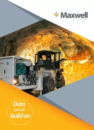
Maxwell GeoSystems are one of the worldu2019s leading providers of information systems for infrastructure projects of all sizes, real time data management and monitoring.

E N D
Data you can build on
CONSTRUCTION DATA MANAGEMENT SYSTEMS MissionOS is a bespoke software platform for the display and interpretation of construction data. The software utilises a robust back office database to process the construction data before displaying it on a fast, ultra-light web interface for rapid interrogation anywhere that has an internet connection. The key features of the back office database include the processing and auditing of all types of construction data. Efficient storing of the data means that web-based queries from the portal interface are much faster. Loading, processing, audit, management, analysis, display & reporting Import any data format for any data source Manual and real-time data capture Data checks on import Audit control for alerts and alarms Transparent calibration processes Adjustments for temporal efects Automatic error correction Alarm issuing Automated Reporting Heartbeat function Powerful Analysis 2 MaxwellGeoSystems Limited Version: 1.0 Company Brochure Date: 1st January 2018
MissionOS The web-based interface provides a much more visual representation of the data making spatial interpretation quicker and easier. Areas where problems are developing can be rapidly identified and action taken to mitigate if necessary. Portal Interface GIS interface with customisable mapping (aerial photography, construction drawings) using a variety of coordinatate systems in plan and section Data visible based on user allowing user hierarchy Instrument theming by review level and/or type Fast graphing of instrument data Rapid multiple instrument selection & graphing using a variety of spatial & data query tools Contouring User defined cross sections Ability to add documents, photographs and annotations to instruments and pins Combined instruments for inferred readings (such as shear and angular distortion) Canvas sheets for user defined dashboards of critical instruments Batch reporting for record purposes as required Instrument filtering to identify “hot” zones AAA information Blogs for user commentary The systems have been implemented on construction projects for excavations, tunnelling, ports, slope stabilisation, dams, mines, structures and reclamations. 3 MaxwellGeoSystems Limited Version: 1.0 Company Brochure Date: 1st January 2018
MissionOS Instrument and construction activity data overlaid onto Construction Map View (Left) Air Photo View (Right) MissionOS System Description Flexible web based Mapping system comprising access to the following layers: INSTRUMENTATION PROGRESS PROGRAMME PRODUCTION QA/QC GROUND INVESTIGATION DATA MAINTENANCE DATA WEBLOGS CANVAS REPORTS and REPORT BINDER 3D Other layers can be provided as part of the MissionOS Prime package Platform Windows, iOS, Android All common browsers (Explorer v6.5+, Chrome, Firefox, Safari) Touch screen compatible Designed by engineers developed by programmers Architecture LAMP (Linus, Apache, MySQL, Php) MySQL database engine (options for Postgres or other database if required) No third party software required 4 MaxwellGeoSystems Limited Version: 1.0 Company Brochure Date: 1st January 2018
MissionOS Speed and Performance Ultra-light IT footprint runs on entry level PCs and Macs, tablets & handhelds Bandwidth friendly – operates effectively on standard 3G (1MB/sec) connections Advanced pre-processing of data volumes gives speed and responsiveness even with massive data sets which is best in breed. Plot 50 real time instruments with 2 years of data in < 10 seconds. Plot 100 TBM ring data (original data size > 500MB) in map or section in under 20 seconds Custom Mapping Base with Plan Section Based on a Custom Mapping Base platform with zoom, pan, region of interest functions Any referencing system can be used (image, map, drawing, in plan or elevation). Interactive Map objects – points, lines and polygons, interactive query and summary of data and graphs Data highlighted by colour and size relative to triggers or magnitude o type. Data viewing rights configurable by user, contract and region with definition of interfaces Definition of active zones of variable shape Construction progress displayed as interactive vector graphics Constantly updated as data changes. Drag and drop functionality for easy adjustment and setup. Historical review of data at any time. Show data as change maps for instruments and progress Apply filters to focus on current information Interactive keys to define layers and labelling Section View 5 MaxwellGeoSystems Limited Version: 1.0 Company Brochure Date: 1st January 2018
INVESTIGATION, DESIGN & MONITORING DATA MissionMonitor & MissionDesigner Mission Monitor focuses on measurement data and provides a fully customisable platform for the collection processing and reporting. This can be further extended with a variety of tools to enable Observational Engineering. This is Mission Designer Data Types Design instrument models from scratch or make use of the Maxwell GeoSystems library of data models and generic data loaders including: Settlement points, settlement plates, casagrande, pneumatic and vibrating wire piezometers, recharge wells. rod extensometers, multipoint borehole extensometers (rod and MEX), inclinometers, vibrating wire instruments strain gauges, crack gauges, load cells, tilt meters and electro levels, 3D points, convergence monitoring, hydraulic profile gauges, shape accelerometer arrays, vibration and sound meters Other instruments can be added as “general” type Ground investigation from AGS version 3.1 and 4 Configurable geographic hazard and sensitive structure schemes with digitiser tools Groups Combine instruments to form new instruments using custom “GROUP” facility (eg. Tilt, distortion, stability etc.) Combine instruments in new ways to provide design feedback eg Excavation Lateral support groups, Tunnel Settlement prediction groups. Observational engineering in real-time. Combine Gaussian Settlement Curves With Real-Time Data Design feedback analysis for retained Excavations 6 MaxwellGeoSystems Limited Version: 1.0 Company Brochure Date: 1st January 2018
MissionOS Data Input Built in ergonomic features (individual, multi records, input by group) Input from files (xls, csv, txt, dbf) to any predefined custom structured format. Automatic import of industry standard formats including: Cambell , Datataker, RST, Geokon, Slope Indicator, Soil Instruments, Leica, Topcon and many more….. Library of generic data loaders . Interactively define data import from any dataloggers – multiple channels. Data Audit and Control Automated internal audit of data for integrity checking Full change record User access statistics Enhanced User Interaction Add documents and photos to GIS objects Add pins for non-object specific data Digitise object direct to cloud and annotate Custom blogging tools for user response management eg AAA reports Automated Data Processing Configurable data access and change rights Transparent processing stages easy for checking Accommodates raw or processed data Remove effects of temperature and tides Correct for background long term movements eg. of benchmarks Correct for changes of pipe top elevation Auto revision for re-instatement, extension and pipe cutting Analysis Custom graphs for a variety of instrument types Y vs time, Y vs chainage, Y vs X with common time or chainage, Y1, Y2 graphs. Linear or log axes Create overlays of programme events Produce multi-plots of data to allow comparison. Animate the data: Sophisticated interpolation and timeslicing engines get rid of holes in the data enabling animation of the construction progress to show the relationships between instrument reading and construction parameters. Forecasting tools help predict future trends and assist decision making. Load prediction data from analyses (Flac, Plaxis, Sigma/W, Seep/W etc) and compare results vs. prediction. Assess progress vs programme 7 Version: 1.0 Company Brochure MaxwellGeoSystems Limited Date: 1st January 2018
MissionOS Alarm Systems Design custom alert, schemes including: (absolute or function e.g alarm = f(x) where x = depth of excavation, distance from tunnel face etc.) Set alarms as functions of predictions Set alarms upward, downward or both Set alarm frequency, filters and repeats Remove effects of natural fluctuations and natural error to avoid repeats Display and Reporting Export raw data to Excel at any time for custom analysis. Custom interactive graphs User define cross sections of data Include surface modelling ion cross sections Large suite of PDF report types in library Save graph definitions to canvas library Build user defined reports and screens using the canvas builder. Combine canvases into complex reports using the binder function Site Process Management Generate data for daily meetings quickly Automate alarm response reports using blogging Conduct daily meeting using live data direct to the web Data Visualisation in 3D Autocreation of 3D models of all numerical metadata built in seconds using WebGL. 3D, 4D and 5D plots Incorporate DEMs of the site stripped from .DWG and .DRG or from SURPAC strings and Laserscan point clouds Compatible with Google Earth 3D representations of entire areas, which contain both constructional and instrumentation elements. 8 Version: 1.0 Company Brochure MaxwellGeoSystems Limited Date: 1st January 2018
PRODUCTION DATA FROM CONSTRUCTION Production Data Management Systems MissionOS incorporates construction activities such that the cause of an observed effect can be identified giving better risk management on a project. All construction elements are captured in a simple hierarchy such that site teams can report progress in a short, standardized format. The data can be used to generate a compatible 3D model directly without further human intervention, showing the status of the works in an illustrative, informative medium. Data Management and Processing All construction activities classified for ease of data input Baseline programme included to map targets to actual progress The portal allows the user to interrogate any of the construction data in a visual environment. When combined with the instrumentation data the relationships and correlations can be readily assessed and analysed. 9 Version: 1.0 Company Brochure MaxwellGeoSystems Limited Date: 1st January 2018
MissionOS Portal Interface Construction progress displayed by colour theming Graph progress of construction Combine progress with instrumentation data Bespoke grouped instruments to show instrument reaction to construction progress 3D models generated from progress data The MissionOS systems can be adapted to a wide spectrum of construction activities and have been successfully implemented on a huge range of projects for excavations, tunneling, ports, slope stabilisation, dams, mines, structures and reclamations. The system is highly effiicient, user-friendly and handles a stupendous volume of data that provides all types of reporting elements, that a huge enterprise solution demands. 10 MaxwellGeoSystems Limited Version: 1.0 Company Brochure Date: 1st January 2018
MissionOS MissionSite and MissionBuilder Defne, create and maintain quality data models to aid efcient management of your business Flexible web based system comprising access to the following layers: Combine construction data with other data feeds from instrumentation and design Analyse data based on defined production cycles Load predictions for key construction metrics Configure construction data models at your business level for consistent data recording Define data loading methodologies with manual and real time capture via FTP, dropbox, web service and email Audit control Configure shift reports for activity management with plant labour and materials recording systems Create rich useful reports with the canvas creation tool Prepare forecasts in real-time 11 Version: 1.0 Company Brochure MaxwellGeoSystems Limited Date: 1st January 2018
MissionOS Data Types Environmental data Risk and hazard information Setting Out data from .DRG and .DWG Programme data from MS Project and Primavera Shift data, Critical time definition, Plant and Labour Drilling and grouting Geological Mapping Support installed Pumping and water measurements Materials testing Site Inventory CCTV and other streams TBMs and other data loggers eg : measurements while drilling (MWD) Shift Reporting Define standard activities enterprise wide by job type and have the flexibility to add user defined activities Simple interactive interface designed for field use Add details to time bars Identify critical time and codify through industry standard “black ball” codes Identify site instructions Identify variations and log direct costs (plant labour and materials) Identify weather, site events including logging of safety events 12 Version: 1.0 Company Brochure Date: 1st January 2018 MaxwellGeoSystems Limited
MissionOS Risk Management Risk register implemented as data table linked to construction items, methods and materials Automate preparation of site risk reports for each planned activity and link to method statements and relevant content Geo-locate hazards for automatic early warning and inclusion in site risk reports Safety Monitoring Monitor site safety reporting using the online blog tool Automate production of site safety statistics and reports Data audit and control Manage record sign off at multiple levels Automated internal audit of data for integrity checking Full change record User access statistics User Interaction Simple consistent design language ensures use is intuitive Set up projects with defined data for collection Staged screen approach to guide users Achieve results with minimum mouse clicks Data Processing Data automatically processed to cycle statistics for reporting based on metres, ring, day, week, month, blast, probe cycle as required Processed statistics available real time to aid review TBM and other data logged sources processed TBM Cutter wear expert system 13 Version: 1.0 Company Brochure Date: 1st January 2018 MaxwellGeoSystems Limited
MissionOS Analysis Evaluate ground risk and forecast ground conditions for design and tender Design construction methods and programmes Assess progress vs programme and assess time delays by critical code Forecast time and costs to completion and evaluate ground impact Assess programme and cost risk in real time Model alternative programmes and methods Dashboard Project dashboard showing key progress and parameter Key programme and cost metrics Display and Reporting Export raw data to Excel at any time for custom analysis. Custom interactive graphs Large suite of PDF report types in library Save graph definitions to canvas library Build user defined reports and screens using the canvas builder. Site Process Management Generate data for daily meetings quickly Automate alarm response reports using blogging Conduct daily meeting using live data direct to the web 14 Version: 1.0 Company Brochure MaxwellGeoSystems Limited Date: 1st January 2018
TUNNEL DATA MANAGEMENT SYSTEMS The TDMS is a module that can be added to MissionOS for the specific high risk construction activity of tunnelling. The module adds several layers of functionality to enable the user to effectively link data to the tunnel excavation and lining process to design, investigation and instrument feedback for better tunnel process control Data Management and Processing Data capture of TBM parameter data in real time Ring file data file size reduced through post-processing to remove idle status data Cutter tool wear prediction Shift reporting Drill and Blast logging Rock mapping/face inspections Grouting details The portal allows the engineer rapid access to all the information associated with the tunnelling works. Any of the recorded parameters can be graphed for any section of the tunnel 15 Version: 1.0 Company Brochure MaxwellGeoSystems Limited Date: 1st January 2018
MissionOS Portal Interface Bespoke dashboard for key instruments or parameters Ring theming of any TBM parameter (min, max and average) for instant analysis Geological cross section Generic canvas screens (100m Lookahead, settlement contour, TBM control) Contouring of TBM parameters such as face pressure, cutter wear etc 3D model generation Volume loss analysis Combine geotechnical and TBM parameters into a single graph to assess correlations The system has been utilised on numerous projects in Hong Kong (Regional Express Line, Shatin Central Link, Hong Kong West Drainage, Lai Chi Kok and Tsuen Wan West Drainage, Liantang Lam Tin and others), Singapore (SPPA cable tunnels), Thailand (MRTBLE) and Malaysia (KVMRT 1&2), United Kingdom (Thames Tideway), U.S. (Los Angeles Metro, Washington NEBT), Australia (Brisbane Airport Link, Perth Airport Link). 16 Version: 1.0 Company Brochure MaxwellGeoSystems Limited Date: 1st January 2018
GeoSystems United Kingdom/Europe United States Hong Kong Maxwell GeoSystems Ltd. Unit A, 20/F Easy Tower, 609 Tai Nan West Street, Cheung Sha Wan, Hong Kong Tel: +852 2581 2288 Maxwell GeoSystems (UK) Ltd 65a Loxley Road London, SW18 3LL Maxwell GeoSystems USA Ltd. 1301 Arapahoe Street, Ste 105, Golden, CO 80401 United Kingdom Tel: +44 (0)7952 517653 United States Tel: +1 303-808-1729 Singapore Australia India Maxwell GeoSystems India Pvt Ltd. Door no 39/2638, 3rd Floor, Modayil Centre Point, M.G Road, Kochi-16, Kerala, India Tel: +91 484-4011161 Maxwell GeoSystems Pte Ltd. 11 Beach Road, #03-01 Crasco Building, Singapore, 189675 Maxwell GeoSystems (Australia) Pty Ltd. 5/26 Lawrence Street, Woonona, NSW 2517 Australia Tel: +61 405 355 931 Tel: +65 3157 9154 / + 65 3157 9155 Website: Demo Portal: Email: www.maxwellgeosystems.com demo.maxwellgeosystems.com sales@maxwellgeosystems.com