Download
1 / 55
550 likes | 638 Views
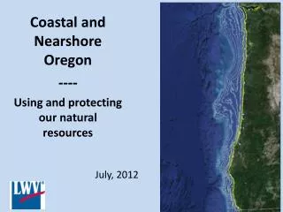
Coastal and Nearshore Oregon ---- Using and protecting our natural resources. July, 2012. Oregon’s Coastline and Coastal Zone 360 miles Extends 3 miles off shore (territorial sea) Rises to crest of coastal mountains Coastal Zone: Extends up the Rogue and Umpqua Rivers

E N D
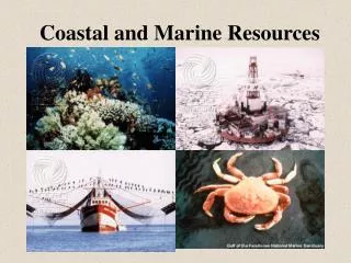
Coastal and Nearshore Oregon ---- Using and protecting our natural resources July, 2012
Oregon’s Coastline and Coastal Zone • 360 miles • Extends 3 miles off shore (territorial sea) • Rises to crest of coastal mountains • Coastal Zone: • Extends up the Rogue and Umpqua Rivers • Extends to end of Puget Island on the Columbia
Oregon’s Coastal Zone and Oregon’s Coastal Non-Point Pollution Control Program
Who manages the coast? Management of the Oregon Coast involves a complex weave of treaties, laws, agency regulations and plans at the international, federal, state and local levels.
International Regulations • 1958 Geneva Conventions on Law of the Sea • 1982 United Nations Convention on the Law of the Sea.
Federal: • National involvement includes: • Coastal planning • Pollution control and other environmental measures • Fisheries and wildlife management • National refuges and wilderness designations
Federal Regulations • Specific Actions: • Coastal Zone Management Act of 1972 (voluntary) • Oregon’s Coastal Management Program approved in 1977 • National Ocean Policy – 2010 • Executive Order : Stewardship of the Ocean, Our Coasts, and the Great Lakes • National policy to ensure protection, maintenance and restoration of Coastal and Great Lakes ecosystems and resources
Regional • A voluntary partnership with California and Washington through the West Coast Governors Alliance on Ocean Health provides for regional coordination and action on issues of mutual concern.
State: • Beach Bill 1967 (public recreation easements) • Planning goals • Goal 16: Estuaries • Goal 17: Coastal Shorelands • Goal 18: Beaches and Dunes • Goal 19: Ocean Resources • Oregon Plan for Salmon and Watersheds 1997
State: • Oregon Resources Management Act of 1987/1991 • Established Oregon Resources Management Program (Ocean Plan) • Established Ocean Policy Advisory Council (OPAC) • Mandates: • Ocean Resources Management Plan (Ocean Plan) • Territorial Sea Plan (TSP)
Oregon Resources Management Program (Ocean Plan) • Ocean stewardship area • Ocean resource conservation • Ocean fisheries • Marine birds and mammals • Intertidal plants and animals • Recreational and cultural resources • Marine water and air quality • Oil and gas • Oil spills • Marine minerals
Territorial Sea Plan • Covers state and federal programs and activities within the 3 mile strip of territorial sea. • Adopted in 1994, amended in 2001 and 2009. • Goal: conserve the long term values, beliefs and natural resources of the nearshore ocean and continental shelf. • Recognized the need for a “spatial map.”
Territorial Sea Plan Spatial Mapping • Oregon MarineMap display of northern coast: • Territorial Sea boundary line • Proposed renewable energy site • Undersea telecommunication cables • Commercial shipping lanes • Electrical transmission lines and substations, and • Draft map of Level 1 (highly valued) resources and existing beneficial uses of the Territorial Sea.
Local Government • Comprehensive plans • Land Use ordinances Federal regulations and the TSP require consistency with comprehensive plans and consultation with local governments affected by any major offshore development. The TSP provides procedures for resolving disagreements between the local government and a federal or state agency.
Coastal Environmental Characteristics • Basalt, mudstone, sandstone cliffs, mountains, beaches, sand dunes • Seismically active • Sea level rising • Habitat to many species • Migratory Routes • Important ecological areas
Estuaries Coastal Environmental Characteristics • Wetland transition zone (saltwater to fresh water) • Intense biologically productive area • Plant and animal nursery and habitat • Natural water cleaning zone • Mitigation zone for storms and floods • 22 major Oregon estuaries
Estuaries • Altered by human development • Endangered due to rising sea levels • Impacted by ocean acidification • Costly to restore • Additional research required on both functions and effectiveness of restorations
The People and the Economy Coastal environment • Older population, limited area for development • Basically rural (farms) and seasonal • Significant income from investment and pensions • Natural resources (fisheries and forestry) provide 15% of income • Tourist attraction • Important Oregon ports
Fisheries • Traditional Oregon industry – salmon, bottom fish, crab, shrimp, clams, oysters • Popular tourist activity • International demand for fish protein • Limited fish farming in Oregon (oysters and hatcheries) • Heavily regulated at both state and federal levels
Oregon Fisheries • Eight species of bottom fish are considered overfished – remediation plans in progress • Several fisheries have achieved the Marine Stewardship Council Certified Sustainable Fisheries standard that reflects sustainable practices. These include: • Pink shrimp fishery • Dungeness crab fishery • Pacific albacore (American Albacore Fishing Assoc. and Western Fishboat Owners Assoc.) • Pacific hake midwinter trawl in the North Pacific
Marine Reserves and Protected Areas • Marine reserves: ocean areas that are fully protected from activities that remove animals and plants or alter habitats, except as needed for scientific monitoring. • Marine Protected Areas: lower levels of protection.
Marine Reserves and Protected Areas • Studies show increase in the plants and animals – size, diversity and density. • The larger fish are more prolific and successful producers.
Marine Reserves and Protected Areas • Design: • Location: does area include necessary habitats and are boundaries enforceable? • Size: is the area large enough to protect the species within? • Number and distance between – are reserves close enough to work as a network? Do they include habitats to allow mobile species to move from one to another?
Marine Reserves and Protected Areas Socio – economic considerations • Perceived loss of of fishing grounds possibly balanced by spill over effect of increased fish from reserves • Increased fishing cost (travel time and cost) • Benefits from non-extractive recreational activities • Monitoring • Compliance and enforcement
Oregon Marine Reserves and Protected Areas • Process started in 2002 • 2008 – Executive order calling for 9 or fewer sites • 20 proposals submitted • Extensive community involvement and discussion
Red Fish Rocks and Otter Rocks – pilot projects in 2009 – fully protected as of 1/2012 2012 – Cape Perpetua, Cascade Head and Cape Falcon added. May 21, 2012 process completed as bill is signed into law.
THE NEXT STEPS: Complete full protection and on-going DATA COLLECTION
Monitoring for reserves and comparative areas Detailed assessments include: • Oceanographic condition: temperature, salinity, chlorophyll, dissolved oxygen, and light • Habitats: depth, relief, substrate type, and biogenic features • Focal species: presence, distribution, abundance, density, and size
Ocean Energy • The ocean provides a variety of energy resources: • Wave energy, • Thermal energy conversion, • Tidal power, • Wind technology • Oregon has adopted a Renewable Portfolio Standard for energy that supports seeking alternate sources including ocean energy.
Wave Energy • Advantages: • Higher availability • Lower variability • Greater forecastability • Good match for Oregon energy needs (more wave power in winter months) • Disadvantages: • Technology and research still in infancy • Potential impacts on habitat
Existing Wave technologies • Point absorber • Oscillating water columns • Overtoppings • Attenuators • Aquamarine Power’s Oyster
Point Absorbers • Bottom mounted or floating • Capture energy from up/down motion of wave • Fully or partially submerged
Oscillating water columns physics-edu.org • Acts as piston on trapped air • Air travels through turbine generator to produce electricity hawaiisenergyfuture.com
Overtoppings Funnels waves over the top of structure into a reservoir Water turns turbine as it returns to sea http://www.wavedragon.net
Attenuators (linear absorbers) • Long Devices oriented in direction of incoming waves • Articulated structures rotate relative to each other driving generators mywindpowersystem.com
Aquamarine Power’s Oyster • Deployed near shore. • Wave activates a pump which delivers high pressure water via a closed-loop sub-sea pipeline to the shore. • High-pressure water is converted to electrical power onshore, using hydro-electric generators. rechargenews.com
Impacts of wave energy devices • remove energy from the ocean, making less available for natural processes, • introduce many large, hard structures, thus creating new and different habitat types. • Alter the views of the coast • Make ocean areas off limits
Other concerns with wave energy • Is it competitive? • Will it close areas to fishing? • Problems with connecting to electrical grid? • What is the economic impact? • Technology still in early development. • What are the costs? • How should the public be involved?
Oregon Wave Energy Development • A variety of federal and state agencies will be involved with the Federal Energy Regulatory Commission (FERC) taking a lead role. • Oregon and FERC have signed a MOU on the development in Oregon • Oregon’s TSP part V specifies guiding principles for decisions on wave energy. • The Oregon Wave Energy Trust provides funding. • The Northwest National Marine Renewable Energy Center does research.
Current status • A number of permits have been requested • Ocean Power Technologies plans to deploy test buoy off Reedsport in late 2012 sustainablebusinessoregon.com
Invasive or Introduced Species • Plants, fish, amphibians, invertebrates, mammals and microbes, have entered Oregon both accidentally and intentionally. • Compete with native species for food and habitat. • May alter habitat. • Control can be expensive. • Examples include: Spartina, Japanese Knotweed, zebra mussels.
Invasive or introduced species • Major pathways for introduction • Ballast water • Biofouling of ships • Introduced as exotics for gardens, aquariums, food industry • Regulation • Variety of regulatory agencies International, federal, state • Regulation requires staffing and funding
Forestry • Level of production and export has declined, but remains important to the Coastal Economy. • Concern with runoff from forestry practices. • Current on-going law suits regarding Best Management Forest Practices under Clean Water Act. • Oregon has agreed to develop specific Total Maximum Daily Loads (TMDL) for pollution from forestry activities in the Coastal Zone.
Dredging • Excavation of material under fresh or salt water • used to: • Deepen and widen shipping channels, • Change the course of stream flow, • Harvest crustaceans, • Enrich eroding beaches, • Harvest rocks, gravel and sand, to extract minerals, • Place underwater cables, • Construct bridges and • Develop waterfronts. Maintenance of navigation channels is crucial to ports
Dredging issues • Cons: • Destroys natural habitat • Changes hydrology of streams • Increases turbidly • Damages fish habitat for reproduction • Destroys riparian vegetation • I Pros: • Necessary for navigation • Provides jobs • Supplies materials for commerce • Supports development
Dredging requirements • Dredging requires permitting including biological opinions. • Currently looking at developing more Regional General Permits. • Suction gold mining takes place in remote sites and requirements for monitoring can offer challenges. Involves one or more miners.
NonPoint Source Pollution • Both nonpoint and point source pollution contaminate our ocean, groundwater, streams, estuaries, lakes and aquifers. • Point source pollution comes out of a pipe, culvert, or channel. • Nonpoint source pollution comes from contamination of stormwater and other runoff water that collects pollutants from surfaces.
Coastal NonPoint Pollution Control Program • Has specific requirements to control pollutants in the coastal region. • Extends Coastal Zone Region Boundary to include the entire Umpqua and Rogue River watersheds • Introduces new TMDLS that are “implementation-ready.” • Impacts forestry, mining, dredging, agriculture.