Download
1 / 11
110 likes | 139 Views
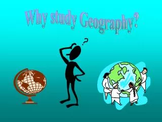
This insightful article delves into the geography of the Earth, covering landforms, bodies of water, and vegetation diversity. Learn about latitude, longitude, and their importance in navigation. Discover the history of the prime meridian and its role in establishing time zones globally. Explore how geography influences human life and the five key themes of geography: location, place, human-environment interaction, movement, and regions.

E N D
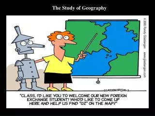
What is the geography of the earth? • Geography is the study of particular places on earth and their characteristics. • An environment includes land and water, as well as weather patterns and all plants and animals that live in a place. The Study of Geography
Only 30% of the earth is covered by land, from huge continents to small islands. • Landforms include: hills, mountains, isthmus, peninsula and islands • Water covers 70% of the earth • Oceans and seas are the largest bodies of water; however the oceans are really just one large body of water that flows around the world • Water is also found within land masses in the form of rivers and lakes. • Many kinds of plants grow on earth • Each environment has its own unique plant life; for example in the desert you will find cacti, in the forest you will find trees etc. • The natural plant life of a region is called its vegetation. Landforms, Bodies of Water and Earth’s Vegetation
The easiest way to locate any place on earth is to use the imaginary lines shown on most maps and globes. • The lines that run east to west are called lines of latitude. “The equator is the middle rung on the ladder of latitude.” • The lines that run north to south are called longitude. • Latitude and longitude are used in GPS and are the primary coordinate system for navigation on the planet. • These lines form an imaginary grid over the earth to allow us to determine the exact location of a place. What are latitude and longitude?
Lines of latitude run east to west, however they measure the distance in degrees north or south from the equator. • A degree is a unit of measurement that describes the distance between lines of latitude and lines of longitude. The symbol for degree is , just like a degree of temperature. • The equator is the starting line for measuring latitude. On any map, the line marking the equator is labeled 0 meaning zero degrees latitude. • The line above the equator is labeled 30 N or 30 degrees north; the line below the equator is marked 30 S or 30 degrees south. • There are 90 degrees of latitude between the equator and the north pole and 90 degrees of latitude between the equator and the south pole. • Math connection: Lines of latitude are also known as parallels. Parallels are lines that run in the same direction and are always the same distance apart. They never meet or cross. Latitude Explained
Lines of longitude run from the north pole to the south pole. • These lines measure distance in degrees east and west of the line of longitude we call the prime meridian. • The prime meridian is marked 0 or zero degrees longitude. The lines west of the prime meridian are measured in degrees from 1 to 180 west. • The line at 180 is called the International Date Line. It is in fact directly opposite on the globe from the prime meridian. • Longitude measurements are also used to evaluate time. Each advance of 15 of longitude represents about one hour’s time in terms of measurement by the sun. Lines of Longitude
The prime meridian was officially established as zero degrees longitude at an international conference in 1884. • While latitude has its zero degree line along the equator, a actual physical feature of the earth, there is no corresponding feature to determine longitude. • Prior to 1884, individual countries used their won lines of latitude on maps, however in 1675 the United Kingdom established the Royal Observatory at Greenwich, just outside the city of London. • This point then became the established starting location the y-axis for the British coordinate system. By 1884 international travel was common and 41 delegates from twenty-five “nations” met in Washington DC for a conference to establish zero degrees longitude and the prime meridian. • With the establishment of the prime meridian and zero degrees longitude at Greenwich, the conference also established time zones. • The world was divided into 24 time zones since the earth takes 24 hours to revolve on its axis and thus each time zone was established every 15 degrees of longitude for a total of 360 degrees in a circle. History of the Prime Meridian
GEOGRAPHY – THE SUPERPOWER It influences everything and everyone. Humans try to control it and use its power. The Five Themes of Geography FOCUS: How has geography affected humans and what changes have we made to master it? 1. Location- How do I get there? The information you give to 911 when you need help.- Exact/Specific Exact or absolute location - latitude and longitude more practically an exact address. Relative location - What is it near? The CVS on Broadway. The park near the police station. The school on Peninsula Blvd. Montauk is on the east end of Long Island. 2. Place -What's it like to live there? How you describe your surroundings to others. - General Describe the physical features - mountains, deserts, forest, rivers. Mt. Everest is a physical place. Describe the cultural features like a “neighborhood”– Stores close on Saturday in Cedarhurst because many people are religious. Theatre district- Broadway in NYC supports the theatre and arts. If you want borsht you go to Brighton Beach. You will find Chinese food in Chinatown. 3. Human Environmental Interaction How do people relate to the land? People change the environment to suit them; for example farmers use water from rivers to irrigate their land for crops, developers fill in marsh land and build homes for people. How do people adapt to their environments? We use air conditioners when it is hot and use warm boots when it is cold we use umbrellas when it rains. 4. Movement- How are people, goods and ideas moved into and out of this place? People migrate from place to place. They moved from Ireland to New York. People trade goods when they need something that people have somewhere else in the world. People exchange IDEAS and INFORMATION through the internet, mail, television, newspapers or books. 5. Regions- Geographers invent regions. Regions are subjective. They carve the world into physical regions – Land with common features such as landscape or climate such as the Rocky Mountains, the Great Plains or Bread Basket.. They carve the world into cultural regions - the corn belt, the rust belt, the sun belt.