Download
1 / 17
250 likes | 489 Views
Scale Issues in Hydrological Modelling: A Review. G. Bl ö schl and M. Sivapalan (Hydrological Processes, Vol. 9, 251-290 [1995]). Introduction.

E N D
Scale Issues in Hydrological Modelling: A Review G. Blöschl and M. Sivapalan (Hydrological Processes, Vol. 9, 251-290 [1995])
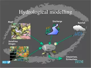
Introduction The development of model steps: (a) collecting and analyzing data; (b) developing a conceptual model (in the researcher’s mind) which describes the important hydrological characteristics of a catchment: (c) translating the conceptual model into a mathematical model: (d) calibrating the mathematical model to fit a part of the historical data by adjusting various coefficients; (e) and validating the model against the remaining historical data set. When the conditions for the predictions are similar to those of the calibration/validation data set. Unfortunately, the conditions are often very different, which creates a range of problems. Processes are often observed and modelled at short-time scales, but estimates are needed for very long time-scales. Sometimes large-scale models and data are used for small-scale predictions. Transfer of information across scales is called scaling and the problems associated with it are scale issues. The issue of the linkage and integration of formulations at different scales has not been addressed adequately.
The Notion of Scales and Definitions Hydrological processes at a range of scales A certain relationship between typical length and time-scales for a given process. Small length scales tend to be associated with small time-scales and the same applies to large length and time-scales. A slim and peaky hydrograph suggests a small catchment. We often just refer to the ‘the scale’ of a process (either small or large) and implicitly assume that this relates to both length and time. Process scale Characteristic time-scales of a hydrological process can be defined as duration (forintermittent processes such as a flood); (b) the period (cycle) (for a periodic process such as snowmelt); and (c) the correlation length (=integral scale) (for a stochastic process exhibiting some sort of correlation). Similarly, characteristic space scales can be defined either as spatial extent, period or integral scale, depending on the nature of the process. Integral scale refers to the average distance (or time( over which a property is correlated. Observation scale Is related to the necessity of a finite number of samples. ‘Observation scale’ in space and time can be defined (Figure 4) as: (a) the spatial (temporal) extent (=coverage) of a data set; (b) the spacing (=resolution) between samples; or (c) the integration volume (time) of a sample. The integration volume may range from 1 dm3 for a soil sample to many square kilometers (i.e., the catchment size) for discharge measurements.
Process versus observation scale Ideally, processes should be observed at the scale they occur. Often the interest lies in large-sale processes while only (small-scale) point samples are available. Modelling (working) scale In space, typical modelling scales are: The local scale (1m); The hillslope (reach) scale (100 m); The catchment scale (10 km); And the regional scale (1000 km). In time, typical modelling scales are: The event scale (1 day); The seasonal scale (1 year); And the long-term scale (100 yrs). Unfortunately, more often than not, the modelling scale is much larger or much smaller than the observation scale. To bridge that gap, ‘scaling’ is needed. Definition of upscaling, downscaling and regionalization To scale, literally means ‘to zoom’; upscaling refers to transferring information from a given scale to a larger scale, whereas downscaling refers to transferring information to a smaller scale. Regionalization, on the other hand, involves the transfer of information from one catchment (location) to another. One of the factors that make scaling so difficult is the heterogeneity of catchments and the variability of hydrological processes.
Nature of Heterogeneity and Variability in Space and Time Heterogeneity at a range of scales ‘Heterogeneity’ is typically used for media properties (such as hydraulic conductivity) that vary in space. The term ‘variability’ is typically used for fluxes (e.g. runoff) or state variables (e.g. soil moisture) that vary in space and/or time. Types of heterogeneity and variability Discontinuity with discrete zones (e.g. intermitency of rainfall events; geological zones0 – within the zones, the properties are relatively uniform and predictable, whereas there is disparity between the zones; (b) periodicity (e.g. the diurnal or annual scale of runoff), which is predictable; and (c) randomness which is not predictable in detail, but predictable in terms of statistical properties such as the probability density function.
Linkages Across Scales from a Modelling Perspective Let g{s;θ;iz] be some small-scale conceptualization of hydrological response as a function of state variables s, parameters θand inputs I, and let G{S;Θ;I} be the corresponding large-scale description. Now, the information scaled consists of state variables, parameters and inputs as well as the conceptualization itself. s↔S; θ ↔ Θ; i ↔ I; g{s;θ;i} ↔ G{S;Θ;I} However, in practice, often only one piece of information out of this list is scaled and the otehrs are, implicitly, assumed to hold true at either scale. Also, the definition of a large-scale parameter Θis not always meaningful, even if θ and Θ share the same name. For example, it may be difficult (if not impossible) to define a large-scale hydraulic gradient in an unsaturated structured soil. Distributing information Distributing information over space or time invariantly involves some sort of interpolation. A wide variety of methods has been designed, including: the isohyetal method; optimum interpolation/kriging. Blöschl et al. (1991) suggested an interpolation procedure based on elevation, slope and curvature.
Aggregating model parameters The study of the aggregation of model parameters involves two questions; (a) an the microscale equations be used to describe processes at the macroscale? (b) If so, what is the aggregation rule to obtain the macroscale model parameters with the detailed pattern or distribution of the microscale parameters given. The macroscale parameters for use in the microscale equations are termed effective parameters. An effective parameter refers to a single parameter value assigned to all points within a model domain as the model based on the heterogeneous parameter field. The concept of effective hydraulic conductivity has been widely studied for saturated flow. Consider, in a deterministic approach… Ideally, the equations should be directly derived at the macroscale rather than using effective parameters. However, until adequate relationships are available, effective parameters will still be used. Disaggregating soil moisture may be required for estimating the spatial pattern of the water balance as needed for many forms of land management. The input to the disaggregation procedure is usually a large-scale ‘average’ soil moisture. Disaggregating precipitation in time is mainly needed for design purposes. Specifically, disaggregation schemes derive the temporal pattern of precipitation within a storm, with the average intensity and storm duration given. Mass curves are probably the most widelu used concept for disaggregating storms. Up/downscaling in one step An example is the Thiessen method for estimating catchment rainfall. The catchment rainfall is determined by a linear combination of the station rainfalls and the station weights are derived from a Thiessen polygon network. Another example is depth – area – duration curves. Linking conceptualization The example for the upward approach relates to deriving a macroscale equation for saturated flow in a stochastic framework based on the small perturbation approach. The approach assumes that the local hydraulic conductivity K and local piezometric head H are realization of a stochastic process and composed of two components
Where and are the large-scale components and k and h are the local fluctuations. In other words, and are assumed to be smooth functions in space and correspond to mean quantitites whereas k and h are realizations of a zero-mean stochastic process.
Distributed parameter hydrological models Nature of distributed parameter models. Distributed parameter models attempt to quantify the hydrological variability that occurs at a range of scales by subdividing the catchment into a number of units. These units may either be so-called hydrological response units…In such an approach, processes with a characteristic length scale smaller than the grid/element size are assumed to be represented implicitly (=parameterized), whereas processes with length scales larger than the grid size are represented explicitly by element to element variations. The representation of processes within a unit (i.e. element) involves (a) local (or site) scale descriptions and (b) some assumptions on the variability within the unit. Distributed parameter hydrological models often represent local phenomena (e.g. site-scale infiltration) in considerable detail, while the variability within a unit (i.e. subgrid variability) is often neglected. To drive the models for each unit, input variables (e.g. precipitation) need to be estimated for each element. This involves some sort of interpolation between observations. Conversely, the response from individual elements is coupled by routing routines. Unfortunately, distributed models invariably suffer from a number of limitations. These include (a) the extreme heterogeneity of catchments, which makes it difficult to accurately define element to element variations and subgrid variability and (b) the large number of model parameters, which makes model calibration and evaluation very difficult. Subgrid variability. The first approach assumes that the parameters and processes are uniform within each element. The second approach uses distribution functions rather than single values. The third approach parameterizes subgrid variability without explicitly resorting to the local equations. Use spatial patterns of state variables to assess the accuracy of models within a catchment. Patterns have a very high space resolution as opposed to a very high time resolution of time series such as hydrographs. Example: evaluated a distributed parameter model on the basis of saturation patterns. Accurate runoff simulations at the catchment outlet do no necessarily imply accurate simulations of distributed catchment response.
Future Research • Organization in catchments has been identified as one of the keys to ‘enlightened scaling.’ New and innovative techniques for quantifying organization as needed. • What is needed is high-resolution spatial data of quantities such as soil moisture. These patterns are needed for defining scale relationships, identifying organization and evaluating distributed parameter models.