Download
1 / 38
380 likes | 389 Views
This project aims to assess the air quality in Houston and Dallas, TX during the NOAA 2006 TEXAQS field mission. It utilizes NASA earth observation data, assimilation/forecast models, and surface measurements to analyze the impact of background ozone production on air quality.

E N D
Impacts of background ozone production on Houston and Dallas, TX Air Quality during the NOAA 2006 TEXAQS field mission R. Bradley Pierce (NASA LaRC) Key Collaborators:Jassim Al-Saadi (LaRC),Chieko Kittaka (LaRC), Todd Schaack (SSEC), Kevin Bowman (JPL),Greg Osterman (JPL), Wallace McMillan (UMBC), Chris Hostetler (LaRC), Dave Winker (LaRC), Jim Szykman (US EPA), Amber Soja (LaRC), Jack Fishman (LaRC) With thanks to: Tom Ryerson, John Holloway, Tahllee Baynard, Ryan Spackman, AnneThompson, Bryan Lambeth, P. K. Bhartia, Lorraine Remer, Arlindo daSilva, and Chris Barnet for providing insitu measurements, satellite retrievals, and model forecasts used in this analysis NCEP Seminar Series, Dec 05, 2006
Purpose of project: Demonstrating the utility of NASA earth observation data and global chemical assimilation/forecast models, integrated with operational EPA surface networks, for use in air quality assessment on a regional scale during the 2006 NOAA Texas Air Quality Study TexAQS II field mission (http://www.al.noaa.gov/2006/). • Approach: • Satellite measurements are used to quantify source strengths and verify model forecasts on a regional to global scale. • Surface and airborne measurements are used to characterize receptor region and verify model forecasts on local scale • Ensemble Lagrangian trajectories are used to identify remote source regions. Trajectories sample forecasted chemical fields to understand chemical transformation during transport. • Global chemical assimilation/forecast models are used to provide estimates of background composition
Single Assimilation Cycle Modeled O3+OMI Obs Operator Adjusted O3 First Guess Column Column increment RAQMSglobal (2x2) Ozone Assimilation/Forecast Procedure Ecosystem/Severity Based wildfire emissions MODIS Rapid Response Wild fire locations NOAA GFS Global Met RAQMS Global Met/Chem 5-day RAQMS Global Met/Chem Forecast OMI O3 Column (OMIDAPS) Real-time OMI Cloud-cleared column OI assimilation conducted at 2x2 degrees, analysis increment applied as percentage adjustment to mixing ratio resulting in minimal impact on troposphere.
Biomass Burning Emission Estimates = (Area Burned) x (Available Fuel) Estimated using the MODIS Thermal Anomaly data Calculated by estimating the amount of fuel that is consumed in each ecosystem under three classes of fire weather severity (low, medium and high) Haines Index (moisture and stability of the local atmosphere) Global high-severity carbon consumption estimates
Continental US (CONUS) wild fire influences during 2006 where highest in 6 years RAQMS Ecosystem/Severity Based wildfire emissions National Interagency Fire Center Year-to-date Statistics: 2006 (1/1/06 - 9/29/06) Fires: 83,752 Acres: 9,074,358 2005 (1/1/05 - 9/29/05) Fires: 53,175 Acres: 8,160,688 2004 (1/1/04 - 9/29/04) Fires: 60,934 Acres: 7,737,472 2003 (1/1/03 - 9/29/03) Fires: 49,180 Acres: 3,167,289 2002 (1/1/02 - 9/29/02) Fires: 67,265 Acres: 6,578,985 2001 (1/1/01 - 9/29/01) Fires: 63,067 Acres: 3,221,391 2000 (1/1/00 - 9/29/00) Fires: 80,158 Acres: 6,862,561
Comparison of RAQMS surface ozone with EPA AIRNow August 25-October 15, 2006 (Assessment of urban predictive skill) PDF of 18Z Mean bias (Analysis & FX) 18Z Mean bias (Analysis) • Median biases are near 18ppbv with slight (2ppbv) reduction in biases for longer forecast periods • Largest biases (~30ppbv) are found in Midwest, Eastern Urban Corridor, Northwestern US and L.A.
Comparison of RAQMS surface ozone with EPA AIRNow August 25-October 15, 2006 (Assessment of urban predictive skill) PDF of 18Z Mean Correlation (Analysis & FX) 18Z Mean Correlation (Analysis) • Median analyzed correlations are near 0.6 ppbv with significant reduction in correlations for forecast periods longer than 54hrs. • Highest correlations (>0.8) are found in Gulf Coast states.
RAQMS 850mb 18Z FX Z Anomaly Correlations August 25-Oct 15, 2006 (Assessment of synoptic background predictive skill) • 2x2 resolution dynamical (Z) forecast shows global forecast skill (ac >0.6) to102hrs • and CONUS forecast skill out to 78hrs at 850mb. • Persistence forecast has no skill at any forecast length.
RAQMS 850mb 18Z FX O3 Anomaly Correlations August 25-Oct 15, 2006 (Assessment of synoptic background predictive skill) • 2x2 resolution chemical (O3) forecast shows global forecast skill (>0.6) to 78hrs • and CONUS forecast skill out to 54hrs at 850mb. • Persistence forecast has no skill at any forecast length.
RAQMS SFC 18Z FX O3 Anomaly Correlations August 25-Oct 15, 2006 (Assessment of synoptic background predictive skill) • 2x2 resolution chemical (O3) forecast shows global forecast skill (>0.6) to 102hrs • and CONUS forecast skill out to 54hrs at SFC. • Persistence shows some global predictive skill at 24hrs
Single Assimilation Cycle Modeled Masses Adjusted Masses MODIS (Terra) overpass 06Z 12Z 18Z 00Z First Guess AOD AOD increment RAQMSregional (80km) AOD Assimilation/Forecast Procedure MODIS Rapid Response Wild fire locations GMAO global aerosol forecasts RAQMS global chemical forecasts RAQMS Regional Sulfate Nitrate Black Carbon Organic Carbon • MODIS AOD assimilation constrains total AOD • RAQMS First Guess determines composition and vertical distributions 5-day RAQMS Regional Aerosol Forecast MODIS AOD
Combined MODIS/CALIPSO view of Saharan Dust Transport (synthesis of aerosol optical depth column and attenuated backscatter profile) August 17, 2006
Combined MODIS/CALIPSO view of Saharan Dust Transport (synthesis of aerosol optical depth column and attenuated backscatter profile) August 19, 2006
Combined MODIS/CALIPSO view of Saharan Dust Transport (synthesis of aerosol optical depth column and attenuated backscatter profile) August 21, 2006
Combined MODIS/CALIPSO view of Saharan Dust Transport (synthesis of aerosol optical depth column and attenuated backscatter profile) August 23, 2006
Combined MODIS/CALIPSO view of Saharan Dust Transport (synthesis of aerosol optical depth column and attenuated backscatter profile) August 27, 2006
RAQMS MODIS AOD Aerosol Analysis/Forecast (08/27 – 08/29 – Texas Saharan Dust Event) RAQMS Dust AOD 08/27 08/28 08/29 Analysis 6hr Forecast 24hr Forecast RAQMS vs AIRNow PM2.5
Evaluation of RAQMS Trop Column O3 using OMI-RAQMSstrat RAQMS Trop Column O3 August 01-October 15, 2006 OMI-RAQMSstrat Trop Column O3 August 01-October 15, 2006 Cloud Cleared • Mean Tropospheric O3 columns are in close agreement with OMI-RAQMSstrat (median bias of ~1 DU) • Mean Tropospheric O3 columns are highly correlated over the Continental US
Evaluation of RAQMS Trop Column NO2 using OMI RAQMS Trop Column NO2 August 01-September 10, 2006 OMI Trop Column NO2 August 01-September 10, 2006 Cloud Cleared • Mean RAQMS Tropospheric NO2 columns are generally low with respect to OMI except over Tropical Biomass burning regions. • Mean RAQMS Tropospheric NO2 columns are reasonably well correlated with OMI over the Continental US
Evaluation of RAQMS CO/O3 profiles using TES CONUS S&S August 21- October 12, 2006 TES RAQMSretrieved RAQMSretrieved - TES O3 CO Mean RAQMSretrieved O3 profiles: within +/-15 ppbv of TES below 400mb show large high biases in the UT/LS Mean RAQMSretrieved CO profiles: generally low by 20-30 ppbv except in upper tropical troposphere
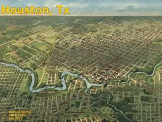
Evaluation of RAQMS Houston/Dallas CO and O3 using P3 insitu NOAA P3 Flights 8/31-10/12, 2006 (dominated by urban sampling below 800mb) • RAQMS median CO profiles are in very good agreement with NOAA P3 below 800mb and low by 20ppbv above 600mb • RAQMS median NO2 profiles are higher than P3 below 800mb. • RAQMS median O3 profiles are systematically high by ~10 ppbv below 800mb and high by 15-20 ppbv above 700mb Preliminary Data!!!
Purpose of project: Demonstrating the utility of NASA earth observation data and global chemical assimilation/forecast models, integrated with operational EPA surface networks, for use in air quality assessment on a regional scale during the 2006 NOAA Texas Air Quality Study TexAQS II field mission (http://www.al.noaa.gov/2006/). • Approach: • Satellite measurements are used to quantify source strengths and verify model forecasts on a regional to global scale. • Surface and airborne measurements are used to characterize receptor region and verify model forecasts on local scale • Ensemble Lagrangian trajectories are used to identify remote source regions. Trajectories sample forecasted chemical fields to understand chemical transformation during transport. • Global chemical assimilation/forecast models are used to provide estimates of background composition
TEXAQS 2006 Ensemble Lagrangian Trajectory Analysis • Ensemble 18Z Back trajectories are initialized daily at locations of Houston and Dallas, TX EPA AIRNow surface ozone monitoring stations. • Trajectories sample forecasted chemical fields to understand transformation during transport. • Lagrangian averaged ensemble O3 P-L is used to classify back trajectories SFC/850mb Houston Back-trajectories 2006090418 SFC Houston Back trajectory Chemistry 2006090318 CO NOy Emissions O3 P-L O3 Integrate O3 P-L along surface back-trajectory for each day of the study period
RAQMSglobal Back-trajectory analysis of regional influences on Houston and Dallas 18Z Ozone Aug-Sept, 2006 =Net O3 Loss =5<P-L<10 ppbv/day =P-L>10 ppbv/day Trajectory Classification Sept 04, 2006 Red=Observed AIRNOW mean and MSA variability Solid=Predicted AIRNOW mean (bias corrected) Dashed=Predicted Background mean (bias corrected) (immediately prior to entering Houston MSA) • Enhanced regional ozone production was present 16% of days during the study in Houston and Dallas Fort Worth (DFW). • Enhanced regional ozone production events preceded 3 out of 6 Houston periods and 4 out of 6 DFW periods with elevated O3.
RAQMS vs TCEQ CAMS surface aerosol comparisons(Deer Park, CAMS site, Houston MSA) Deer Park site Total PM2.5 Aerosol/Ozone Event of Interest Black: Measurement Red: RAQMS Dust Total Carbonaceous Sulfate Aerosol/Ozone Event of Interest Aerosol/Ozone Event of Interest
Sept 04, 2006: Elevated aerosol loading during a period of significant O3 production along Houston back trajectories HSRL Aerosol Backscattering Ratio (Hostetler, LaRC) • Objectives of this flight • CALIPSO validation • Air quality to the west of Houston CALIPSO overpass
09/04/2006 HSRL Aerosol Backscatter RAQMS AerosolBackscatter along HSRL Flight Track
Trajectory Analysis: • Identify transport paths and source regions • Run a trajectory model backward in time for 12 days from HSRL flight track • Trajectories initialized at all points with Aerosol Extinction > 0.3 km-1 within the boundary layer HSRL Aerosol Extinction for 09/04/2006 HSRL Flight Track
09/01/2006 08/26/2006 3-day Back trajectories 9-day Back trajectories 09/01 09/02 08/26 09/04 08/23/2006 12-day Back trajectories Back trajectories are initialized along HSRL flight track within BL where the column AOD is > 0.3 • HSRL backtrajectories originated from Ohio River valley 3-days earlier. • HSRL backtrajectories originated from Canada and the Gulf Coast 12 day’s earlier. 08/23
August 23, 2006 Column AOD, CO and Tropospheric O3 (CALIPSO and TES orbital tracks are also shown) MODIS AOD columns show enhancements within the Canadian branch of the back trajectories due to wild fires in the Pacific NW. AIRS CO columns show enhancements within the Canadian and Gulf Coast branch of the back trajectories. OMI-RAQMSstrat tropospheric O3 columns are obscured by clouds along the Canadian branch, but show O3 enhancements within the Gulf Coast branch of the back trajectories.
August 23, 2006 TES Mid-continental CO and O3 Profiles TES vertical cross-sections show significant low level CO enhancements over N. US and S. Canada and both lower and upper tropospheric CO enhancements over the Gulf coast. The upper tropospheric CO enhancement over the Gulf also shows elevated upper tropospheric ozone.
August 23, 2006 Column AOD and Attenuated Backscatter CALIPSO Attenuated Backscatter Carbonaceous Sulfate
Major Finding • A synthesis of satellite and in situ measurements with photochemical modeling and Lagrangian trajectory analyses provides a quantification of regional influences on Houston and Dallas Air Quality during TEXAQS 2006. • Enhanced background O3 production was present 16% of days during the study in Houston and Dallas Fort Worth (DFW), and preceded 3 out of 6 Houston periods and 4 out of 6 DFW periods with elevated O3. • A September 04, 2006 case study illustrates the influence of remote emissions from the SE US and Pacific NW on Houston air quality and demonstrates the importance of integrating of satellite, aircraft, and surface measurements of aerosol and trace gases in conjunction with advanced modeling techniques for characterizing the impact of emissions from remote sources on local air quality. • (Reported to the TEXAQS Rapid Science Synthesis Team for • Incorporation into Texas Commission on Environmental Quality State Implementation Plan to US EPA)
Thanks to: Fred Fehsenfeld, Bruce Doddridge & James Meagher for coordinating the NASA/NOAA, Satellite/Airborne collaboration during TEXAQS2006
Orthographic maps of OMI and RAQMS total Ozone Column October 15, 2006 NASA News RELEASE 06-338: “NASA and NOAA Announce Antarctic Ozone Hole Is a Record Breaker. NASA and National Oceanic and Atmospheric Administration (NOAA) scientists report this year's ozone hole in the polar region of the Southern Hemisphere has broken records for area and depth.”
OMI Column O3 Observations Aug 01- Oct 15, 2006 RAQMS Column O3 Analysis Aug 01- Oct 15, 2006 Total Column Ozone Timeseries August 01- October 15, 2006 Assimilation of cloud-cleared OMI ozone column captures observed mid-latitude temporal and latitudinal variations. RAQMS analysis underestimates mid-September through mid-October (Julian day 260-290) Antarctic ozone loss by 17%
Comparisons between In-situ (TexAQS2006) and RAQMS Aerosol Preliminary Data!!! 9/13 – 10/13 (16 flights) In-situ: Ryan Spackman (NOAA) 9/13 – 10/10 (14 flights) In-situ: Tahllee Baynard (NOAA) Extinction (532nm)at Dry Extinction (532nm)at RH=85% Absorption (530nm)at Dry Black Carbon RAQMS generally overestimates dry extinction and black carbon aerosol mass aloft but does very well in estimating the median absorption and moist extinction.