Download
1 / 18
180 likes | 284 Views
Step-by-step instructions for effective collaboration in the Central Region forecasting process to enhance communication and grid sharing. Emphasis on open-mindedness, sharing early, responsiveness, and showing meteorological thoughts in concert with grids.

E N D
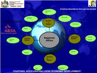
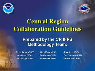
Central Region Collaboration Guidelines Prepared by the CR IFPS Methodology Team:
Step 1-Attitude • Approach collaboration with an open mind • Be willing to listen as well as share ideas/thoughts. • The forecaster’s tone in chat (12 Planet) and/or phone, should be one which conveys to others that you are willing to negotiate.
Step 2-Use Your Grids • Work from the idea that the inherited grids are the best (collaborated) forecast • They should be the starting or reference point from which future changes (if any) will be made. • This allows all to start on a level (similar) playing field.
Step 3-Share Early • After your initial look at the forecast data, express your initial thoughts in chat. Identify offices you are talking to in message • Let others know early in the forecast process what looks good (e.g. grids that need little, if any, changes) and what changes you see that may be needed in the forecast. • Be sure to address major points and significant changes.
Step 3 (cont.) • Example 1 • DDC_long: PUB GLD ICT… latest model suites continue to support a faster progression of arctic cold front, with front moving into my CWA on Day 4 instead of Day 5. Would like to at least trend this way, what do you all think? • Example 2 • MKX_long: latest analysis and model consensus continue to support the spirit of the going forecast. Prelim expectations are that little, if any changes are needed to overall grids in Days 1 and 2. Just beginning to look at forecast for Days 3 and beyond, will get back with prelim thoughts shortly.
Step 4-Be There • Be responsive to questions from others. • If you have no comment yet, say so. If you are busy with something else at the moment, say so. Let others know you are there. • Saying something is better than not saying anything.
Step 4 (cont.) • Example 3a • EAX_short: To TOPEKA, with slower moisture return expected into eastern KS/western MO tonight, am considering lowering or removing PoPs tonight. What are your thoughts? • TOP_short: I have been delayed in looking at data, due to an admin/computer problem in the office. Will get back to you shortly... • ACCEPTABLE: Though Topeka cannot answer the question yet, they explain why and keep the lines of communication open.
Step 4 (cont.) • Example 3b • EAX_short: To TOPEKA,with slower moisture return expected into eastern KS/western MO tonight, am considering lowering or removing PoPs tonight. What are your thoughts? (No response from TOP. Grids for period in question are sent 3 hours later). • UNACCEPTABLE: Same question posed by EAX, however they are left to ponder what TOP is thinking. The communication link is broken, with late post of grids allowing little time to resolve any differences.
Step 5-Show Grids • Share your meteorological thoughts in concert with your ISC grids. • This should be done early and often throughout the forecast process. Do not wait to post all grids at once toward the end of the process. • Save and send prelim grids (with thoughts) as you work through the forecast day.
Step 5 (cont.) • Example 4a • OAX_short: continue to prefer the ETA solution through 72 hrs in general. Max temps may be warmer than we currently have for Fri. Progd 850mb temps would support temps about 5 degrees warmer. Am open to thoughts and willing to compromise. Will send my prelim grids for Days 1 and 2 shortly. • Example 4b • OAX_long: the shortwave dropping through the Plains looks a little more vigorous on Day 3 now. Moisture return looks better as well, with low level flow backed more than previously thought. Considering low PoP now and have shown this in grids just sent for Sat/Sat ngt. By no means a sure thing, and can go either way, depending on thoughts from surrounding offices. What are your thoughts GID, TOP?
Step 5 (cont.) • Example 4c • OAX_long: made minor tweaks to Days 3 grids based on coordination from surrounding offices. Have sent to ISC for viewing. Am working on Day 4 to 7 grids now. Do not expect any major changes. Hope to have prelim thoughts and ISC grids in by the top of next hour. • Examples 4a-4c are ACCEPTABLE. Sending your thoughts and/or ISC grids in chunks, as you work through the forecast process, allows your neighboring offices time to see and respond to your thoughts earlier in the forecast process. Remember, they are just preliminary grids and subject to change through the collaboration process. Get your thoughts out early and show your hand. • This will allow more time to work out any potential discrepancies.
Step 5 (cont.) • Example 5 • ICT_long: grids sent to ISC for Days 1 to 7. Comments welcome. • UNACCEPTABLE. Waiting to show your hand all at once (i.e. sending all preliminary grid elements for Days 1 to 7), should be avoided, especially if done late in the forecast process. • This is more along the lines of “notification” and shows less willingness to negotiate, share thoughts, and is detrimental to the collaboration process.
Step 6-Don’t Go Alone • Significant changes must be collaborated! • Express your meteorological thoughts/reasons before you make too many changes in the grids. • Negotiate and compromise with your neighboring offices. • When a minority view still exists, then consensus should take precedence. • If you can’t get “buy-in” from the majority, then you should not make the proposed change if it will put the grids out of meteorological tolerance. • As a general rule, going it alone should be avoided.
Step 6 (cont.) • There may be times when a meteorological event is imminent (in the short term; generally in the 0 to 24 hour period) that will mainly affect your CWA, or area of concern. • An attempt to collaborate should be made. • If differences cannot be resolved to within tolerance, then the expected meteorological event should be represented in the grids as the forecaster deems appropriate, to best serve his/her local users in the affected CWA.
Step 7-High Impact Leaders • Complex weather situations (such as winter storms or those that require headlines, etc.) will likely test the collaboration process. • If the affected offices can reasonably agree on the CWA(s) that will be impacted the greatest by the storm, then these offices should take the lead in setting the meteorological tone for the event, with adjacent offices becoming willing partners to blend in. This should be discussed in chat early in the forecast process.
Step 7 (cont.) • If meteorological differences of opinion cannot be worked out, then it is suggested that the HPC be used as a tie-breaker as to which area will be impacted the greatest (if reasonably possible to determine). • This should be discussed among the affected WFO’s and the HPC in the chat room.
Step 8-Document • Document collaboration successes and breakdowns. We learn through our successes and failures. If the process breaks down or problems were noted during the collaboration process, report it to supervisor. • Offices need to develop effective QC or verification methods to ascertain and improve forecast skill. • Document, through local case studies, when significant differences arise in meteorological expectations, and share what was learned by the outcome of such events.
Final Step!! If you are communicating in chat, with a willingness to negotiate, doing so early and often, then you should end up with a well-collaborated forecast, that is as seamless as the science allows.