Download
1 / 38
380 likes | 395 Views
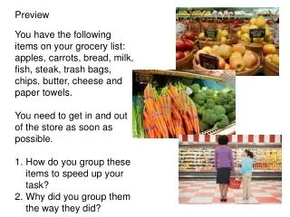
Preview. You have the following items on your grocery list: apples, carrots, bread, milk, fish, steak, trash bags, chips, butter, cheese and paper towels. You need to get in and out of the store as soon as possible. How do you group these items to speed up your task?

E N D
Preview • You have the following items on your grocery list: apples, carrots, bread, milk, fish, steak, trash bags, chips, butter, cheese and paper towels. • You need to get in and out of the store as soon as possible. • How do you group these items to speed up your task? • Why did you group them the way they did?
Region How the earth is divided for study. • Geographers choose how they will classify the world based on common characteristics. • they are man-made tools for making better sense of the world.
3 Types of Regions • Formal • Functional • Perceptual
Formal Region Characterized by a common human or physical property such as political identity, climate, or landforms
Formal Region Example: Counties, States, Countries
Formal Region Example: Desert, Rainforest, Tundra
Formal Region Example: The Rockies, Atlantic Coastal Plain
Functional Region Organized around a focal point, with surrounding areas linked by transportation, trade, or communication
Functional Region Example: Metropolitan Areas - Greater Houston Area
Functional Region • Examples • Airline hubs • - Houston Intercontinental Airport
Perceptual Region A place defined by popular feelings and images rather than by objective data.
Perceptual Region Example • The “South”
Perceptual Region Example The “Bible Belt”
Example • Muslim World
Directions for Regions Activity 1. Examine the image on the placard 2. Use your notes to identify the type of region the image represents 3. Complete your chart 6. Check with your teacher and repeat
Example 14 The Grain Belt
Example 21 Texas Voting Precinct Map
Processing Assignment Create your own examples of a region map using your high school as a region. You can create a formal, perceptual or functional map. One example would be a map of who sits where in the cafeteria.