Download
1 / 2
20 likes | 107 Views
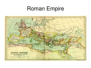
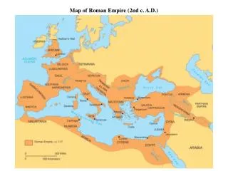
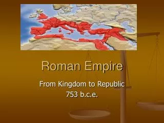
Engage students in understanding the Roman Empire by mapping key locations like Rome, Britain, Spain, and Carthage. Follow Mr. Hawthorne's guidance from the 'Western Civilization' textbook (pp. 156 & 165) to recognize historical sites such as Hadrian's Wall in Britain, Gaul in France, Greece, Syria, Palestine, and Sicily. This interactive and informative activity will deepen students' knowledge of the Roman Empire's vast reach and its impact on various regions.

E N D
Roman Empire Map Activity Mr. Hawthorne Western Civilization
Identify the Following Locations (Using pp. 156 &165): • Rome • Britain • Hadrian’s Wall • Gaul • Spain • Greece • Syria • Palestine • Carthage • Sicily