Download
1 / 22
220 likes | 366 Views
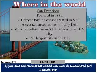
Where in the world... Geospatial Resources for Academic Libraries , 2003. E. Hamilton, UNB Libraries Atlantic DLI Training February 27, 2003. Session Objectives: --to provide an overview of geospatial resources for academic libraries

E N D
Where in the world...Geospatial Resources for Academic Libraries,2003 E. Hamilton, UNB Libraries Atlantic DLI Training February 27, 2003
Session Objectives:--to provide an overview of geospatial resources for academic libraries --to review access & administrative issues associated with licensed data --to see the data in action—the potential for research!
Outline • -Overview: the paperwork & logistics • Products, documentation, & demo: • A. Service New Brunswick • B. Statistics Canada • C. Natural Resources Canada • D. DMTI Inc.
SERVICE NEW BRUNSWICK & MORE!
Service New Brunswick --Five year license for post-secondary academic institutions, administered through UNB Libraries --Libraries must appoint a contact for administration of license, provide authentication of users, and work with users to help them understand the conditions of use --Mode of delivery dependent on recipient library preference --User support through UNB Libraries, with Dept. of Geodesy and Geomatics Engineering assistance
Service New Brunswick Includes: • Digital topographic database for NB • Digital terrain model database • Softcopy orthophotos • Digital Property Database (snapshot) • Landsat imagery • Other products mutually agreed upon
Service New Brunswick Future developments? • Other products • Other government departments • Broader access • Other provinces
DEPOSITORY SERVICES PROGRAM (DSP) AND NATURAL RESOURCES CANADA (NRCAN)
DSP & NRCAN --Five year agreement involving both print and digital geo-spatial products CMO category 1 full print depository CMO category 3 selective print depository Educational full print and digital --Libraries must appoint a contact for administration of license, provide authentication of users, and work with users to help them understand the conditions of use --FTP delivery, many formats; physical signed license; restrictions on output; no lab or networked use without permission
DSP & NRCAN Digital products for category 1 + digital may receive: • Earth Sciences Sector, CTIS • NTDB vector data, 1:50 000 and 1:250 000 • CDED • CanImage Geological Survey of Canada • “A” series maps [selective on CD-ROM] • Open file digital maps [as available through Monthly Circular] Canada Map Office [as applicable]
DSP & NRCAN Future developments? • More raster data free (e.g. Toporama, Geoconnection activity) • More vector data included in DSP • Better license with the standardized license initiative within government
STATISTICS CANADA AND DATA LIBERATION INITIATIVE
DLI & Census Geography Census geography included under Data Liberation Initiative (whew!) License conditions apply and DLI contact administers program Census cartographic files from 1981 to 2001 at varying levels of Census geography FTP delivery of spatial files and documentation; two formats available: MapInfo, ArcInfo
DLI Geographic Products For Standard Geography • Digital boundary files • Road network files • Skeletal road network files • Hydrographic files • Geosuite • Postal Code Conversion File (Plus, FEDs)
DLI Geographic Products Future Developments? • More health region mapping • More tools to help with DA and conversion to standardized geography • Greater use of free geographic viewing and downloading with spatial fusion
DMTI Spatial Bundle Initiated by former STC employee & organized through CARL; administration at UT but files also available for downloading through IDLS License conditions apply; feedback to make product better requested Licensed data from incredible variety of sources, e.g. one way street information in route logistics file Black box approach
DMTI Spatial Bundle • CanMap Atlas Bundle • CanMap Parks • CanMap RouteLogistics • CanMap Rail • CanMap Streetfiles • Census Bundle • Digital Elevation Models • Geopinpoint • Enhanced Postal Code • Enhanced Points of Interest Database
DMTI Spatial Bundle Best development in past year? Marcel’s SMART download page!
DMTI Spatial Bundle Future Developments? • Joint ventures • Student-oriented projects, contests, and scholarships • Additions to the product line
But Can I Map It? Spatial files from Statistics Canada + User data, by Health Region