Download
1 / 10
110 likes | 307 Views
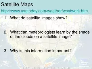
Web 2.0 : Online Maps & Satellite Imaging. Christie Tyler. What does online maps and satellite imagery refer to?. Online maps are searchable databases that can display various map data on a web page. Google Maps Live Search Maps ( now Bing Maps ) MapQuest National Geographic

E N D
Web 2.0: Online Maps & Satellite Imaging Christie Tyler
What does online maps and satellite imagery refer to? • Online maps are searchable databases that can display various map data on a web page. • Google MapsLive Search Maps (now Bing Maps) MapQuestNational Geographic • Satellite imagery consists of photographs of Earth or other planets made by means of artificial satellites.Virtual Earth software uses satellite imagery. • Google EarthMS Virtual Earth (now Bing Maps for Enterprise)NASA World WindTerraServer-USA
What is a Virtual Globe? • 3Dsoftwaremodelor representation of the Earth or another world. • User can freely move around in the virtualenvironment by changing viewing angle & position • May be geographical features or man-made • Roads & buildings • Population & other demographic features –Wikipedia http://en.wikipedia.org/wiki/Virtual_globe
How do I get Google Earth? • Go to the Google search page or iGoogle at http://www.google.com/(or earth.google.com) • Click the more menu, then even more • Click on Earth to download the latest free edition to install on your computer. • (Note Picasa Google’s free web album also)
First offered as GoogleEarth in2005 • Originally released as Earth Viewer by Keyhole, Inc. • Keyhole Inc. bought by Google in 2004 • Commercial Edition Google Earth Pro - $400 • Runs on MS 2000, XP, Vista, Mac OSX 10.3.9+ , Linux • Since 2008 available for iPhone OS • Browser Plug-in for Firefox 3, Safari 3, IE 6 & 7 • Available in 38 languages • Uses satellite images,aerial photography & GIS 3D globe superimposed on maps
What’s new in Google Earth 5.0 ? Historical Imagery Explore the Ocean Touring • http://www.youtube.com/profile?user=GoogleEarthVideoHelp
Google Earth in the Classroom • Tours >Student Presentations • Search & Placemarks>Illustrate setting • Geotagged Photos>Field Trips or Studies • Layers, Add-ins & Special Features • Lit Trip • Environmental & Science Studies • 3D model of Ancient Rome
How do I find and mark places in Google Earth? • Search same as with Google Maps • Placemarksicon to mark the spot • Geotagadd latitude& longitudecoordinatesto photos in Google Earth • Use Picasa Google’s free digital photo album • Photos are only on your computer in a KML file
Two ways to Geotag Photos • Panoramioonline photo upload • Geotag photos that will show up with a Googlemapon a web page • Submit photos for review (monthly) to be added to GoogleEarth’s (public) Panoramio layer&Google Maps • Picasa Web Album • displays map of photos that have been geotagged in Google’s free photo album Picasa and uploaded to the web album
My Google Earth Places • Movie of My Google Earth