
Aiguille de Rochefort: Epic Ridge Climb in Mont Blanc Region
Join the adventure of a mixed ridge climb in the stunning Mont Blanc region. Follow the route from the Rifugio Torino, crossing glaciers and facing treacherous weather conditions, to reach the Aiguille de Rochefort at 4001 meters. Witness breathtaking views and challenging terrains as the team braves icy slopes and narrow snow ridges. Experience the thrill of the exposed traverse and steep rock climbs, overcoming obstacles with determination and skill.

Aiguille de Rochefort: Epic Ridge Climb in Mont Blanc Region
E N D
Presentation Transcript
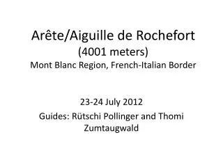
Arête/Aiguille de Rochefort (4001 meters)Mont Blanc Region, French-Italian Border 23-24 July 2012 Guides: Rütschi Pollinger and Thomi Zumtaugwald
The old team is back again, this time for an awesome mixed ridge climb in new surroundings – the Mont Blanc region. This photo shows the more exciting part of our route – leaving out the approach from the hut, which would be beyond the bottom left corner. Moving from left to right, we began by climbing the steep slope (loose rock!) below the Dent du Géant and then skirted its base, continuing to our highest point, the Aiguille de Rochefort (4001 meters). There, we turned around and retraced the route all the way back to the hut.
Our tour starts and ends at the Rifugio Torino (3382 meters), pictured here on the left. It sits 2080 meters above the little village of Entrèves , the first place you see when you emerge from the Mont Blanc tunnel in Italy. The Torino hut itself sits exactly on the border between Italy and France!
Our guides, Rütschi (left) and Thomi (right) are waiting for us at the cable car station in Entrèves . We ride with other alpinisti to the top station, skipping a dusty 4-hour walk up through a couple of construction zones. This year, the lift is being completely rebuilt: Heavy machinery mars the views and makes a racket. From the cable car station, we climb up 100 stairs (!) through a drippy tunnel to the hut entrance.
After a surprise birthday cake for Rütschi – the hut guests all join in the singing – we reconnoiter tomorrow’s route. (Some of the best views are from the fire escape off the hut’s third-floor bathroom!) To the south, Monte Bianco di Courmayeur (4748 meters; the second highest peak in the alps) shines in the evening sunlight …
But to the northwest, clouds obscure most of the route for tomorrow’s climb. This is an early hint of approaching bad luck. Despite a glorious forecast, thick clouds – and winds – roll in overnight, coating all the rock with a treacherous dusting of ice and driving the temperature way down. Ugh!
The next morning, we set off from the hut at 0435 … in dense fog. We don’t feel the altitude – it’s the end of our month in the mountains and we’re in top form. The forecast was clear, sunny conditions, but instead we are heading into thick clouds, 50-60 km/hour winds and temperatures around freezing. Die Berge sind hart!
The first part of the tour is a glacier crossing, which ends with some steep zigzags, and then we are on the rock. At times the fog thins, but it is still impossible to see the route ahead. Here are M and Thomi starting to climb the first rock passage, around 0600. The fog has deposited ice on everything.
Not far from the base of the Dent du Géant (pictured here), Thomi leads M up one of the nicest climbing passages of the tour, a big crack on good granite slabs – but then decides it’s too treacherous due to the ice that is everywhere. So, we climb and rappel back down. We stow our sticks in the snow at the base of the Dent (red arrow). Now, the fun is about to start, as we begin the amazingly exposed traverse. It’s the sharply defined snow ridge to the left of the Dent du Géant in this photo. Don’t look down!
The passages beyond the Dent (here, behind M, in the fog) alternate between snow ridges and frosted pinnacles. We keep thinking it is going to clear. The wind is bitterly cold and M pulls the hood over her helmet. Even Rütschi is changing gloves repeatedly, to keep his fingers warm …
The snow ridges on this tour are among the narrowest we have ever traversed. And the length of the sections with double cornices heightens the excitement. It’s a new experience having clouds beneath you on both sides, obscuring the extent of the exposure. You just sense the truly immense drop; concentration is key here! This picture of Rütschi (front) and J, taken upon our return, shows a bit of what we were missing on the way up …
Some of the snow faces are as steep as 50 degrees and our track, already narrow, deteriorates into toeholds kicked into soft, weak snow – or rough ice where we need to use the front teeth of our crampons to get any hold at all. We switch gears without much thought; wow, we have become so blasé about such terrain! In this photo, J and Rütschi descend one of the less steep passages, where you can still manage without turning around and doing the ‘fly walk.’
Just ahead of us are three German/Swiss climbers who set out earlier but are going slower. Each time we want to pass, they block our way, studiously ignoring us. This becomes especially frustrating on the crux pitch of the rock climbing, right beneath the summit. Here are Rütschi and J (foreground) and the three tormenters, inching along in front.
Ascending the final summit block of the Aiguille de Rochefort is like parts of the Breithorn half-traverse above Zermatt. Today, the wind has formed little jagged ice ‘flags’ that stick out sideways from the rock face – kind of like fur standing on end. But, boy do they feel sharp when the rope or a boot knocks them loose and they fly in your face! This photo (from the web) shows the conditions on the summit crux pitch in much nicer weather!
We summit at 0830. Hooray!! Here’s J giving the thumbs-up at 4001 meters, with a ring of frozen beard and hair around his face. Farther along the ridge, the Dôm de Rochefort appears briefly, only to be swallowed by clouds again. M is glad for the sunshine (note that smile!), but the wind is still bitterly cold and our candy bars are … frozen solid.
We know we can’t continue along the ridge to the Dôm – and no one else does either. There is too much new snow (no track), and too much wind. The three German desperados, who arrived 5 minutes before us, start their descent just before we do. Infuriating! But this time, we leave politeness aside and overtake them, rappelling rough and fast right through their midst. Here’s the view looking back up to the summit block. Nice conditions, eh?!
The clouds disperse during our return along the ridge – now we can finally see the beauty of the climbing ourselves. Wow. Our – rather exposed! - route from the summit (X) is marked in red.
Our longest break is at the Frühstücksplatz (3933 meters; see the tiny X), the flat space just under the Dent du Géant. We enjoy the warmth and the rest, but feel a bit of frustration looking back at the part of the ridge we didn’t get a chance to tackle. The normal ascent route on the Dent is covered with ice and snow (left edge in photo). No one will be climbing there today until well into the afternoon.
Rütschi grumbles a bit; he is still angry at the three climbers who slowed us down, and mentions that they weren’t even securing themselves properly. But then he catches himself and switches to positive thinking, asking if we didn’t think the route was beautiful. “Yes,” we shout!
Views of the two Mont Blanc summits dominate during our return from the Aiguille. We see three little points moving against the backdrop of the glacier. It’s not people, but the cable car that runs between the Torino hut and Aiguille du Midi, the big local tourist attraction. Midi is the terminus of a lift that starts in Chamonix; and once R points it out, we can see the dark boxy object on the top of the needle – Cosmiques hut (3613 meters). This huge expanse of glacier and towering peaks is at once scary and trivial, due to the accessibility for day trippers in urban gear.
The final rock descent – pictured here - is on big blocks interspersed with faint trails in the loose debris. The terrain reminds M of the Matterhorn. J gets to pick his route; Rütschi just follows and stops him if he goes astray. Thomi is more protective of M, giving her detailed instructions. “Jetzt links, jetzt rechts, jetzt wieder rechts” …. She considers asking him to give her more independence, but then lets it go. When we step off the Bergschrund to the glacier, both of us realize we have down-climbed really, really well, making good time even on the loose sections.
The big sloping, 2 km long glacier we cross to get back to the hut is surprisingly firm, even in late morning with the strong sun. During the final 100 meter ascent below the hut, our leg muscles feel sluggish – we have put out a lot of energy keeping warm, in addition to the climbing itself. At 1115, we unrope and three of us stomp up through the slippery glacial mud of the construction site. (R has gotten sidetracked by a Dutch version of Angelina Jolie!) It has taken us just under 7 hours for a round trip of about 10 km and a ascent/descent of more than 1000 meters. At the lookout platform next to the hut, M and J take photos of the ridge. We are surrounded by tourists in shorts and sandals – and we have long underwear on!
In the chaos of the hut’s gear room, we bumble a bit locating items and trying to stuff as much as possible into our packs. Half-eaten sandwiches, half empty bottles, sticky candy wrappers… There are a few moments of tension as Rütschi can’t find his fancy Adidas approach shoes and suspects that someone stole them. M thinks like a thief and finds them stowed inside an old cupboard!We decide to abandon the hut and have our celebratory drinks and lunch in the valley. Rütschi knows a good pizzeria from his many visits to Entrèves for spring ski tours on the Haute Route. It’s a stuffy ride down in the crowded cable car, and we listen to multi-track Italian chatter – so different from restrained, private conversations in ‘Germanic’ lifts. The pizzeria delivers: A super-delicious lunch with local mushrooms on a pizza that is way too big for the plate on which it’s served. We enjoy a long, good-natured ‘Plausch’/chat with Thomi and Rütschi. We are so lucky to be unterwegs with these two guys!
They zip off into the Mont Blanc tunnel ahead of our car. We expend our last willpower staying awake at the wheel in the sun and heat. The trip through Chamonix, Argentiere, the frontier Col, and down to Martigny in the Rhone valley has fascinating scenery, but we feel it pass by as in a dream. One quick stop on the highway at Gampel for yummy, high-octane cappuccinos, and we can complete the drive safely back to our home in Saas Almagell. Mission accomplished!
Tour stats:* Roundtrip distance from Rifugio Torino (3382 meters) to the summit of the Aiguille (4001 meters) is 10 km.* Total ascent/descent is 1050 meters, counting the big dip beneath the hut. * Tour time, hut to hut: 6 hours and 50 minutes.Memorable moments:Frozen Mars bars and frozen SaaserWurst. Climbing passages where fist- to head-sized rocks are frozen into the surrounding gravel.