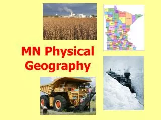
MN Physical Geography
MN Physical Geography. Minnesota from Space. Minnesota’s Natural Boundaries. Northwest Angle. Minnesota’s Topography. Minnesota Relief (Elevation). Eagle Mountain Highest Point in MN (2,301’). Minnesota’s Glaciers. 4 continental glaciers advanced and retreated across MN

MN Physical Geography
E N D
Presentation Transcript
Minnesota’s Glaciers • 4 continental glaciers advanced and retreated across MN • The Pleistocene ice age was the most recent and covered most of MN • Along the way glaciers picked up rocks and soil and transported it to the south
Minnesota’s Glaciers • The rocks and soil left behind known as “glacial drift” • The melting also left behind many shallow lakes • Soils left behind are an “unsorted” mixture of soil, rocks and pebbles
Canadian Shield • Physical region of mostly bare bedrock and little topsoil • Covers much of central Canada, northeastern MN and northern Wisconsin
“Ice-Scoured” Surface Most of the Arrowhead region is “ice-scoured”
Boundary Waters Canoe Area • Much bare bedrock • Soil pushed to the south by glaciers • Little soil left behind is thin and rocky
Glacial Moraines Moraines are belts of hills that form at the edges of melting glaciers when boulders, stones and soil accumulates Moraine Glacial Lakes
MN Moraine Belts • Glaciers moved across “Moraine and Lakes” region of central MN several times leaving many moraines • Region is hilly with many shallow lakes Moraine and Lakes
Moraine and Lakes Region • This region is covered by “Glacial drift” (soil, rocks, sand and pebbles) deposited on the land when glaciers melted • Region is hilly with many shallow lakes • Flattest areas are “outwash plains”
MN Moraines Monticello’s “Little Mountain” Powder Ridge
Minnesota Relief(Elevation) Buffalo Ridge
Buffalo Ridge Buffalo Ridge
Minnesota Relief(Elevation) Driftless Area
Driftless Area • SE MN is described as “Driftless” because it was never touched by glaciers
Driftless Area • Driftless area has no glacial drift • Few lakes and many rivers and streams • Millions of years of erosion visible
Red River Valley Minnesota Relief(Elevation)
Minnesota’s 3 Continental Divides • A continental divide is a high point of land separating the direction rivers flow Laurentian Divide • Most of southern MN’s water drains into Mississippi and Gulf of Mexico • Much of Arrowhead drains into Lake Superior eventually reaching Atlantic • NW MN drains north to Lake Winnipeg and Hudson Bay
Lake Agassiz Lake Duluth MN’s Glacial Lakes Brown’s Valley Lake Minnesota
Glacial Lake Agassiz • When last glacier melted the drainage path of the melt water was blocked • Lake Agassiz formed until glacier melted • Overflow created Minnesota River • Sediments settled to the bottom filling in low spots and creating an extremely flat surface
Red River Valley • Red River Valley is an extremely flat area that was once covered by Lake Agassiz • Sediments fell to bottom creating thick and sticky soils known as “gumbo”
Red River of the North • Why is the path of the Red River Valley so crooked? • The land is so level the river struggles to find a consistent downhill slope
Red River of the North Downtown Moorhead/Fargo
Arrowhead Red River Valley Moraine and Lakes • MN’s Physical Regions Driftless Buffalo Ridge
Minneapolis Climate Humid Continental Wide ranges in temperatures
MN Temperatures Hot Summers and Cold Winters
MN Precipitation • Most of the moisture that falls in MN comes from Gulf of Mexico • Precipitation greatest in the SE and least in the NW Jet Stream
March 29, 1881 4 Distinct Seasons
MN Growing Season Consecutive Days Averaging 43oF or More Only southern MN has a long enough growing season for corn
MN Natural Vegetation • Natural vegetation is an indicator of a region’s precipitation, temperatures and soil • NE MN mostly coniferous forest • Central MN mostly deciduous • S & W MN mostly prairie
Percent of MN in Commercial Forests 70% of MN’s commercial forest industry located in NE MN