Download
1 / 105
1.05k likes | 1.23k Views
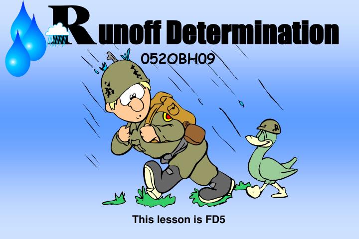
unoff Determination. 052OBH09. This lesson is FD5. Terminal Learning Objective. ACTION: Identify designs of drainage structures . CONDITION: Given FM 5-430-00-1, and student Drainage Structure workbook.

E N D
unoff Determination 052OBH09 This lesson is FD5
Terminal Learning Objective ACTION: Identify designs of drainage structures. CONDITION: Given FM 5-430-00-1, and student Drainage Structure workbook. STANDARD: Identify drainage structure designs that will accept expected runoff and facilitate construction and traffic flow.
Why is drainage important?? In the Theater of Operations (T/O) you do not want water to adversely affect mission accomplishment.
Drainage, Drainage, Drainage ***Drainage is the most crucial part of any site layout
RESPONSE TO RAINFALL (LOSSES) • INTERCEPTION: RAINFALL TRAPPED ON THE CANOPY OF VEGETATION. • TRANSPIRATION: THE LIVING PROCESS OF PLANTS THAT RETURN WATER TO THE ATMOSPHERE. • EVAPORATION: DEPENDENT UPON GROUND TEMPERATURE, AIR TEMPERATURE, WIND SPEED, AND RELATIVE HUMIDITY. • DETENTION: TOPOGRAPHIC FEATURES OF THE EARTH'S SURFACE. • INFILTRATION: WATER THAT ACTUALLY STRIKES THE GROUND AND SOAKS INTO SOIL. SOIL TYPE, VEGETATION, MOISTURE CONTENT, AND THE SLOPE OF THE AREA ARE ALL FACTORS AFFECTING THIS.
Drainage Structure Design Procedures • Estimate the Quantity of Runoff : how much water the structure will have to carry expressed in cubic feet per second (cfs). • Determine the area (normally in acres) contributing run-off to the structure. • Design a drainage structure (ditch or culvert) capable of transporting the maximum expected runoff or “Q”.
Hasty Method Rational Method The “Q” of an area is the Peak quantity of water(run-off) expressed in cubic feet per-second. Determining “Q” Methods of Runoff Estimation
Hasty Method Limitation: must be used to determine “Q” of an all season live stream. Continuity Equation: Q = V x A Where: Q = Quantity of water(cfs) V = Stream velocity(ft/sec)* A = Cross sectional area(sf) * When not given, the constant of 4 ft/sec will always be used.
Q = V X A V = Velocity or speed of the water A = Cross sectional area (in square feet) of the waterway
Determining Velocity 1. Measure Distance from A to B 2. Throw object in at point “C” 3. Measure time required for object to float from point A to point B. C A B
60 ft 7 sec = 8.57 or 9 fps Determining Velocity Velocity = distance (from A to B) time required to float from A to B C A B 60 feet
A = Cross sectional area of the waterway V = Rule of thumb, if not given use constant of 4 ft/sec
X H A = (W1+ W2) 2 W2 is always measured from the point where the positive vegetation ends. W 1 Q = V X A W 2 H
Requirement : Using the Hasty Method calculate the “Q” of this stream. (Page 4) 5 4 4 3 3 Drawing not to scale
5 + 38 2 2 = 4 X 4 = 16 sq. ft. 16 sq.ft. x 4 fps. (velocity assumed) Q = 64 cfs. 5 4 3 Drawing not to scale
How much water is going to flow into this proposed culvert location? Rational Method • Used to estimate the expected peak storm water runoff to a basin outlet. (low point)
CULVERT(s) Proposed Road
Rational Method Assumptions & Limitations • Area not larger than 1000 acres and regular in shape, with a consistent soil and cover type. • The entire drainage area contributes to a single point once peak runoff is obtained. • The rainfall intensity is uniform over the entire area. • There are no active streams in the area.
Formula for Rational Method Continuity Equation: Q = C x I x A Where: Q = Quantity of water(cfs) C = Runoff coefficient I = Intensity of rainfall(in/hr) A = Drainage area (acres)
Rational Method Step 1 • Delineate drainage basin: this is basically determining the total area expressed in acres that is going to contribute water to our ditch or culvert.
Steps Performed to Delineate an Area • Locate position of proposed drainage structure or any existing structure. • Identify and mark all high points. • Draw flow lines away from high points • Draw delineation line / or boundary line
Low Point 60 60 70 30 50 70 80 80 90 90 100 100 110 90 a. Identify proposed drainage structure Blue Falcon Expressway
60 60 70 30 50 70 80 80 90 90 100 100 110 90 b. Identify And Mark Natural Terrain High Points X X
60 60 70 30 50 70 80 80 90 90 100 100 110 90 c. Draw water flow lines (running perpendicular to contours) X X
C L Road flow lines.
60 60 70 1. Connect the high point’s (the X’s) 30 50 70 80 2. Draw delineation line(s) for road(s). 80 3. Use common sense and the flow arrows to tie it all together. 90 90 100 100 110 90 d. Draw Delineation Line X X
Rational Method Step 2 • If required delineate area into subareas based on soil or cover types. • This is done because water will runoff unlike soils and covers at different rates and, some soil or cover types will allow greater infiltration then others. (bare soil verses concrete)
60 60 70 30 50 70 80 80 90 90 100 100 110 90 Delineation by soil and cover types. X X
Rational Method Step 3 • Determine total acreage and acreage of all sub areas. • Methods to determine acreage: Computer Aided Design (Terra Model) Planimeter Geometric Approximations Count Squares Method Stripper Method
60 60 70 30 50 70 80 80 90 90 100 100 110 STRIPPER (1 ea.) “CANDY” 90 Determine Area : 1. For this exercise please use the stripper method. Once again for your education the “Stripper method” Map Scale 1” = 285 ft
60 60 70 30 50 70 80 80 90 90 100 100 110 STRIPPER (1 ea.) “CANDY” 90 Determine Area Map Scale 1” = 285 ft
60 60 70 30 50 70 80 80 90 90 100 100 110 STRIPPER (1 ea.) “CANDY” 90 Determine Area Map Scale 1” = 285 ft
60 60 70 30 50 70 80 80 90 90 100 100 110 STRIPPER (1 ea.) “CANDY” 90 Determine Area Map Scale 1” = 285 ft
60 60 70 30 50 70 80 80 90 90 100 100 110 STRIPPER (1 ea.) “CANDY” 90 Determine Area : Measure each line Map Scale 1” = 285 ft
60 60 70 30 50 70 80 80 90 90 100 100 110 90 Determine Area : Measure each line 7.2 7.5 6.7 Map Scale 1” = 285 ft
60 60 70 30 50 70 80 80 90 90 100 100 110 90 Determine Area : add together each line value to obtain a “sum of lines”. 7.2 + 7.5 + 6.7 =21.4 7.2 7.5 6.7 Map Scale 1” = 285 ft
60 60 70 30 50 70 80 80 90 90 100 100 110 90 Determine Area : Multiply sum by width of the stripper. 21.4 x 1.0 = 21.4 square inches 7.2 7.5 6.7 Map Scale 1” = 285 ft
Determine Area : Determine & square map scale in this example 1” = 285’, square map scale 285 X 285 = 81225 60 60 70 30 50 70 80 80 90 90 100 100 110 90 7.2 7.5 6.7 Map Scale 1” = 285 ft
Determine Area : Multiply map scale squared by sum of lines in square inches: 81225 X 21.4 = 1738215 60 60 70 30 50 70 80 80 90 90 100 100 110 90 Divide this answer 1738215 (area in sq.ft) by 43,560 (the number of square feet in an acre) 1738215 / 43,560 = 39.90392561983 or 39.9 acres 7.2 7.5 6.7 Map Scale 1” = 285 ft
10 20 40 110 100 80 80 60 80 90 80 90 100 50 40 Proposed Culvert Now its time to show your expertise with this newly acquired skill, turn to page 07 of your student handout and complete the delineation P.E. and determine the total area in acres. Scale 1” = 285 ft.
10 20 40 110 100 80 80 60 80 90 80 90 100 50 40 Proposed Culvert X Total area between 55-60 acres X X Scale 1” = 285 ft.
Walk Through Practical Exerciseon the Rational MethodSteps listed starting on page 8 of HandoutThis practical exercise is on page 19 & 20
Path 2A Path 1A Path 2B Path 1B Path 3B Path 3A Known information: A. Location: Paliskin Airfield, Seoul, Korea B. Surface Composition, Cover type, and Acreage GMd soil Average Turf 39.7 Acres Compacted Gravel 1.0 Acres C. Total Acreage 40.7 Acres
Rational Method Step 1 • Delineate drainage basin to determine the area contributing runoff to our proposed drainage structure. (already done for this exercise) 1. Identify location of proposed drainage structure. 2. Identify and mark highpoints. 3. Draw flow lines perpendicular to contours. 4. Draw delineation line based upon flow lines.
Path 2A Path 1A Path 2B Path 1B Path 3B Path 3A Known information: A. Location: Paliskin Airfield, Seoul, Korea B. Surface Composition, Cover type, and Acreage GMd soil Average Turf 39.7 Acres Compacted Gravel 1.0 Acres C. Total Acreage 40.7 Acres Rational Method Step 2 • If required, sub divide the delineated area by soil and cover types. • Already done: GMd soil with average turf (grass) 39.7 acres Compacted gravel 1.0 acres