Download
1 / 28
280 likes | 611 Views
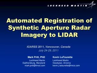
Automated Registration of Synthetic Aperture Radar Imagery to LIDAR. Mark Pritt, PhD Lockheed Martin Gaithersburg, Maryland mark.pritt@lmco.com. IGARSS 2011, Vancouver, Canada July 24-29, 2011. Kevin LaTourette Lockheed Martin Goodyear, Arizona kevin.j.latourette @ lmco.com.

E N D
Automated Registration of Synthetic Aperture Radar Imagery to LIDAR Mark Pritt, PhD Lockheed Martin Gaithersburg, Maryland mark.pritt@lmco.com IGARSS 2011, Vancouver, Canada July 24-29, 2011 Kevin LaTourette Lockheed Martin Goodyear, Arizona kevin.j.latourette@lmco.com
Problem: SAR Image Registration • Registration of SAR and optical imagery is difficult. • Features appear different. • Different viewpoints and illumination conditions cause difficulties: • SAR layover does not match optical foreshortening. • Shadows do not match. • Conventional techniques rely on linear features. • But these features can be rare and noisy in SAR imagery. MSI image SAR image
Solution • Our solution is image registration to a high-resolution digital elevation model (DEM): • A DEM post spacing of 1 or 2 meters yields good results. • It also works with coarser post spacing. • Works with terrain data derived from many sources: • LIDAR: BuckEye, ALIRT, Commercial • Stereo Photogrammetry: Socet Set® DSM • SAR: Stereo and Interferometry • USGS DEMs
Methods • Create a predicted image from the DEM, illumination conditions and sensor model estimate. • Register the predicted and the actual images. • Refine the sensor model. SAR Image Predicted SAR Image
Methods (cont) • The same approach works for SAR and optical sensors. • Projection into the imaging plane is similar. • Layover in SAR images is similar to occlusion in optical images. • Radar shadow is similar to optical shadow. SAR Sensor Optical Sensor Image Plane Image Plane Scene Scene Layover Occlusion Shadow Shadow
Methods (cont) • To register SAR and optical images, use the DEM as the “bridge”. • Generate a predicted “DEM” image for each SAR and optical image. • Register the predicted images to the actual images. • This neatly bypasses the problem of direct SAR-optical registration. SAR Image DEM MSI Image
Example 1: SAR-LIDAR Registration COSMO-SkyMed SAR Image of Mosul, Iraq BuckEye LIDAR DEM Post Spacing: 1 meter Absolute Accuracy: 1.5 m (CE90) Area: 100 km2 21,000 x 20,000 pixels
Results COSMO-SkyMed SAR Image
Results (cont) Predicted SAR Image from DEM and Estimated SAR Camera Model Flicker with previous slide
Results (cont) Normalized Cross-Correlation Image Between Predicted and Actual Images Flicker with previous slide
Results: Zoom Note the SAR layover and shadow COSMO-SkyMed SAR Image
Zoom (cont) Note the SAR layover and shadow Predicted SAR Image from DEM Flicker with previous slide
Zoom (cont) Cross Correlation Flicker with previous slide
Registration Accuracy NCC Registration Tie Points Best shift: Δx = 16.76m • Δy = 4.27m After least-squares fit to shift-only registration function with RANSAC outlier removal, 4572 tie points remained.
Registration Accuracy (cont) Error Propagation This includes the geospatial errors in the DEM and the registration. CE90 = circular error 90%
Results: SAR-MSI Registration SAR Image: COSMO-SkyMed, Date: Oct 2008, GSD: 1 m
SAR-MSI Registration (cont) MSI Image: IKONOS, Date: Oct 2010, GSD: 2.2 m Flicker with previous slide
SAR-MSI Registration (cont) SAR Image: COSMO-SkyMed, Date: Oct 2008, GSD: 1 m
SAR-MSI Registration (cont) MSI Image: IKONOS, Date: Oct 2010, GSD: 2.2 m Flicker with previous slide
SAR-MSI Registration (cont) SAR Image: COSMO-SkyMed, Date: Oct 2008, GSD: 1 m
SAR-MSI Registration (cont) MSI Image: IKONOS, Date: Oct 2010, GSD: 2.2 m Flicker with previous slide
Example 2: SAR-MSI-LIDAR Fusion Waterton, Colorado COSMO- SkyMed SAR Ikonos MSI BuckEye LIDAR DEM BuckEye Lidar: March 2003 (4.1 x 5.2 km, 0.75-m post spacing) Ikonos: July 9, 2001 (1-m GSD). COSMO SkyMed SAR: Oct 31, 2008 (0.5-m GSD)
Results: EO Image Draped Over DEM Note alignment of features
Results: SAR Image Draped Over DEM Note alignment of features Flicker with previous slide
Results: MSI Image Draped Over DEM Note alignment of features Flicker with previous slide
Results: Fly-Through Click picture above to play movie
Conclusion • We have introduced a new method for registering SAR images with other sensor data: • LIDAR, Digital Elevation Models, Optical Images, MSI • It works by image registration to a high-resolution DEM. • It does this by generating a predicted image from the DEM and sensor model estimate. • It then registers the predicted and actual images and refines the sensor model estimate. • Accuracy: 1-2 m CE90 • Our approach also extends to the case where no DEM is available: • DEM can be generated from stereo EO or interferometric SAR.
Conclusion (cont.) • For an extension to Video Geo-registration: • Pritt, M & LaTourette, K., Stabilization and Georegistration of Aerial Video Over Mountain Terrain by Means of LIDAR. • FR1.T08.4