Download
1 / 45
450 likes | 523 Views
Dive into the study of how geographical areas shape political processes and vice versa, impacting nations and states worldwide. Learn about territoriality, nation-states, and the significance of ethnic, religious, and racial factors in geopolitics. Uncover the influence of size and shape on a state's economy, governance, and nationalism. From the U.S.-Canada to the Armenia-Azerbaijan conflicts, track the complex relationships between ethnicity, religion, and territorial disputes. Discover how geopolitical powers control territory and influence global policies. Delve into electoral geography, redistricting, and the dynamics of elections.

E N D
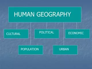
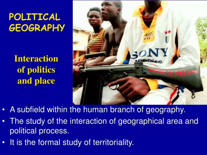
POLITICAL GEOGRAPHY • A subfield within the human branch of geography. • The study of the interaction of geographical area and political process. • It is the formal study of territoriality. Interaction of politics and place
U.S.- Canada boundary Alberta- Montana
U.S.- Mexico boundary Calexico, California- Mexicali, Mexico
Politics of Geography Effect of place on politics and effect of politics on place Example: Making political boundaries Politics on place Place on politics
Political Geography • Economics supposedly eroding significance of national borders. • However, many ethnic minorities feel they deserve states of their own. • States under attack from above (global economics) and from below (ethnic communities). • Yet states are still powerful, and can respond.
STATE • A politically organized territory • Administered by a sovereign government • Recognized by a significant portion of the international community. A state must also contain: • a permanent resident population • an organized economy
NATION - STATE • A country whose population possesses a substantial degree of cultural homogeneity and unity. • Stems from European Renaissance idea (Rousseau) of the “social contract” as highest moral order. • Imposed on much of the world by the West. Classic Example of a Nation-State: Japan
Multi-ethnic States Every U.S. citizen = American nationality Every American = belongs to a “race” (though this has no scientific meaning) Some Americans = identified with ethnicity
Geographic Characteristics of States • SIZE • What role does size play in the economy of a state? In government services? In nationalism and patriotism? • Does shape have any effect? • What are the most powerful nations on earth today? • What were the most powerful nations on earth 200 years ago?
Geographic Characteristics of States Shape • Compact - smaller states, especially if they are simply shaped. • Prorupt are nearly compact but possess one or sometimes two narrow extensions of territory. • Elongated – thin, narrow, long shapes. • Fragmented – islands or other fragments. • Perforated– “holes” cut into the state. On the next slide, match the term to the State.
Shape • Compact • Prorupt • Elongated • Fragmented • Perforated
African colonies
Types of territoriality State Ethnic Religious Racial Fears of “Balkanization” (splitting state) But common defiance of outsiders
Kurds – “Nation Without a State” Ethnic group in Turkey, Iraq, Iran, Syria. Many Kurds want to create a state of “Kurdistan” States pit Kurds against each other.
Iraq Ethnic: Arabs vs. Kurds Religion: Sunnis vs. Shi’as Rulers were Sunni Arab
Armenia-Azerbaijan War, 1988-94 ARMENIA (Christian) vs. AZERBAIJAN (Shi’a Muslim) Yet Shi’a Iran stayed neutral, fearing ethnic Azeris in NW Iran (Ethnic territoriality won) Armenian (above) and Azeri views
Kashmir conflict KASHMIR (CHINA) INDIA (Hindu) vs. PAKISTAN (Muslim) PAKISTAN CHINA INDIA British India partitioned into two states, 1948. Kashmir had Muslim majority but Hindu ruler. Wars split Kashmir between India, Pakistan, and China (all now have nukes) Indian and Pakistani propaganda maps
GEOPOLITICS-State’s power to control territory, shape international policy and other states’ foreign policy.
Enlargement of Soviet bloc after World War II Berlin Wall, 1961-89
View of Communist “Red Bloc” during Cold War Lumping failed to recognize differences among Communists, or local causes of conflict
Terrorism, Al-Qaeda, and “The Axis of Evil” • President G.W. Bush used this phrase in 2002 to describe Iraq, Iran, and North Korea (formerly called “rogue states”) to suggest that post 9-11 geopolitics is best understood as capitalist democracies versus dictatorships and the terrorists they sponsor. • PBS NewsHour discussion of the speech.
Cartoon: Bush’s View of the World? Problem: some former allies later seen as “evil”
United Nations Member States (191) Switzerland 2002
European Union Began as European Economic Community (EEC), 1957. Stronger in 1994 10 new members joined, 2004 Turkey, Greece, Romania, Bulgaria want to join.
Levels of administrative regions
ELECTORAL GEOGRAPHY Political Geography of Elections Variation of voting districts and voting patterns
U.S. congressional delegation redistricting Reapportionment : allocating seats to a geographic area (after every census)
“Gerrymandering” Redistricting for partisan purposes
1860 Presidential Vote Led to Southern secession, Civil War
Davis (D) 48% Simon (R) 42% Camejo (G) 5% Copeland (L) 2%
205 229 1 I