Human Geography
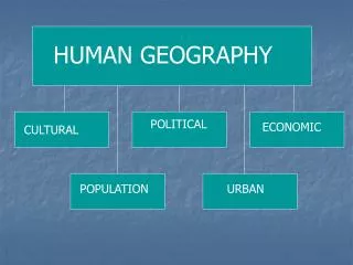
Human Geography. Conclusion of Geography’s Nature and Perspective. UNDERSTAND Scale. SO IMPORTANT!!!!. Size of unit studied Scale implies degree of generalization broad or narrow Varying sizes local regional global. Hierarchy.


Human Geography
E N D
Presentation Transcript
Human Geography Conclusion of Geography’s Nature and Perspective
UNDERSTAND Scale.SO IMPORTANT!!!! • Size of unit studied • Scale implies degree of generalization • broad or narrow • Varying sizes • local • regional • global
Hierarchy • An order or gradation of phenomena, with each level or rank subordinate to the one above it and superior to the one below.
Regionalization Process • The process of delineating the Earth, its small areas or other units into regions and a state of such a delineation. • All regions have area (some defined spatial extent) and boundaries (limit), however these are not always evident or easy to see. • Regional Map Activity
Diffusion • Movement of any characteristic. • In other words, the spread of something. • The more easily accessible something is, the more quickly it can be moved from one culture to another.
Hearth • Place where the characteristic began. • Origin.
Relocation Diffusion • Physical spread of cultures, ideas, and diseases through people. • When people migrate, they often bring with them various aspects of their culture. • Migration diffusion.
Expansion Diffusion • Spread of characteristic from a central node or a hearth through various means. • Hierarchical • Contagious • Stimulus
Hierarchical Diffusion • Idea that a phenomenon spreads as a result of a group, usually the social elite, spreading ideas or patterns in a society. • Fashion: Clothing Trends • Music: Rap and Hip-hop
Contagious Diffusion • Usually associated with the spread of a disease. • Spreads adjacently.
Stimulus Diffusion • Takes part of an idea and spreads that idea to create an innovative product.
Distribution • Everything on Earth’s surface has a physical location and is organized in space in some fashion. • Three aspects: • Density • Concentration • Pattern
Density • How often an object occurs within a given area or space. • Population Density (# of people/amount of land) • Physiological • Arithmetic
Concentration • Refers to the proximity of a particular phenomenon over the area in which it is spread. • Clustered or agglomerated= close together. • Dispersed or scattered= spread out.
Pattern • Relates to how objects are organized in their space. • Singular line= linear. • Clustered together= centralized. • Lack of pattern= random distribution. • Geographers interpret patterns for meaning and try to establish MODELS to explain patterns. • Models examine behavior and attempt to infer meaning and predict future occurrences.
Field Work • Collection of information outside a laboratory or workplace setting. • informal interviews • direct observation • participation in the life of the group • collective discussions • analyses of personal documents produced within the group • self-analysis • results from activities undertaken off or online • life-histories
Geographers use fieldwork to understand linkages among places and to see the complexities of issues.
Census • Procedure of systematically acquiring and recording information about the members of a given population. • It is a regularly occurring and official count of a particular population
U.S. Census= Every 10 years • Used to assign • Congressional seats • Electoral votes • Government program funding • The United States Census Bureau is the government agency that is responsible for the United States Census.
Remote Sensing • Method of collecting data by instruments that are physically distant from the area of study.
GIS • A collection of computer hardware and software that permits storage and analysis of layers of spatial data.
GPS • A space-based satellite navigation system that provides location and time information in all weather, anywhere on or near the Earth, where there is an unobstructed line of sight to four or more GPS satellites. • It is maintained by the United States government and is freely accessible to anyone with a GPS receiver. • There are at least 24 operational GPS satellites at all times.
GPS operations depend on a very accurate time reference, which is provided by atomic clocks at the U.S. Naval Observatory. • Each GPS satellite has atomic clocks on board.
A GPS receiver "knows" the location of the satellites, because that information is included in satellite transmissions. • By estimating how far away a satellite is, the receiver also "knows" it is located somewhere on the surface of an imaginary sphere centered at the satellite. • It then determines the sizes of several spheres, one for each satellite. The receiver is located where these spheres intersect.