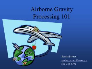
Airborne Gravity Processing 101
Airborne Gravity Processing 101. Sandra Preaux sandra.preaux@noaa.gov 571-344-5792. Outline. What we have: The Measurement Systems The Data What we want: Gravity How we get there: Conversion From Raw Measurements A Note About Time Correcting for Airplane Motion

Airborne Gravity Processing 101
E N D
Presentation Transcript
Airborne Gravity Processing 101 Sandra Preaux sandra.preaux@noaa.gov 571-344-5792
Outline • What we have: • The Measurement Systems • The Data • What we want: Gravity • How we get there: • Conversion From Raw Measurements • A Note About Time • Correcting for Airplane Motion • Correcting for Sensor Orientation • Tying into an Absolute Reference • Filter
GPS Antenna IMU Absolute Gravity Tie Gravimeter • Positioning System • GPS in Gravimeter • GPS in IMU • GPS Base Station • Orientation System • IMU • Gravimeter Platform • Gravity • Main sensor in the Gravimeter GPS Base Station Or 2 Or 3
NRL Meter S93 in NOAA 52 in Florida for GLS05 Survey, May 2005 NRL Meter S93 in NOAA 52 in Alabama For GLS06, January 2006
The Data • Position • Latitude, Longitude, Ellipsoidal Height • And/or GPS X, Y, Z • Velocity and Acceleration • Orientation • Pitch, Roll, Yaw • Platform Cross and Long Acceleration • Gravimeter • Spring Tension, Beam Position, Cross Coupling • Meta Data • Lever Arm between GPS antenna and Gravimeter • Vertical Distance from Gravimeter to Tie Spot • Gravity at the Tie Spot
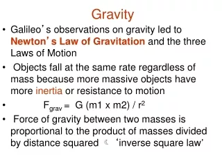
What do we want from this data? • Gravity, g • g=Gravitation-the Vertical Component of Centrifugal Acceleration • Units: 1 gal = 1 cm/s2 = 103 mgal 1 mgal = 10-5 m/s2 • At the Equator: C=3373 mgal • We want errors in g of 1 to 2 mgal or less www.dinosaurtheory.com/solution.html
How do we get there? • Combine ST, BV, and CC with various manufacturer scale factors to get graw • Translate positions from the GPS antenna to the sensor position • Synchronize position and gravity measurements • Remove Accelerations due to Airplane motion • Correct for slight deviation of sensor from level • Correct for Instrument Drift and Tie to Absolute Measurement • Filter
Synchronizing the Data • More than 95% of the Measured Beam Velocity is due to Aircraft Motion • A Cross-Covariance Analysis finds the best delay for each 4 minute window during the flight to 0.01 seconds
Airplane Motion • Full acceleration of the airplane in a rotating reference system • Historically • r, ω and their derivatives are defined in terms of latitude, longitude and height • The resulting vertical acceleration is then subtracted from graw • Common simplifications reduce computation time with errors smaller than 1 mgal for low altitude, slow flight Centrifugal Coriolis http://www.webweaver.nu/clipart/earth2.shtml
Eötvös Correction • The Vertical • Component of: • Coriolis Term • Centrifugal of Airplane West East • Depends on: • Speed • Direction • Latitude • Altitude
Vertical Acceleration • 2nd Derivative of Height • Mostly less than 10,000 mgal • May have spikes to 50,000 mgal during data collection • May have spikes to 100,000s mgal offline
Off Level • If the gravity meter is off level, gmeasured < g • Two ways to correct • Derive off level angle from platform horizontal accelerations • Use the difference in the sum of accelerations between the airplane and the meter to derive the correction
How do we get there? • Combine ST, BV, and CC with various manufacturer scale factors to get graw • Translate positions from the GPS antenna to the sensor position • Synchronize position and gravity measurements • Remove Accelerations due to Airplane motion • Correct for slight deviation of sensor from level • Correct for Instrument Drift and Tie to Absolute Measurement • Filter