Download

1 / 27
280 likes | 518 Views
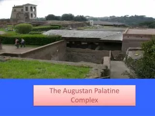
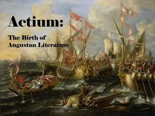
IWA Regional Symposium on Water, Wastewater & Environment: Traditions and Culture 22-24 March 2014, Patras, Greece. The Augustan aqueduct in the context of road system and urbanization of the served territory in Southern Italy Giacinto Libertini, Bruno Miccio, Nino Leone and Giovanni De Feo.

E N D
IWA Regional Symposium on Water, Wastewater & Environment: Traditions and Culture 22-24 March 2014, Patras, Greece The Augustan aqueduct in the context of road system and urbanization of the served territory in Southern Italy Giacinto Libertini, Bruno Miccio, Nino Leone and Giovanni De Feo Marcus Vipsanius Agrippa, brotherly fellow of Augustus, pivotal pillar of Augustus success and power, and builder of the Augustan aqueduct Emperor Gaius Julius Caesar Octavianus Divi Filius Augustus
The Augustan aqueduct (Aqua Augusta) was exceptional in size (the main trunk about 103 km long, the branches about 60 km). It served 13 towns, the civil port of Puteoli (one of the two most important civil ports of the Empire, the other was Alexandria in Aegyptus), the military port of Misenum (one of the two most important military ports of the Empire, the other was Ravenna), and many villas of eminent figures. Atella Acerrae Nola Cumae Neapolis Puteoli villae Baia Palepolis Bavli Herculaneum Misenum Pompeii villae Oplontis portus civilis (Puteoli) portus militaris (Misenum)
Here, the Augustan aqueduct is examined in the rich context of the cities and roads existing in the Roman age in the crossed area. In Roman times (like today), the area was very fertile and densely populated. Many ancient centers are still in existence and many ancient roads coincide with the modern road layouts. Allifae Cubulteria Formiae Teanum Suessa Telesia Minturnae Trebula Cales Forum Popilii Beneventum Caiatia Sinuessa Urbana Casilinum Saticula Ad Octavum Capua Caudium Calatia Ad Novas Volturnum Vicus Feniculensis Atella Suessula Nola Abellinum Acerrae Liternum Ad Teglanum Neapolis Cumae Puteoli Urbula Palepolis Baia Bavli Herculaneum Pompeii Misenum Oplontis Nuceria Salernum Stabiae
The centuriations existing in the same area were also considered. As it was (and is) a very fertile area, it was subdivided (“centuriated”) more times, creating a network of country roads (limites) whose paths are quite often still preserved, allowing the reconstruction of the grids of limites which are two millennia old! Allifae Cubulteria Formiae Teanum Minturnae Suessa Trebula Telesia Cales Caiatia Forum Popilii Beneventum Sinuessa Urbana Casilinum Saticula Ad Octavum Capua Caudium Calatia Ad Novas Volturnum Vicus Feniculensis Suessula Atella Nola Acerrae Abellinum Liternum Ad Teglanum Neapolis Cumae Puteoli Urbula Palepolis Baia Bavli Herculaneum Pompeii Misenum Oplontis Nuceria Salernum Stabiae
The centuriations (centuriationes), in their typical form, were regular subdivisions of a territory by a network of unpaved country roads (limites), which defined a series of square areas, called centuriae, in general assigned to war veterans. The presence of modern road layouts or borders, placed at regular intervals and with uniform orientations, allows the reconstruction of the original grid of a centuriation. EXAMPLE 1 Upper figure: Persistences related to two centuriations in the same area (Ager Campanus I, Gracchian age, purple color, and Ager Campanus II, Sullan and Caesarean age, green color). Lower figure: the two reconstructed grids.
EXAMPLE 2 Upper figure: The area to the north of the ancient city of Suessula, where only few sparse ruins are found Lower figure: Parts of the reconstructed grids of four centuriations (Suessula [yellow], Ager Campanus I [purple], Ager Campanus II [green], Acerrae-Atella I [violet]), the roads of the area [red], walls and amphiteater of Suessula [yellow]
The persistences of centuriation limites’ in the area crossed by the aqueduct or near it. The grids inferred from them have limites in all thousands of kilometers long! Allifae Cubulteria Formiae Teanum Minturnae Suessa Trebula Telesia Cales Caiatia Forum Popilii Beneventum Sinuessa Urbana Casilinum Saticula Ad Octavum Capua Caudium Calatia Ad Novas Volturnum Vicus Feniculensis Suessula Atella Acerrae Nola Abellinum Liternum Ad Teglanum Neapolis Cumae Puteoli Urbula Baia Palepolis Bavli Herculaneum Misenum Oplontis Pompeii Nuceria Salernum Stabiae
Short description of the Augustan aqueduct and of the surrounding areas First segment - From the source to the "caduta della Laura" (fall of the Laura, included) (371 -> 205 m above sea level (“asl”); 18 km) Abellinum aqueduct of Beneventum fall of the Laura
Second segment – From the “caduta della Laura” (fall of the Laura, excluded) to monte Paterno tunnel (included) (205 -> 70 m asl; 16.4 km) - It passed near the town of Nuceria Alfaterna, the third or fourth of Campania for population (not served by the aqueduct) Ad Teglanum Terravecchia place fall of the Laura Urbula monte Paterno tunnel Nuceria
Third segment - From Monte Paterno tunnel (excluded) to the branch points for Nola and Pompeii (70 -> 50 m asl; 13.7 km) - Around the valley of Sarnum (Sarno) river, up to the watershed with Clanium (Regi Lagni) basin Nola Abellinum Mura d’Arce (today) Ad Teglanum fall of the Laura (1883) Urbula monte Paterno tunnel Oplontis Nuceria Pompeii
Branch for Nola (6.9 km) - The great Vergilius complained that he had not obtained the privilege of a private water connection for his villa in Nola Abella Nola Villa Augusti Ad Teglanum Tirone place
Branch for Pompeii, Oplontis, Herculaneum (12.4 km up to the sub-branch for Pompeii + 12.9 km from Pompeii to Herculaneum = 25.3 km) villa Augusti Ad Teglanum Urbula Herculaneum villa Poppaea Oplontis Pompeii Nuceria villa papyri castellum aquae
Pompeii The grid of Nuceria II centuriationis all around the site of the buried city. This demonstrates that the area was again subdivided and cultivated after the 79 AD eruption castellum aquae Oplontis Pompeii villa Poppaea
Fourth segment - From the branch points for Nola and Pompeii to the branching point for Acerrae (50 -> 47 m asl; 13.8 km) + Branch for Acerrae (6 km). - Villa Augusti “apud Nolam”, the place chosen by Augustus for his last days Acerrae Nola great canal bridge (3.5 km) villa Augusti Ad Teglanum
Villa Augusti in its context: - surrounded by “client” towns and by centuriations assigned to Augustus’ war veterans; - encircled by the Augustan aqueduct with a view on the great canal bridge Urbana Casilinum Beneventum Ad Octavum Saticula Capua Caudium Ad Novas Calatia Vicus Feniculensis Suessula Atella Abella Acerrae Nola Liternum Abellinum villa Augusti Neapolis Ad Teglanum Cumae Baia Palepolis Puteoli Urbula Bavli Herculaneum Misenum Oplontis other (undefined) Augustan centuriations Nuceria Pompeii
Fifth segment - From the branch for Acerrae to the branching point for Atella (47 -> 44 m asl; 4.5 km) Branch for Atella (8.8 km), famous for its fabulae atellanae (theater comedies) Atella Acerrae great canal bridge (3.5 km) Villa Augusti
A general view of the area of Capua, Atella, Acerrae, Suessula, Calatia, the core of Campania felix Casilinum Capua Saticula Calatia Ad Novas Vicus Feniculensis Suessula Atella Acerrae Nola Liternum
Sixth segment - From the branch point for Atella to the “Ponti Rossi” (“red bridges”, included) (44 -> 41 m asl; 7.4 km) great canal bridge (3.5 km) Ponti Rossi Neapolis
Seventh segment - From the Ponti Rossi (excluded) to the tunnel for "Fuorigrotta" (included) (41 - > 40 m asl; 8 km) First branch for Neapolis (0.05 km up to the walls); Second branch for Neapolis (0.7 km); Branch for Palepolis (Partenope) (0.5 km) Belisarius’ entry point (536 AD) Neapolis castellum aquae (destroyed in the 15th century) thermal baths Palepolis
Branch for Pausylipon (the famous villa of Vedius Pollio, bequeathed to Augustus, 5.5 km) Branch for Nisida (5.2 km). On this small island there were the villas of Lucius Licinius Lucullus, famous for his “lucullian” dinners and of Marcus Iunius Brutus, one of the main Caesar’s murderers Palepolis villas of Lucullus and of Brutus thermal baths Nisida Pausylipon (villa of Vedius Pollio) Seiano grotto (770 m)
Eighth segment - From the tunnel for “Fuorigrotta” (excluded) to Puteoli (40 -> 38 m asl; 7.8 km) - Puteoli had a very important civil harbour, was the second town of Campania for population, and had the third greater amphiteatre (after Roma and Capua) in all the Roman empire local aqueduct thermae Puteoli piscinae Serapeum amphitheatrum
Ninth segment - From Puteoli to the branching point for Cumae (38 -> 36 m asl; 5.5 km) - Cumae was heavily fortified and there was even a large military tunnel (Cocceius tunnel, nearly a kilometer in length) which connected it with the lake of Avernus, used for a certain time as military harbour Cumae local aqueduct Avernus lacus Arco Felice Puteoli Baia Cocceius military tunnel (1 km)
Tenth segment - From the branching point for Cumae to the cisterna Dragonara (36 -> 0 m asl; 8.4 km) Cumae local aqueduct Puteoli Baia portus civilis Cumae Bavli portus militaris Misenum piscina mirabilis cisterna Dragonara
Cumae, Greek center founded in the 8th century BC, was a very important city and played a key role in the origins of Western civilization. Cumae founded Dicearchia (Puteoli), Partenope (Palepolis), Neapolis, and many other centers. Cumae defeated the Etruscans of Capua in 524 BC, then - allied with the Latins - the Etruscans again in 504 BC, freeing Roma from the Etruscan domination, and finally - allied with Syracusae - the Etruscan fleet in 474 BC. The Latin alphabet, the most widely used alphabet in the world, is practically the Greek alphabet as it was written and pronounced in Cumae: it was adopted by the Romans with some minor modifications.
Conclusion Often, studying great structures of the ancient world, as the Augustan aqueduct, little attention is devoted to the framing of the structure in the general context of the civitates and the area served. In our case, the persistent tracks of the routes of many centuriation limites (extended in all for thousands of kilometers!) and of ancient roads are quantitatively very noteworthy and impressive. In this context, a service structure as the Augustan aqueduct is evident in its full meaning as a very important element in a more general and complex organization. This brief exposition is certainly very limited in relation to the richness of the subject and it clearly indicates the need for a more detailed study. This is the potential prelude for further enrichments based on the rational integration of data of different types, not limited to the archaeological data and the classical literary sources.