Download
1 / 22
220 likes | 362 Views
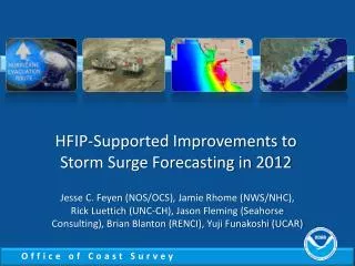
HFIP-Supported Improvements to Storm Surge Forecasting in 2012. Jesse C. Feyen (NOS/OCS), Jamie Rhome (NWS/NHC), Rick Luettich (UNC-CH), Jason Fleming (Seahorse Consulting), Brian Blanton (RENCI), Yuji Funakoshi (UCAR). Model Improvements Prioritized by NOAA’s Storm Surge Roadmap.

E N D
HFIP-Supported Improvements to Storm Surge Forecasting in 2012 Jesse C. Feyen (NOS/OCS), Jamie Rhome (NWS/NHC), Rick Luettich (UNC-CH), Jason Fleming (Seahorse Consulting), Brian Blanton (RENCI), Yuji Funakoshi (UCAR)
Model Improvements Prioritized by NOAA’s Storm Surge Roadmap • Roadmap is NOAA’s plan for improving models, products and services • Highlights need for NOAA to establish storm surge model ensembles that are: • High resolution • Able to capture large scale storms • Capture effects of tides, waves, and river inflow • Community based to leverage multi-agency investments
Concept of a Next Generation Storm Surge System Wave Modeling Wave spectra Hurricane Modeling Ensemble output NHC Official Forecast Tracks Water Level, Currents Wind, Pressure Products Storm Surge Modeling Water Level, Currents Tidal Database River Level Water Level Inflow Products -GIS-based -Inundation graphics-Hydrographs -Wave Conditions -Ensembles Hydrologic Modeling Precipitation Coastal hazards modeling -Flexible grids that combine large regions with locally high resolution -Combine effects of surge + tide + waves + rivers to assess flooding
High Res Total Water Level Modeling • ADCIRC • Community-based model being actively developed by academia; routinely used by USACE, FEMA • Runs on 10K+ CPUs • Unstructured grids combine basins with local resolution down to tens of meters • Includes tides, river inflows, waves (via internal SWAN model) • Supports forcing from gridded windfields or track forecast files (via asymmetric Holland parametric hurricane wind model)
High Res Surge Ensembles • ADCIRC Surge Guidance System (ASGS) • Provides automated software system for running ADCIRC + SWAN • Forced by NAM or driven by NHC Forecast Advisories • Utilizes growing library of ADCIRC grids • Developed via support from USACE and DHS; maintained by researchers at UNC-CH and partners • Perturbs official NHC forecast • Official forecast track, wind speed increase, veer halfway/fully to edges of cone, slower forward speed, change in Rmax
Gulf Coast Test Grid Resolution • 424K nodes • From Westerink et al., 2012 AMS Conference session on IOOS Coastal Modeling Testbed
Dissemination of Surge Predictions • ADCIRC generates standard NetCDF output • RENCI has developed MATLAB-based viz tool “AdcircViz” to display results • Accesses runs from NOAA and elsewhere • NOAA relied upon RENCI THREDDS server in 2012 RENCI AdcircViz Schematic
2012 Storm Surge Forecast Guidance • Opportunity to provide proof of concept • Focused on Gulf Coast due to grid availability • Used by NHC Storm Surge Unit to augment official guidance for Isaac and Sandy • Helps fill gaps in operational guidance • Captures large storms (e.g., Sandy) • Higher resolution • Includes tide contributions • Some external runs included wave effects
Hurricane Isaac • Provided output for most advisories from 21 (early Sunday) to 34 (Wednesday morning near landfall) • Generally provided 5 ensemble members • Official, left, right, 20% more intense, slower, softer left • Also was able to provide access to USACE high resolution results in Louisiana
ASGS Ensemble – Sandy Adv 23 Official Track 20% More Intense Left shift Right Shift
Hurricane Sandy • Provided output for most NHC advisories from 20 (Sunday) through 29 (Monday afternoon right before landfall) • Grids in NY area were limited in resolution, so fewer ensemble members were used; higher resolution in NC did help there • Also provided a few results from NAM-forced runs as Sandy transitioned to post-tropical
Challenges and Future Work • Improved grid coverage needed • Full Gulf and East coast at efficient 500 m resolution • Need OPeNDAP/THREDDS for data delivery • Enables use of community tools; CSDL investigating • Install viz tool at operational center • Further testing of real-time scripting • Coupled surge+wave predictions • Evaluation of HWRF forecasts for surge • Surge prediction improvements with HWRF track forecasts and gridded wind fields