Download
1 / 13
130 likes | 241 Views
This document discusses the implementation of Open GIS (OGC) web services by the Iowa Environmental Mesonet (IEM) to efficiently collect and serve environmental data. It highlights the motivation behind the initiative, an overview of services such as WMS, WFS, and WCS, and the software components used, including PostGIS and MapServer. The IEM focuses on aggregating environmental data from various sources in the Upper Midwest, emphasizing collaboration and effective disaster management. Lessons learned underscore the benefits of OGC services in reducing redundancies and improving development efficiency.

E N D
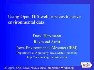
Using Open GIS web services to serve environmental data Daryl Herzmann Raymond Arritt Iowa Environmental Mesonet (IEM) Department of Agronomy, Iowa State University http://mesonet.agron.iastate.edu
The Rundown • Motivation • Overview of OGC web services (WMS,WFS,WCS) • IEM web service offerings • Example implementations • What we have learned
The Iowa Environmental Mesonet • Data collection and collaboration project based at Iowa State. • Focused on collecting any environmental data from the Upper Midwest. • We don’t own any of the observing sites, but collect from others that have them.
The Software Components PostGIS – Spatial datablade for the PostgreSQL RDBM MapServer – Extremely fast and capable internet mapping server also supporting WFS,WMS,WCS Linux – What else would you build your enterprise data system on?
Some of IEM OGC Offeringshttp://mesonet.agron.iastate.edu/ogc/
Supporting 2004 Hurricanes Provided Disaster Management Interoperability Services a RADAR WMS to support their decision support software http://www.cmi-services.org
Providing Road Conditions to Media Outlets • WFS and WMS support generation of images for display in TV Weather graphics systems
NWS Warnings WFS • Retrieve current and historical NWS warnings (polygon and county based). • Archive begins Jul 2002
Lessons Learned • OGC webservices greatly reduced chaos on our server. Chaos being: • Redundantly storing data for different apps • Versioning issues with redundant data • Redundant code to simply add a RADAR layer to a map • The application development time reduced • Performance hit was remarkably small
More Lessons Learned • Often, the performance bottleneck is the overhead of HTTP • The client application/implementation is absolutely key • (Daryl’s 2 cents) The OSS community needs to generate some killer OGC desktop interfaces and scripting libraries.
Time for Questions? mesonet.agron.iastate.edu Daryl Herzmann 515.294.5978 Akrherz@iastate.edu