Download
1 / 17
170 likes | 306 Views
Trends in map e-services. Karel Charvat http://www.ccss.cz. data3. analyse. catalogue. Data, analyse, catalogue,. data2. data1. searching í. Web/local. web. What is it?. Application: human - machine Services : machine - machine. Interoperability, distribute system

E N D
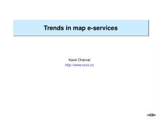
Trends in map e-services Karel Charvat http://www.ccss.cz
data3 analyse catalogue Data, analyse, catalogue, ... data2 data1 searchingí Web/local web What is it? • Application: human - machine • Services: machine - machine • Interoperability, distribute system • Offering services, not data • Data collection and management on one place, data are all time actualise • Special black boxes on WEB as services • Utilisation of different SW platforms • User use only requested functionality
Cartographic projection Klient CSS Cascading topograf. mapa Klient tématický obsah Web Map Service (WMS) <Exception> <Format>application/vnd.ogc.se_xml</Format> <Format>application/vnd.ogc.se_inimage</Format> <Format>application/vnd.ogc.se_blank</Format> </Exception> <VendorSpecificCapabilities /> <Layer> <Name>corine</Name> <Title>Corine CR map</Title> <SRS>EPSG:28403 EPSG:4326 EPSG:2065</SRS> <LatLonBoundingBox minx="15.2647" miny="49.9462" maxx="15.2717" maxy="49.9508" /> <BoundingBox SRS="EPSG:28403" minx="3.519e+006" miny="5.535e+006" maxx="3.5195e+006" maxy="5.5355e+006" /> <Layer queryable="0" opaque="0" cascaded="0"> <Name>foto</Name> <Title>fotografie</Title> <Abstract>No a toto je strucný popis toho vseho <a href='http://www.bnhelp.cz' target='_blank'> Metadata</a></Abstract> </Layer> <Layer queryable="0" opaque="0" cascaded="1"> <Name>dmu25</Name> <Title>DMU25</Title> <SRS>EPSG:28403</SRS> </Layer> • Transmission of Images • Queries • GetCapabilities- metadata about services • GetMap- map • GetFeatureInfo– queries on maps
Web Features Service (WFS) • Data transmission in GML • Basic • GetCapabilities-metadata services • DescribeFeatureType- structure (XML schema) • GetFeature- GML data • Extended (editing) • LockFeature • Transaction (INSERT, UPDATE, DELETE, QUERY, DISCOVERY)
Other Specification • Styled Layer Descriptor (SLD) • Filter Encoding • Web Coverage Service (WCS) • Web Registry Server (WRS) • Web Coordinate Transformation Service • Gazetteer profile for WFS • Geoparser service • Web Terrain Server (WTS) • Web Pricing & Ordering Service (WPOS)
Planed: Product Support of OGC services ESRI - ArcIMS WMS server SLD, WFS server ESRI - ArcGIS, ArcExplorer WMS client, WFS client ? UMN Mapserver SLD support ? Implementation in products Product Support OGC services Autodesk - Map Guide No find ESRI - ArcIMS WMS server, WFS server Intergraph - Geomedia Web Map WMS server, WFS server Intergraph - Geomedia WFS client Map Info - ? WMS server – not sustainable documented UMN Mapserver WMS server + client, WFS server + client
Our contribution • To build system on MobileInternet platform, • To use open platforms for building of this system. • To define groups of users, describe the requested functionality for defined groups of user and on the base of this functionality define user profiles. • To combine effective tools, which will offer information access, but also analytical tools, which will offer complex data analysis including 3D analysis
Our contribution • To implement metadata model, this will be able to describe all available data source, including data validity, data history and data source. • To offer possibilities of access to distributed data source and so increase effectively of data access and data analysis. • To build decision-supporting system
WMS applications development • Under 5FP WirelessInfoIST-1999-21056 - The project aims to implement advanced wireless communications into multimedia systems and services for agriculture and forest administrations, business and NGO to improve access to agriculture and forest information. The communication via standard commercial equipment like as GPRS, GSM, HSCSD and special equipment developed for special cases are tested. • Open source technologies are used
WirelessInfo results • Mobile Internet GIS applications (multimodal, multiterminal) for field computers, PDA, MDA, WAP (WBMP format) communication human-computer, computer-computer machine-computer • WMS, WFS mobile services • Mobile data management • Web coordinate transformation services • Location Based Services (LBS) • GIS analysis services
GIS analysis services Based on GRASS Open Source software
Thank you for attention • WWW.wirelessinfo.cz • www.premathmod.cz