Download
1 / 20
200 likes | 330 Views
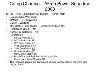
Co-op Charting – Akron Power Squadron 2008. USPS – NOS Coop Charting Program - Chart 14844 Position Data Worksheet Method – DGPS(WAAS) Datum – WGS 84 Manufacturer and Model – Garman GPS Map 182 Confidence Check – No Number of Satellites – 10 Participants Cdr Jan Holmes, AP

E N D
Co-op Charting – Akron Power Squadron2008 USPS – NOS Coop Charting Program - Chart 14844 • Position Data Worksheet • Method – DGPS(WAAS) • Datum – WGS 84 • Manufacturer and Model – Garman GPS Map 182 • Confidence Check – No • Number of Satellites – 10 • Participants • Cdr Jan Holmes, AP • Lt/C John Abbott, AP • Lt/C Craig Fraser, AP • 1st Lt Bill Bartilson, AP • 1st Lt Don Gifford, AP • Lt Liana Mihalca, AP • P/D/C Brian Logan, SN • Report Prepared by P/D/C Brian Logan, SN • Photos by Lt Liana Mihalca, AP • The following pages are annotated copies from Maptech program and digital charts
Port Clinton Entrance Verify Lights at end of pier head Vessel location – center of channel at entrance: L 41° 31.130’ N Lo 82° 56.141’ W
085 ° M Verify Green Island Light Verify light (not lit at 1100 hrs), Verify Day board NR Bearing to light 085M Boat position: L 41º 38.646’ N Lo 82º 52.209’ N Water Depth at position: 29’
Verify Boat Ramp as marked on W side S. Bass Island • Vessel approx 100 yds offshore • Bearing to centerline of ramp 125M • Boat position: • L 41º 39.261’ N • Lo 82º 50.296’ N
Verify R “2” Fl R 4 sec Boat abeam - position: L 41º 39.789’ N Lo 82º 49.291’ N
14844 Inset – verify position of aids – boat abeam R “2” L 41° 39.484’ N Lo 82° 49.099’ W G C“1” L 41° 39.568’ N Lo 82° 48.864’ W G C“3” L 41° 39.494’ N Lo 82° 48.900’ W R“4” L 41° 39.371’ N Lo 82° 49.091’ W G C“5” L 41° 39.418’ N Lo 82° 48.939’ W
14844 Inset – verify position of aids – boat abeam R N “10” L 41° 39.305’ N Lo 82° 49.228’ W R N “8” L 41° 39.289’ N Lo 82° 49.293’ W Lighted Float by GC”3” L 41° 39.514’ N Lo 82° 49.869’ W R N “6” L 41° 39.305’ N Lo 82° 49.228’ W
14844 Inset – aids are missing R N”2” and G C “1” Buoys Missing R N”6” and G C “3” Buoys Missing
14844 Inset – R N “4” – No Number on Buoy - position L 41° 39.356’ N Lo 82° 49.432’ W R N “2” – No Number on Buoy - position L 41° 39.337’ N Lo 82° 49.408’ W G C “1” – No Number on Buoy - position L 41° 39.336’ N Lo 82° 49.427’ W
14844 Inset – 144 ° M Visual - Verify Perry Monument From Vessel position G C“5” L 41° 39.418’ N Lo 82° 48.939’ W Bearing to Monument (avg 6 bearings) 144 ° M
14844 Inset – Water Tower not on Chart 166 ° M Visual – Sighting on Water Tower. Appears to right of Microwave tower when viewed from water. Water Tower not marked on 14844 Chart or inset From Vessel position L 41° 39.286’ N Lo 82° 49.250’ W Bearing to Tank (avg 6 bearings) 166 ° M
14844 Inset – 192 ° M Visual - Verify Micro Tower From Vessel position R “4” L 41° 39.371’ N Lo 82° 49.091’ W Bearing to Tank (avg 4 bearings) 192 ° M
Construction at Lonz Marina. Old entrance filled in. New Entrance moved north Green and Red daymarks still located at old entrance Visual sighting – verify Cupola atop Lonz Winery
Construction at Lonz Marina. Old entrance filled in. New Entrance moved north. New Entrance on magnetic bearing 282Bearing to Tank (avg 3 bearings) 282 ° M from vessel position L 41° 40.562’ N Lo 82° 48.300’ W 282 ° M
G C “7” L 41° 40.364’ N Lo 82° 47.445’ W R N “6” L 41° 40.418’ N Lo 82° 47.176’ W G C “5” L 41° 40.296’ N Lo 82° 46.894’ W
Verify Ballast Island Tower Light Verify Day board NR on tower Bearing to light 231M Boat position: L 41º 40.810’ N Lo 82º 46.892’ N 231 M
Visual sighting – verify South Bass Lighthouse Visual sighting – verify Ferry Dock Starve Island Reef R “2” L 41° 36.692’ N Lo 82° 49.029’ W Vessel in 24’ water depth
G “1” West of Catawba L 41° 34.618’ N Lo 82° 52.086’ W Vessel in 24’ water depth Visual observe G light at Catawba Island State Park Ramps G Light at entrance to CIC – Port side - not marked on chart. Visual observe marked R light at starboard entrance to CIC
Visually verify light at port and starboard entrance to Catawba Island Marina South Visually verify green light and daymark (G “5”) to port and Red light and daymark (R “6”) to starboard marking entrance to Le Marin.
Visually verify Green light to port and red light to starboard marking entrance to Colony Club Harbor Visually verify green light and daymark (G “1”) to port and red light and daymark (R “1”) to starboard marking entrance to Northwest Catawba Marina.