Download
1 / 21
210 likes | 536 Views
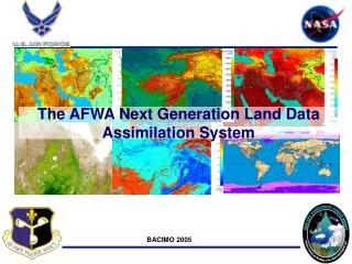
The AFWA Initial Operational Configuration for the NASA Land Information System. John Eylander Specialized Modeling Teams John.Eylander@us.af.mil. JCSDA Workshop, May 13 th , 2009. AFWA mission: A Global Team for the Global Fight.

E N D
The AFWA Initial Operational Configuration for the NASA Land Information System John Eylander Specialized Modeling Teams John.Eylander@us.af.mil JCSDA Workshop, May 13th, 2009
AFWA mission:A Global Team for the Global Fight Maximizing America's power through the exploitation of timely, accurate and relevant weather information; anytime, everywhere.
Integration Team Project Leaders CHRISTA PETERS-LIDARD (NASA) JOHN EYLANDER (AFWA) AFWA Integration Team Chris Franks (NG) Ted Lewiston (SES) Ryan Ruhge (NG) Marv Freimund (SES) Richard Ritz (AFWA) NASA Development Team SUJAY KUMAR (SAIC) James Geiger (GSFC) Yudong Tian (UMBC/GEST) Jing ‘Lily’ Zeng (ERT/SAIC) Ken Harrison (ESSIC) Additional LIS Team members and Collaborators R. H. Reichle1, J. Santanello1, M. Rodell1, H. Kato1, D. Mocko1, C. Alonge1, M. Garcia1, K. Arsenault1, B. Cosgrove1, J. Dong1,B. Li1, J. L. Eastman1, S. Olden1, L. Lighty1,K. E. Mitchell 2,J. Meng 2,H. Wei 2, P.R. Houser3, E.F. Wood4, J. Sheffield4, B. Doty5, P. Dirmeyer5, J. Adams5, X. Zhan6 , W. Crow7
Land InformationSystem Land Information System • NASA developed Land Information System (LIS) • 3 year (FY02 – FY05) NASA ESTO Computational Technologies Project • Goals: • Realistic Land Surface Modeling • High resolution, High performance computing • Efficient data management • Interoperable & Portable
LIS Design - Extensibility • Highly flexible, configurable framework • multiple domains • LSM options • Meteorological forcing options • EnKF data assimilation module (from GMAO) • JCSDA CRTM interface (in progress, tentative FY10 release)
LIS Integration (IOC) Goals • Goal 1: LIS to fully replace all AFWA Agriculture Meteorology (AGRMET) model capabilities • Precipitation, radiation, and surface forcing algorithms • Grid processing and GriB output software • Goal 2: Generate LIS products at higher resolution • ¼ degree resolution threshold for IOC • Goal 3: Demonstrate use of software portability, configurability, and retrospective testing capabilities • 1-year spin-up of initial conditions prior to IOC; spin-up ‘warm-started’ from AGRMET • Common infrastructure enables joint testing/evaluation of software/science changes High Performance Computing Center Program (HPCMP) Navy DoD Supercomputing Resource Center (DSRC) IBM cluster 1600 system (Babbage). Babbage has 3072 total 1.9 GHz CPU’s Power5+ processors. Babbage uses a proprietary network and IBM's High Performance Switch (HPS), also know as Federation, to communicate between nodes. The switch provides ~7-14 microsecond latency with a raw bandwidth of 2 GBps.
Current LIS Development Initial Operational Configuration
LIS - AFWA Initial Operational Configuration • LIS AFWA IOC defined as: • Global ¼ degree resolution, Latitude & Longitude grid • ‘AGRMET’ surface meteorological forcing • ‘AGRMET’ precipitation forcing • Surface observations • METAR precipitation reports & present weather estimates • Geostationary Infrared Precipitation estimate (GEOPRECIP) • SSMI & SSMIS rain rate environmental data record • AFWA World Wide Merged Cloud Analysis-based estimate • Poleward of 50 degrees • Climatology • ‘AGRMET’ radiation forcing • Relies upon AFWA World Wide Merged Cloud Analysis
IOC LIS initialization • LIS implemented ‘warm’ • AGRMET input data archive starting December, 2005 • Dual archive, AFWA dev/test & Navy DSRC on-line storage • Enables retrospective testing of current and upgraded AFWA-LIS configuration by NASA and AFWA • Month prior to IOC, completed 1-year retrospective test of LIS in AFWA configuration • Test also ‘warm-started’ from ½ degree AGRMET data • Week before implementation, ran in real-time mode on test system to support implementation
Surface Forcing LIS IOCMeteorological Surface Forcing • Lower troposphere temperature and humidity profile • NCEP GFS blended with synoptic observations • Near surface winds derived from 10-meter GFS winds • If GFS is not available, NOGAPS used as a backup
LIS IOC‘AGRMET’ Precipitation Forcing AFWA Blended Global Precipitation Estimate • Barnes analysis method blends observations from: • Gauge reports • AFWA Geostationary IR satellite precipitation estimate • AFWA CDFSII precipitation estimate • DMSP SSM/I & SSMI/S rainrate estimates (Tropics only) • Climatology Precipitation Forcing
LIS IOC‘AGRMET’ Radiation Forcing Shortwave Radiation Longwave Radiation Cloud information (coverage, top, types) from the AFWA CDFSII Reference: Shapiro (1987) References: Idso (1981) and Wachtmann (1975)
LIS Final Operational Configuration (FOC) • FOC defined as • AGRMET turned off • Only ¼ degree LIS products available • Support for WRF initialization • Separate LIS domain for each AFWA WRF domain • LIS domains match resolution/projection (grid) of WRF domain • FOC tentatively scheduled for February, 2010 • After FOC, plan to continually increase resolution of global system as input data resolution increases • Coupled LIS-WRF system to be completed FY2009 (April 2010), implemented late CY2010 (tentative)
Current LIS R&D Current LIS development efforts
LIS Data Assimilation The generic LIS-DA framework already includes the NASA/GMAO EnKF module, and has been demonstrated for soil moisture and snow examples (Kumar et al., AWR 2008): Added Tskin EnKF plug-in and NASA/GMAO bias estimation module. EnKF and direct insertion algorithms already included in latest LIS Version 6.0 release
Architecture Changes LIS-CRTM Coupling • New 3D Meteorological Inputs support • Formerly only surface layer was required to force LSM • RTM requires Atmospheric Profile (N layers ) • Implemented as Supplemental Forcing • GFS data options need to be discussed with AFWA • New RTM Forward mode • Computes Tb, emissivity by channel • Planned Radiance Assimilation mode • Will invoke LIS DA routines to assimilate Tb New RTM extensible interface To add RTM, implement required interfaces CRTM added as first RTM to LIS Simulates satellite-observed radiance Supports numerous sensors
Snow Cover/Depth Analysis • AFWA-NASA Snow Algorithm (ANSA) • Improves upon the science contained within the AFWA Snow Depth Analysis (SNODEP) model • Merges microwave snow depth measurements (e.g. AMSR-E) with visible NDSI snow cover (e.g. MODIS) • Current model uses primarily Synoptic Observations of Snow Depth, SSMI snow mask EDR, and climatology AMSR-E SWE converted to Snow Depth (inches) AFWA SNODEP model 20071212 12Z
AFWA-NASA Snow Algorithm (ANSA) (575) MODIS snow 80-100% and SWE 2-480 mm ANSA snow map 15 January 2007 (550) MODIS snow 21-79% and SWE 2-480 mm (450) MODIS snow 1-20% and SWE 2-480 mm (390) MODIS snow 80-100% and SWE 0 mm (370) MODIS snow 21-79% and SWE 0 mm (360) MODIS snow 1-20% and SWE 0 mm (375) MODIS snow 1- 100% and SWE water mask (355) MODIS snow 0% and SWE 2-480 mm (350) MODIS cloud and SWE 2-480 mm (330) MODIS cloud and SWE 0 mm Blended Snow Grid Values (300) MODIS cloud in AMSR-E swath gap (345) MODIS snow1-100% in AMSR-E swath gap (305, 290) MODIS no data SWE 2-480 mm (295) MODIS in darkness and SWE 2-480mm (250) MODIS in darkness and SWE 0 mm (253) AMSR-E Permanent Snow/Ice (201) MODIS snow 1-100% and SWE land not processed (200) MODIS snow 1-100% and SWE no data (0) Land (1508) Ocean (1498) Fill
Summary • NASA-AFWA LIS project resulted in successful integration of LIS into operations • February 24, 2009 Initial Operational Configuration • Joint LIS development system aids “bridging the gap” between research and operational communities • Recent advances key enablers to further science development of land data assimilation, land surface modeling, forecasting of land surface characteristics • Advanced data assimilation architecture • Community Radiative Transfer Model (CRTM) interface • LIS-WRF coupling • Advanced global snow characterization • FOC targeted for February, 2010 • AGRMET decommissioned, enable LIS support for WRF domains