Download

1 / 28
290 likes | 501 Views
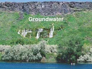
Surface Water – Groundwater Interaction in San Acacia Reach. Nabil Shafike New Mexico Interstate Stream Commission. SW/GW A Single Resource. Gaining / Losing Streams. Winter et al. 1998. Disconnected Stream. Winter et al. 1998. Stream Aquifer Interaction Under Stress.

E N D
Surface Water – Groundwater Interaction in San Acacia Reach Nabil Shafike New Mexico Interstate Stream Commission
Gaining / Losing Streams Winter et al. 1998.
Disconnected Stream Winter et al. 1998.
Stream Aquifer Interaction Under Stress Winter et al. 1998.
Mathematical Representation Land Surface If h > RBOT Leakage = Cond (HRIV – h) If h <= RBOT Leakage = Cond (HRIV – RBOT) Riverbed Conductance = KLW/M Water Table River Surface Streambed Stream –aquifer System Impermeable Walls Head in Cell (h) River Stage (HRIV) MODFLOW River Packages: - Riv1 (MODFLOW 83) - Riv2 (Miller 1988) - Stream Pckg (Prudic, 89) - BRANCH (Swain et al, 97) - SFR-1 (Prudic et al, 2004) M RBOT W Representation of the Stream –aquifer System
Drain Unit 7 Rio Grande Socorro Main Canal San Acacia Lemitar Irrigation System 1200 9 Mile outfall Neil Cupp Waste Way LFC Channel Storm Water Riparian System Storm Water BDA Diversion Riparian System BDA Diversion Bosque del Apache NWR Waste Way San Marcial Elephant Butte Reservoir Conceptualization of the SW System
Conceptualization of the Groundwater System (Anderholm 1987)
10 9.5 6.5 3.5 12 6.5 4 Distance (mile) Loss (cfs/mile) 1 to 4 5 to 10 13 to 20 5 to 12 4 to 10 2 to 10 1 to 2 Brown Arroyo Escondida Br. San Marcial San Acacia HW 380 North BdA South BdA Fort Craig Rio Grande Seepage Analysis
Aquifer Test Analysis H. Hydrauic Conductivity (Kx) = 72.0 ft/day V. Hydraulic Conductivity (Kz) = 3.6 ft/day Kh : Kz = 20 : 1 Specific Yield (Sy) = 0.15 Specific Storage (Ss) = 6.0e-07 1/ft Discharge (Q) = 76.0 gpm
Operation Scenarios: 1- Max diversion of 500 cfs and min of 100 cfs 2- Max diversion of 1000 cfs and min of 100 cfs 3- All flow diverted to LFCC with a max of 2000 cfs Hydrology of year 2001 was used in all scenarios
Water Above Land Surface Current Operation Maximum Operation
Concluding Remarks For this specific year (2001-hydrology) and given the model input conditions: 1- SW Operations impact its interaction with the groundwater system. 2- There is no significant difference in depletions between current operation of the LFCC as a drain and a maximum diversion between 500 cfs to 1000 cfs. 2- Operating the LFCC up to its maximum capacity (2000 cfs) provides the most efficient way to convey water to Elephant Butte because evapotranspiration losses are reduced.