Download
1 / 12
120 likes | 140 Views
This national network, hosted by Dalhousie University, brings together Canadian researchers, stakeholders, and users to predict marine hazards and improve response. Facing challenges like limited funding and diversifying priorities, initiatives like Smart Ocean/Smart Industries Canada seek to advance ocean industry collaboration. Through workshops, information sharing, and strategic planning, MEOPAR aims to build an integrated Atlantic Ocean observing system. International partnerships, like the Canada Foundation for Innovation, offer opportunities for shared planning and funding of infrastructure. Key research areas include Arctic and marine ecosystems, air-sea exchange, deep-water circulation, and biodiversity. MEOPAR also supports transatlantic research collaborations, graduate schools, and training programs to advance ocean science and technology. Join us in shaping a sustainable future for ocean observation in Canada.

E N D
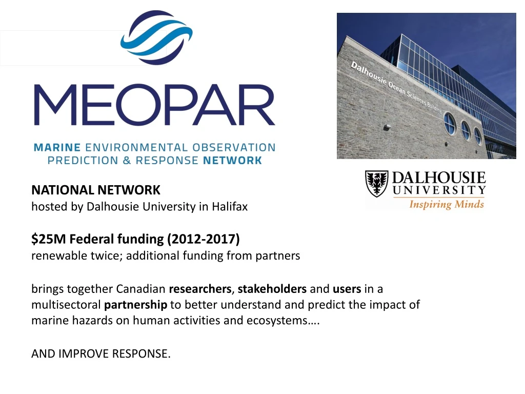
NATIONAL NETWORKhosted by Dalhousie University in Halifax $25M Federal funding (2012-2017)renewable twice; additional funding from partners brings together Canadian researchers, stakeholders and users in a multisectoralpartnership to better understand and predict the impact of marine hazards on human activities and ecosystems…. AND IMPROVE RESPONSE.
Facing Galway: Some Atlantic Canadian realities… • Small population / tax-base (c. 2.5 million inhabitants) • Political / economic “influence“ of region is limited • Federal government science capacity is decreasing.... • No new funding mechanisms comparable to Horizon 2020 → A diverse and changing funding landscape for ocean observation… and changing priorities… Government Department of Fisheries and Oceans Environment Canada Defence Research and Development Canada Natural Resources Canada Canada Space Agency Academic esp. NSERC Individual projects andlarger networks (OTN, MEOPAR, ONC, ArcticNet, etc. Industry Oil and gas Transportation Aquaculture Fishing MEOPAR may help to build a joined-up Canadian effort… Initial efforts include:
Montreal Community Workshops. March 2014 Established “Ocean Gliders Canada” Develop shared operational support Inventory Canadian capabilities and activities Share information and activities via a web portal Coordinate training opportunities and emergency response capabilities Created a “Canadian Community of Practice for Ocean Data Management”: Explore how to inventory current ocean data holdings Examine how to build a national structure that builds on local and regional strengths Identify, share and make use of code and distributed expertise Coordinate links to international data infrastructures (IOOS, Copernicus, etc.) COMING UP, May 2014 Smart Ocean / Smart Industries Canada: An International Workshop to Advance Industry-Science Collaboration and Ocean Industry Data Collection in Canada ….will set the stage for an initial Canadian Atlantic pilot project on ocean observations by industry, in support of Canada’s commitment to trans-Atlantic research under the “Galway Statement on Atlantic Ocean Cooperation,” with potential for future expansion to the Pacific and Arctic Oceans.27-29 May 2014, Montreal, QC, Canada
Observing System Strategy: Agree on principles Identify needs, opportunities, allies: set priorities, avoid over-reach Mobilise and align multiple, multisectoralfunding sources* *(incl. international partnerships) →Draft Strategy Paper: Towards a Canadian Contribution to an Integrated Atlantic Ocean Observing System • Principles • Use the 4 M’s * • Science-led (but involve people!) • Flexible, interoperable, relocatable • Concentrate on data sharing/ access • Plan for sustainability • Build on what exists (i.e. has survived) • Identify and promote RAD’s • Encourage international involvement • Explicit links to operational models • Explicit links to remote sensing • * Multidisciplinary, multisectoral, • multipurpose, multinational
New Infrastructure Opportunities? → Possibilities for INTERNATIONAL shared planning and funding of “Arctic and Marine” infrastructure through Canada Foundation for Innovation.
Identify and promote RAD’s Researcher Aggregating Devices: Focus infrastructure, observations AND projects spatially Ideally where science and user needs intersect Requires discipline and compromise Regions must be carefully chosen: enough science for all? International and open 4 RADs and Their Motivations: Baffin Bay / Davis Strait: GreenEdge project; Ice-cover and ecosystems; Arctic /freshwater transport; air-sea exchange Labrador Sea: VITALS, OSNAP Deep-water formation, freshwater impacts, MOC, CO2, O2, acidification Flemish Pass: MOC, heat flux, CO2 flux, biodiversity, deepwater oil Scotian Shelf/Slope: MOC, acidification, deep circulation, biodiversity, deepwater oil; air-sea Fish Aggregating Device (FAD)
Horizon 2020 Topics arising from Galwaye, of high relevance to MEOPAR include: EU 3.5 million EU 15-20 million EU 6 million
Transatlantic Research School Ocean System Science & Technology Halifax Kiel CAN$3.2 million EUR€1.8 million Goal: Convey technical and research skills in ocean science and advanced technologies, and promote informed management of deep sea and open ocean environments. Cape Verde
Outcome #3: two, new, bilateral Graduate Schools... Germany: Uni. Bremen + AWI Canada: Univ. Quebec a Montreal + 8 other Canadian Universities Ecosystem Hotspots; Ocean Dynamics; Seafloor Structures NSERC CREATE: Transatlantic Ocean System Science and Technology Helmholtz Research School Ocean System Science and Technology Germany: GEOMAR + Uni. Kiel Canada: Dalhousie University and Halifax Marine Research Institute
Climatological Mean Air-Sea CO2 Flux (Takahashi et al, 2009)
Accuracy of Basin-Wide pCO2 Maps Seasonal mean RMS error (μatm) Large mapping errors in the Labrador Sea and around the Grand Banks … can be seen as a consequence of the lack of training data in this area. The extension of monitoring pCO2 is highly recommended as our results indicate a significant improvement in the basin-scale pCO2 maps… more observations would be particularly useful in the Labrador Sea and the NAC area. Friedrich, T., and A. Oschlies (2009), Neural network-based estimates of North Atlantic surface pCO2 from satellite data: A methodological study, J. Geophys. Res., 114, C03020, doi:10.1029/2007JC004646