Download
1 / 22
220 likes | 240 Views
Learn about the integration of ground-based remote sensing stations at Lindenberg Observatory to enhance meteorological analysis, forecasting, and climate research. Explore field experiments and results from various campaigns.

E N D
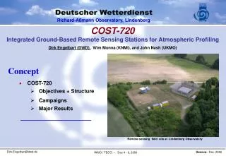
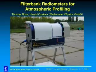
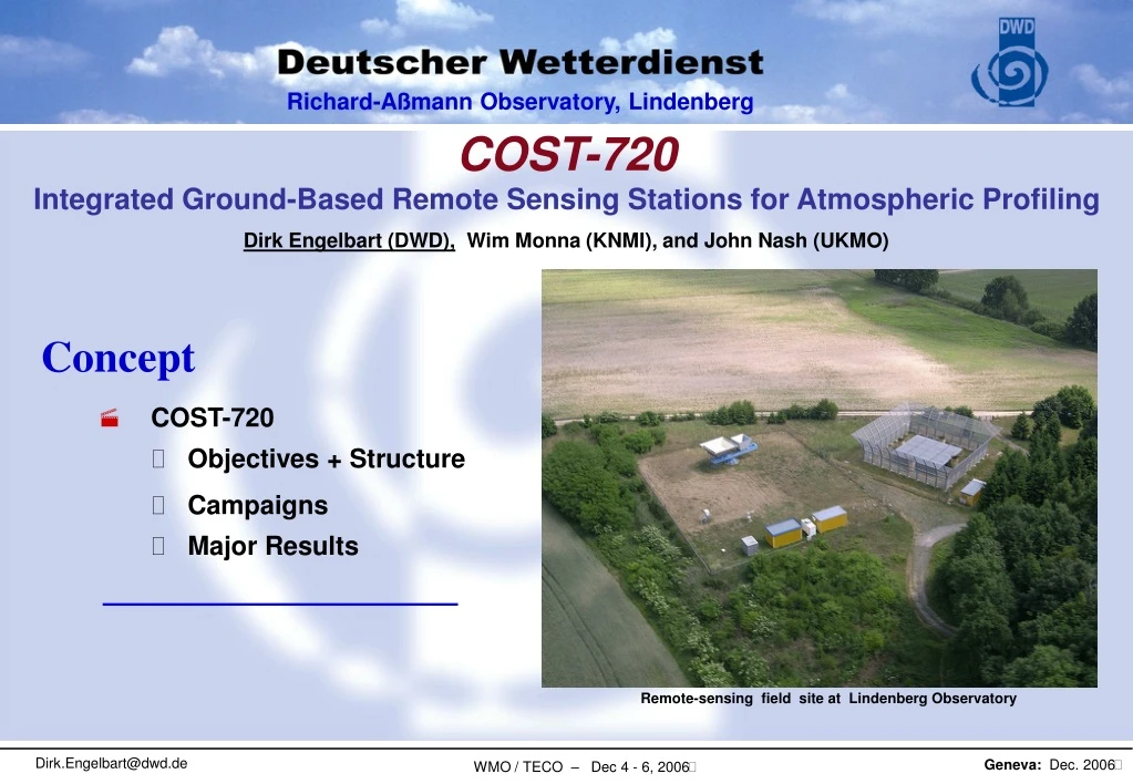
Remote-sensing field site at Lindenberg Observatory COST-720 Integrated Ground-Based Remote Sensing Stations for Atmospheric Profiling Dirk Engelbart (DWD), Wim Monna (KNMI), and John Nash (UKMO) Concept • COST-720 • Objectives + Structure • Campaigns • Major Results
Goals of COST-720 • development of integrated ground-based remote-sensing stations for atmospheric profiling • Assessment of their use for meteorological analysis, forecast, climate research and monitoring • Set-up of networks of integrated profiling stations during dedicated campaigns
Organisation - I WG1, Basic Techniques and Algorithms • Assessment of the state of the art of individual techniques in view of potential for integration • Improvements where necessary and possible • Considered measurement systems: - Microwave and IR Radiometer - water-vapour and Doppler wind Lidar - Wind profiling radar/RASS - Cloud radar - SPC ceilometer - C-Band weather radar.
Organisation - II WG2, Integration • Development / assessment of methods to derive - Temperature profiles - Humidity profiles - Cloud characteristics - boundary-layer characteristics • from integrated remote sensing • for different kinds of users
Field experiments: TUC • Payerne, Switzerland • 15 November, 2003 – 15 February, 2004 • In-situ & ground-based remote-sensing systems Instruments • 1290 MHz wind profiler • 78 GHz cloud radar • radiometers (ASMUWARA, Radiometrics, IR) • radiosondes (3 types) • ceilometer • GPS humidity system • total sky imager • BSRN instruments Goals • Test of basic ground-based T and U profiling systems • Study ability to detect PBL phenomena • Assess automatic cloud detection systems • Provide dataset to study system integration
Field experiments: TUC Results: 10 reviewed papers published in a Special Issue «COST-720 TUC» of Met.Z.: Vol. 15, No. 1, 2006, 97pp. • Intercomparisons found biases in both …. • microwave radiometers • all radiosondes’ humidity • FMCW cloud radar can monitor fog base/top • Radiometer and wind profiler able to monitor: • T and humidity inversions near surface • First integration of Wind Profiler and Microwave Radiometer for humidity profiling
Field experiments: CSIP CSIP = “Convective Storm Initiation Project” Central-Southern England, June – August 2005 COST-720 and UK Universities • System integration studies for summertime PBL • High-resolution NWP modelling Instruments: • Microwave radiometer • Laser ceilometer • 1290 MHz windprofiler • Chilbolton radar • Radiosondes
Field experiments: CSIP Results • UHF radar can see lids of convective inhibition and resolve structure of convective plumes • Radiometer IWV in good agreement with most GPS sensors at high temporal resolution • Radar refractivity measurements can make humidity changes • Cold Pools behind mesoscale convective systems • Analysis is ongoing... See: • http://www.env.leeds.ac.uk/csip/
Field experiments:Helsinki Testbed Helsinki Testbed (see: Poutiainen paper) • Southern Finland, Finnish MetOffice, August 2005 (start) • = permanent integrated profiling station Provides data & experience for • Mesoscale weather research • Forecast- and dispersion-model development Instruments • Finnish weather observation network • Vaisala WXT510 weather transmitter network (60) • 1.3 GHz windprofiler/RASS • Dual-polarization weather radar
Field experiments: LAUNCH-2005 (see special poster) (29th Aug. – 31st Oct, 2005) • Assessment of new or improved humidity, temperature, andwind profiling systems profiling systems: • Water vapour Lidar systems (Raman Lidar and DIAL) • Doppler wind Lidar vsWPR (ZIE) • inter-comparison of different types of MWP systems • FTIR spectrometer • High-range SPC ceilometer • Assessment of various algorithms, combining different techniques for profiling of cloud parameters (integrated profiling), in particular • LWC profiling • Improved rain rate profiling by radar • Provision of a data set, designed for validation and comparisons between measurements and NWP output, • Provision of a datasetfor OSEs using 3D-/4D-VAR data assimilation for high-resolution WV-profiling systems in regional NWP modelling • 3D-VAR / 4D-VAR MM5/ECMWFsystem of Hohenheim + of L‘Aquila (3D-VAR) • NWP output validation using the FZK-IFU MM5 with amodified integration and advection scheme
LAUNCH-2005: Basic techniques Improvement of microwave profiling (humidity & temperature) Validation Dec.2004 – Nov.2005: Bias & rms-error of T and U profiles (vs. RS) applying: neural network measurement-based regression (operational regr.) Model-based regression method (training): - may improve profiling performance - allows easy use of MWP at all sites
DWD RAMSES(Raman Lidar for Atmospheric Moisture SEnSing) LAUNCH-2005: Basic techniques Lidar:RAMSES data example:Sep 25/26, 2005 • DWD - RAMSES • automated operation, data acquisition, • & evaluation • at MOL-RAO now 15 months of test • operation • similar fully-autonomous systems are • in test mode at Payerne and Cabauw • commercial network systems below • 150 k€ now available • (COST-720 final workshop)
LAUNCH-2005: Basic techniques Lidar:RAMSES data example:Sep 25/26, 2005
Mean Z-R-relation over 30 hours “Large“ drop mode, 6 hours “Small“ drop mode, 8 hours LAUNCH-2005: Integrated Profiling Rain rates by Weather Radar + Micro-Rain Radar • Z/Rrelation (x-Band Rad.) according to real DSD DSD: • classified in modes • measured by MRR
Raman Lidar DIAL Microwave Radiometer LAUNCH-2005: European domain Cloud Radar / MRR Systems in the domain 14 Lidar systems (WV systems) 8 MWP systems (2 MW radiometer) 3 cloud radars (+1 MRR at Leipzig) 11 MRR (Validation) Ceilometers (Validation)
LAUNCH-2005: Assimilation of WV lidar WV mixing ratio Oct. 26/27, 2005 Observation Height asl / km ECMWF i.s. 4D-Var i.s. i.s. = initial state 00:00 01:00 23:00 02:00 Time UTC
LAUNCH-2005: Validation of humidity modeling RAMSES LM Clouds MWP Water-vapour mixing ratio 14.10., 1712 UTC - 15.10., 0511 UTC
Model validation using Integrated profiling Cloud profiling (CloudNet cooperation) Comparison Measurement -Model: (Examp. Chilbolton vs.DWD-LM: Jan – Sep 04) • Freq. of LWCs in clouds • Obvious model deficits • Strong model underestimation of LWC in low clouds
Major Results ofCOST-720 / I (related to operational users) • Basic techniques & algorithms - major improvements in microwave profiling (operationally applicable all-weather technique) • Algorithms for system Integration - combination of MWP and WPR for improved humidity sounding - MWP, cloud radar, lidar, rain-gauge (CloudNet) - weather radar and MRR for improved rain rates from weather radar - MWP, cloud radar + lidar for profiling of cloud characteristics • Proposals for system integration • Wind: compos.profiling using Sodar + WPR • Temperature: RASS + MWP • Humidity: MWP + WPR (WV Lidar for validation & reference) • Clouds: MWP, cloud radar, lidar (+ rain gauge) (see Results-III)(IPT, radar-lidar method or CloudNet retrieval) …..still ongoing evaluations (LAUNCH, CSIP, Helsinki-Testbed)……
Major Results ofCOST-720 / II (related to operational users) • Results for NWP - definition and test of NetCDF data formats for MWP and Lidar humidity profiling - OSEs using WV-Lidar in data assimilation to NWP models clear impact for high data qualities - validation potential of NWP output (supply of reference quality for wind, temperature, humidity profiles and cloud characteristics) • New system developments related to COST-720: - hardware improvements of MWP systems enhanced all-weather capabilities - autonomous WV Raman-lidar systems in Lindenberg / in near future also Cabauw(in 2007) and Payerne(early 2007) - commmercial Doppler-wind (100k€) and aerosol/humidity lidar (<150k€) • Network stations for integrated profiling in Europe Lindenberg (GER), Payerne + Bern (CH), Palaiseau (Paris, F), L’Aquila + Rome + Potenza (I), Cabauw (NL), Camborne + Chilbolton (GB), Helsinki (FIN)
Major Results ofCOST-720 / III (related to operational users) Integrated station for NWP validation / cloud profiling: Instruments – Doppler cloud radar (Pulsed or FMCW / 94 or 35 GHz [less attenuation]) – SPC Ceilometer or (real) Lidar – Dual-frequency microwave radiometer (23.8, 36.5 GHz / use ceilometer to help calibrate) – Rain gauge (drop counting rather than tipping bucket) CLOUDNET has realized integration meanwhile: www.cloudnet.org • 4 remote-sensing sites (currently), 7 models (currently) • already provides yearly/monthly statistics for cloud fraction and IWC / LWC including comparisons betw. observations & models Algorithms (developed and/or assessed during COST-720) – Integrated profiling technique (IPT) – Radar-Lidar approach – CloudNet retrieval (classification)