Download
1 / 30
300 likes | 341 Views
Learn how to use APRS to track balloon flights in real-time, exchange location data, and map active APRS stations. This presentation introduces the basic components and data formats of APRS, as well as advanced components and programs for tracking balloon flights. See examples of using APRS+SA and Delorme Street Atlas for mapping and tracking balloon flights, and discover how APRS can enhance the flight experience for observers on the ground.

E N D
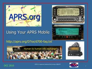
APRS and Ballooning Slides by Rick von Glahn, NØKKZ Edge of Space Sciences, Inc. www.eoss.org
APRS Automatic Position Reporting System Created by Bob Bruninga WB4APR
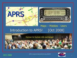
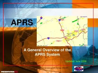
General APRS Concept • Exchange Location Precisely and Automatically via Radio • Map Location of Active APRS Stations • Track Moving Stations
Basic Components • Transceiver • Terminal Node Controller (TNC/Modem) • Computer • GPS (Global Positioning System Receiver) optional
Advanced Components • Currently Kenwood makes an HT that incorporates all basic components with the exception of the GPS receiver • Screen Shots Bearing (arrow in compass) and range the Maidenhead Grid Sq shown too The Latitude and Longitude of the received station
Data Transmissions • Each station programs their system to transmit their location • Location can be entered manually or automatically via an attached GPS receiver
Ballooning APRS Concept • Equip Balloon with an APRS station • Continuously beacon position and altitude • Ground stations receive data • Use to track balloon flight • I-gates Pass data into the Internet • Distant and non-amateur stations can track • Federal Aviation Administration Live tracking via Findu.com
Data Formats • APRS – Several Different Formats N0KKZ-3>APRS:@140003h3936.68N/10402.55WO063/008/A=005230 KG4YLM-11>TPSUVP,RELAY,WIDE:'pYnpr'/>$7R} • GPS – Several Different Formats GGA String W5VSI-11>APRS:$GPGGA,141740,3841.7501,N,09648.7576,W,1,05,1.06,448.9,M,-27.7,M,,*46 RMC String W5VSI-11>APRS:$GPRMC,144448,A,3842.0341,N,09648.8991,W,15.694,4.2,060702,5.2,E*51
APRS Decoded • Plain Text Version N0KKZ-3>APRS:@140003h3936.68N/10402.55WO063/008/A=005230 Altitude Speed Symbol Table Switch Course Symbol Time (UTC)14:00:03 Latitude (Degrees and Minutes) 39° 36.68 Minutes North Longitude104° 02.55 Min West
APRS Decoded • Compressed Version KG4YLM-11>TPSUVP,RELAY,WIDE:'pYnpr'/>$7R} No embedded timestamp Latitude = 40.593° N Longitude = -104.03316° W Altitude = 55,426.51 ft. Speed = 86 knots Course = 32.2° True
GPS Strings Decoded W5VSI-11>APRS:$GPGGA,144440,3842.0022,N,09648.8955,W,1,09,1.02,1307.5,M,-27.7,M,,*7B AltitudeMeters Latitude 38° 42.0022’ North Time (UTC)14:44:40 Longitude96° 48.8955’ West Speed(Knots) Course W5VSI-11>APRS:$GPRMC,144440,A,3842.0022,N,09648.8955,W,15.694,4.2,060702,5.2,E*51 Navigation Receiver Warning A=OK V=Warning Date 06-Jul-2002 Magnetic Variation 5.2° East
APRS Data Preferences • Plain Text over encoded unless time is critical • A human being can actually read and interpret the data without the further assistance of a computer • Embedded timestamps greatly assist in post flight computations • Altitude information is required
Programs • Many APRS programs are available • APRS-DOS • APRS-Plus (Aprs+SA) • UI-View • APRS-Point • WinAPRS • Many more • Tucson Amateur Packet Radio good source • www.tapr.org
Examples of APRS+SA • APRS+SA by Brent Hildebrand (KH2Z) • Decodes Most Formats of APRS data • Exports data to Delorme Street Atlas (+SA) for mapping • Displays Messages and Bulletins • Displays Weather
APRS+SA • Program Screen Shot
APRS+SA • Delorme Street Atlas Map of Data from APRS+SA
APRS+SA • Tracked Moving Station
Combining APRS and High Altitude Ballooning • APRS systems are placed on board the balloon and at Ground Stations • Allows in flight tracking of the progress of the balloon (both its location and altitude) • Greatly enhances probability of quick recovery of balloon systems
Using APRS+SA to Track • Screen Shot of the History Tab in APRS+SA showing the flight data
Delorme Street Atlas Map • The track of a balloon flight (black line) • Track is updated LIVE during the flight
I-Gating into the Internet • Local Aprs Station with Internet connection must … • Receive APRS Data via RF packet radio station • Relay that Position data into the internet via I-Gate software • UI-View very good I-Gate • APRS-Plus can also I-Gate
UI-View Gating into the Net • Stations being Igated are being displayed and recorded to a Log File
Getting APRS data from the Internet • Computer with an Internet connection • Either • APRS software • Web Browser
UI-View • While I-Gating UI-View can still receive data from both RF and the Internet • The CW#### stations are all on the internet only and are Citizen’s Weather Stations
Browser Display • Findu.Com display of N0KKZ-1 • Note Raw Packet and time received data at top of window
FAA Display • APRS reported position relative to VORs • Must be pre-arranged with Russ Chadwick (contact EOSS webmaster for info) • FAA Loves this capability in the Denver regional center
Conclusions • APRS greatly enhances the flight experience for observers at the ground station and for anyone monitoring the flight via APRS enabled radio/TNC/computer systems or via the internet • APRS gives greater confidence to both Flight Controllers and Tracking and Recovery coordinators with a more precise knowledge of the current balloon trajectory information • APRS can be used to keep FAA apprised of your payloads location live via the web (findu.com) • APRS increases accuracy and speed in the recovery process
Visitors are always delighted to watch the balloon’s live flight path via APRS
Balloon Systems Recovered Rapidly • Happy Tracking and Recovery Crew
Credits • Bob Bruninga (for APRS itself) • http://web.usna.navy.mil/~bruninga/aprs.html • Brent Hildebrand (for APRS+SA) • http://www.tapr.org/~kh2z/aprsplus/ • Roger Barker G4IDE SK (for UI-View) • http://www.ui-view.org • Delorme for Street Atlas • http://www.delorme.com • EOSS Tracking and Recovery Team • http://www.eoss.org/eoss_rdf/ This presentation is available at: http://www.eoss.org/aprs/