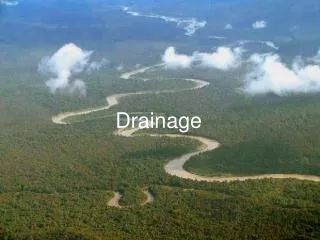
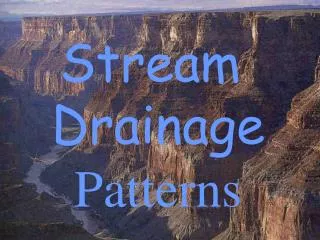
Stream Drainage Patterns
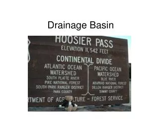
Stream Drainage Patterns. Start by reading the first page of the notes!. THE BEDROCK OF IN AN AREA WILL CAUSE STREAMS TO DRAIN IN A PATTERN. THAT CAN BE SEEN FROM OVER-HEAD (airplane). THESE ARE CALLED. DRAINAGE PATTERNS. Mississippi River Delta. C.

Stream Drainage Patterns
E N D
Presentation Transcript
Stream Drainage Patterns
THE BEDROCK OF IN AN AREA WILL CAUSE STREAMS TO DRAIN IN A PATTERN
THAT CAN BE SEEN FROM • OVER-HEAD (airplane). • THESE ARE CALLED DRAINAGE PATTERNS
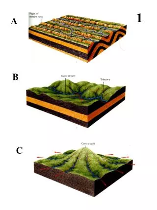
Match the geologic structures belowTo the drainage patterns they would create.
THISOCCURSWHEN: Rock resistance is all similar
Like the veins in a leaf • Horizontal rock layers • Most common
WATER FLOWS DOWN HILL FOLLOWING THE PATH OF LEAST RESISTANCE
THIS OCCURS IN THE AREA OF A STRUCTURAL DOME with rock layers of variable resistance surrounding the center of the dome C. WATER FLOWS IN THE PATH OF LEAST RESISTANCE
FOLLOWING THE PATH OF LEAST RESISTANCE
STAGES IN LANDSCAPE DEVELOPMENT: • THE MATURITY OF A LANDSCAPE DEPENDS UPON THE PORTION OF THE LAND THAT HAS BEEN WORN DOWN TO OR NEAR • BASE LEVEL (NOT SEA LEVEL)
YOUNG • 1.MUCH OF THE LAND AT HIGH ELEVATIONS • 2. STEEP HILL SLOPES • 3. FAST STREAMS • 4. DEEP V-SHAPED VALLEYS
MATURE • 1. ROUNDED HILL SLOPES (IF MOIST CLIMATE) • 2. STREAM VALLEYS ARE BROAD • 3. STREAMS BEGIN TO MEANDER
OLD • 1. MOSTLY ERODED TO BASE LEVEL • 2. STREAMS HAVE LOW SLOPE (GRADIENT) • 3. STREAMS MOVE SLOW & MEANDER • 4. FERTILE AND THICK SOIL HORIZON A
UPLIFT CAN CAUSE OLD LANDSCAPES TO BEREJUVINATED BACK TOYOUNG AGAIN
ENVIRONMENTAL PLANNING AND CONSERVATION CAN HELP TO PRESERVE OUR • SOIL,WATER,AND AIR
Notice how the rock types weather differently Differences in rock resistance creates varied and interesting landscapes. shale Which rock is least resistant?
THE INFLUENCE OF CLIMATE ON LANDSCAPE: gentle steep Fertile Thick A layer rocky Chemical due to Increased amount Of moisture Physical due to abrasion