Download
1 / 35
350 likes | 506 Views
Challenges in Earth Science Application Development for Grid Architectures. Dorian Gorgan Technical University of Cluj-Napoca dorian.gorgan@cs.utcluj.ro. Outline. Objectives and Issues SEE-GRID-SCI Project ESIP and gProcess platforms description EO Application Development Methodology

E N D
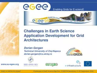
Challenges in Earth Science Application Development for Grid Architectures Dorian Gorgan Technical University of Cluj-Napoca dorian.gorgan@cs.utcluj.ro
Outline • Objectives and Issues • SEE-GRID-SCI Project • ESIP and gProcess platforms description • EO Application Development Methodology • GreenView application • GiSHEO Project • eGLE applications • EnviroGRIDS Project • Conclusions Challenges in Earth Science App Dev., EGEE'09 Barcelona, 21-25 September, 2009
Objectives and Issues • Explore huge spatial data (i.e. satellite images) to supply information on the earth surface, weather, clime, geographic areas, pollution, and natural phenomena • Support many variables based processing - satellite image type (e.g. MODIS, Landsat), geographic area, soil composition, vegetation cover, season, and context (e.g. clouds) • Develop tools and components to support the development of Grid oriented EO (Earth Observation) applications • Develop and experiment the EO Application Development Methodology • Flexible description, instantiation, scheduling and optimal execution of the Grid processing • Compatibility of EO projects: SEE-GRID-SCI, GENESI-DR, GiSHEO, EGEE, and EnviroGRIDS • Explore and experiment data availability and accessibility to GENESI-DR from remote Grid applications in terms of accessing policies, types, formats, services, data replication, transfer performance, granularity, consistency, and efficiency Challenges in Earth Science App Dev., EGEE'09 Barcelona, 21-25 September, 2009
Project: EnviroGRIDS Product: Grid SWAT, Appl’s Project: EGEE Product: Appl’s, Services, Tools Project: GiSHEO Product: eGLE Project: GENESI-DR Product: EO Services, Data Project: SEE-GRID-SCI Product: ESIP, GreenView Project: MedioGrid Product: gProcess Earth Observation Related Projects Challenges in Earth Science App Dev., EGEE'09 Barcelona, 21-25 September, 2009
ESIP Platform • ESIP - Environment Oriented Satellite Image Processing Platform • The Environment oriented Satellite Data Processing Platform (ESIP) is supported through the SEE-GRID-SCI (SEE-GRID eInfrastructure for regional eScience) FP7 project (2008-2010), funded by the European Commission, http://www.see-grid-sci.eu/ • Partners • ESIP Platform development: 1. Technical University of Cluj-Napoca (UTCN), ESIP coordinator 2. National Center for Information Technology (NCIT) Bucharest 3. West University of Timisoara (UVT) 4. ICI Bucharest, national coordinator of the SEE-GRID-SCI project Challenges in Earth Science App Dev., EGEE'09 Barcelona, 21-25 September, 2009
ESIP Features • ESIP layers on gProcess platform that is a set of satellite image oriented operators, services, and particular algorithms. • The gProcess platform is a collection of Grid services and tools providing the following basic functionality: • Visual manipulation based interactive description of the Grid based satellite image processing by pattern workflow (i.e. DAG) • Development of hypergraphs as a composition of basic operators, services, and subgraphs • Pattern workflow instantiation for particular satellite image • Satellite data management, access and visualization • Workflow based Grid execution • Process execution control and visualization • Optimal execution for appropriate mapping of the processing over the Grid resources Challenges in Earth Science App Dev., EGEE'09 Barcelona, 21-25 September, 2009
GreenView Appl. EO Appl’s . . . Application Oriented Level ESIP gProcess Platform Grid Infrastructure Process Description EO Data Image and Spatial Data Functional Levels • Data: satellite images (e.g. MODIS, Landsat, Ikonos and QuickBird); environmental data; diagrammatic process description. • Grid Infrastructure: middleware (Globus Toolkit 4, gLite). • gProcess Platform: service oriented architecture; collection of services providing creation, execution, and scheduling of the jobs; job resource management; access to image database; file transfer; data replication; workflow based execution; image processing. • ESIP: adds satellite image oriented operators, services, and particular algorithms. • Application Oriented Level: set of tools and components that support the development and the execution of the workflow based distributed processing. • EO Oriented Applications: pilot applications through which the user may access data, and particular processing and visualization. Challenges in Earth Science App Dev., EGEE'09 Barcelona, 21-25 September, 2009
Bands: NIR, RED Bands: NIR, SWIR Gond’s Water Detection Algorithm • Gond’s water detection algorithm Gond V., Bartholom E., Ouattara F., Nonguierma A. and Bado I. Surveillance et cartographie des plans d’eau et des zones humides et inondables en rgions arides avec l’instrument VEGETATION embarque sur Spot 4, International Journal of Remote Sensing, 2004, 25,5. pp. 987- 1004. • Landsat satellite image: SWIR (5), Red (3) and NIR (4) spectral bands Challenges in Earth Science App Dev., EGEE'09 Barcelona, 21-25 September, 2009
Input S2 OP3 Input SG Output OP1 Input OP2 S1 Input Hypergraphs The hypergraph is a complex graph that combines operators (OP), services (S) and subgraphs (SG). The subgraph could be a simple or complex graph. Inputs: Spectral bands in satellite images – MODIS, Landsat, QuickBird, etc OP examples: Add, Subtract, Blur, Sharpen, EdgeDetection, HistogramEq, PseudoColoring, Erosion, etc. Challenges in Earth Science App Dev., EGEE'09 Barcelona, 21-25 September, 2009
Web Service Composition • Design and implement a business workflow architectural model which allows the extension of the workflow description and execution tools in the Grid environment with Web service based computation nodes • Automatic discovery of Web services • Automatic binding of Web services • Semantic annotation • Composition of Web services based on templates • Automatic invocation of composed Web services from Grid environment Challenges in Earth Science App Dev., EGEE'09 Barcelona, 21-25 September, 2009
Service Composition Related Architecture Challenges in Earth Science App Dev., EGEE'09 Barcelona, 21-25 September, 2009
EO App Development Methodology • Algorithm identification and analysis • Data model definition • Identify atomic parts of the computation/algorithms • Parallel and serial processing • Atomic computation Implementation as services, procedures, distinct applications • Algorithm implementation • gProcess based process description • Workflow based description (i.e. PDG) • Workflow instantiation (i.e. iPDG) • Execution over Grid • Develop the application interface • Build up the GUI and link the interactive components to the Grid application entities Challenges in Earth Science App Dev., EGEE'09 Barcelona, 21-25 September, 2009
GreenView Application • GreenView - Refinement of surface and vegetation parameters in SEE region based on satellite images Research is supported by SEE-GRID-SCI (FP7) project, funded by the European Commission through the contract nr RI-211338. • Investigates the change of the vegetation distribution in the Carpathian Basin and its climate-related causes. The study could be extended to study the impact of urban environment on the vegetation. • GreenView application development partners: • UTCN, NCIT, UVT, and ICI (Romania) • Eötvös Loránd University (ELU) from Budapest (Hungary) • Research and Educational Networking Association of Moldova (RENAM) Acknowledgments: • Climate change data have been retrieved from the PRUDENCE data archive, funded by the EU through contract EVK2-CT2001-00132. • MODIS data have been produced and distributed by NASA through the EOS Data Gateway system. • Biome-BGC version 4.1.1 was provided by the Numerical Terradynamic Simulation Group (NTSG) at the University of Montana. NTSG assumes no responsibility for the proper use of Biome-BGC by others. Challenges in Earth Science App Dev., EGEE'09 Barcelona, 21-25 September, 2009
GreenView Pilot Application • Functionality: • Data interpolation • Model calibration • Uses the ESIP Platform • Inputs • satellite image types (MODIS, Landsat, Aster etc.) • Meteorological data • Field measurements Eddy covariance measurements for a particular geographical area Example: • The data model is defined by a MODIS satellite image representing a certain area of the Earth and temperature data values recorded in specific points inside the same area. • The resolution of the MODIS image is 1Km2 and the resolution of the temperature measurements is about 150Km2 Challenges in Earth Science App Dev., EGEE'09 Barcelona, 21-25 September, 2009
GreenView Application • Data interpolation • Computes data to an arbitrarily chosen grid defined by the user • fine to coarse resolution • coarse to fine resolution • Provides data series for a period chosen by the user, in time steps of the original data or averaged for a certain period • Model calibration • GPP (Gross Primary Production) the total amount of carbon taken up by vegetation via photosynthesis • Determination of GPP • Field measurements (eddy covariance technique) – accurate, but limited • MOD 17 product (algorithm is based on the BIOME-BGC ecosystem model) • Calibration and sensitivity analysis – based on BIOME BGC model • Period: 1997–2008, Monte Carlo method • Requires high computation resources → Grid computation • Post processing • Nonlinear inversion method Challenges in Earth Science App Dev., EGEE'09 Barcelona, 21-25 September, 2009
Web interface GreenView application Coarse to fine Fine to coarse GPP computing Client ESIP (gProcess) Client gProcess Platform Server GRID Infrastructure GreenView Related Architecture Challenges in Earth Science App Dev., EGEE'09 Barcelona, 21-25 September, 2009
{year, month} Pseudo-coloring Interpolation Output MODIS satellite image Coordinates conversion Temperature values GreenView - Coarse To Fine Interpolation GreenView is available on Internet: http://gisheo01.mediogrid.utcluj.ro:8095/interpolation_v2.1/ Challenges in Earth Science App Dev., EGEE'09 Barcelona, 21-25 September, 2009
GreenView - GPP Computation Challenges in Earth Science App Dev., EGEE'09 Barcelona, 21-25 September, 2009
GreenView - Results Challenges in Earth Science App Dev., EGEE'09 Barcelona, 21-25 September, 2009
GreenView - GPP Computation Challenges in Earth Science App Dev., EGEE'09 Barcelona, 21-25 September, 2009
Research project GiSHEO - On Demand Grid Services for Higher Education and Training in Earth Observation (http://gisheo.info.uvt.ro) Supported by ESA PECS Program (http://pecs.esa.int/) for the period of 2008-2010 Research team (Romania): • West University of Timisoara (UVT) • Technical University of Cluj-Napoca (UTCN) • Romanian Space Agency (ROSA) • National Institute for Space Research (INCAS) Challenges in Earth Science App Dev., EGEE'09 Barcelona, 21-25 September, 2009
General Objectives • Study the requirements and specifications for distance learning in Earth Observation training User requirements (i.e. professor, students), eLearning environment functional specifications, usability requirements, lesson structure, user interaction techniques. • Tools development over GRID Technology to enable the creation and the execution of lessons for Earth Observation Create specialized tools that take advantage of GRID capabilities in a transparent manner for the user (student or teacher) in order to allow the processing of massive data. • Creation of lessons templates in order to allow non-technical teachers to create lessons for Earth Observation Create templates that allow teachers specialized in Earth Observation, but with non-technical studies, to develop new lessons by using GRID advantages and large amounts of data (satellite images). • Use Earth Observation data and services provided by GENESI-DR. Explore and experiment data availability and accessibility to GENESI-DR from remote Grid applications in terms of: accessing policies, types, formats, services, data replication, transfer performance, granularity, consistency, and efficiency Challenges in Earth Science App Dev., EGEE'09 Barcelona, 21-25 September, 2009
Lesson Level GiSHEO eLearning Environment (eGLE) eLearning Oriented Level gProcess Platform Grid Infrastructure Process Description Patterns, Templates, Lessons, Teaching materials Image and Spatial Data Functional Levels in eGLE Architecture Challenges in Earth Science App Dev., EGEE'09 Barcelona, 21-25 September, 2009
Teaching materials of various topics and subjects. Teaching materials, tutorials Lesson Lesson description, execution, and management. Lesson patterns Lesson resources Workflow based process description. Process description Complex Services Service description, search, discovery and composition. Services, operations from GiSHEO, GENESI-DR, other ESA projects. Operation Operation Service Service Grid Infrastructure EO Data Spatial Data User Data eGLE - Data and Process Flow Challenges in Earth Science App Dev., EGEE'09 Barcelona, 21-25 September, 2009
gProcess Editor Lesson Scheduler Manager Viewer This is the content of the lesson. It exemplifies different pattern of the lesson content. This is the content of the lesson. It exemplifies different pattern of the lesson content. Executor Input Input Input Output workflow eGLE - Lesson Execution Challenges in Earth Science App Dev., EGEE'09 Barcelona, 21-25 September, 2009
EnviroGRIDS Project • EnviroGRIDS - Gridifying the Black Sea catchment to support its sustainable development • Founded by the European Commission FP7 framework (Theme 6:environment), April 2009 – March 2013 • 27 partners • Coordinator • University of Geneva, Switzerland Challenges in Earth Science App Dev., EGEE'09 Barcelona, 21-25 September, 2009
EnviroGRIDS Project 27 Challenges in Earth Science App Dev., EGEE'09 Barcelona, 21-25 September, 2009
Introduction Challenges in Earth Science App Dev., EGEE'09 Barcelona, 21-25 September, 2009
General Objectives • Gap analysis • Spatially explicit regional scenarios of development • Modeling of large scale, high resolution distributed hydrologic processes • Develop access to real time data from sensors and satellites • Streamlining the production of indicators on sustainability and vulnerability of societal benefits • Develop early warning and decision support tools at regional, national and local levels • Build capacities in the implementation of many new standards and frameworks Challenges in Earth Science App Dev., EGEE'09 Barcelona, 21-25 September, 2009
Grid Oriented Objectives and Tasks • Link, gather, store, manage and distribute key environmental data • Gridification of applications • Build capacities in the implementation of several new standards for sharing geospatial data. • Main references are GEOSS (Open Geospatial Consortium), OGS (Open Geospatial Consortium), and INSPIRE Directive (Infrastructure for Spatial Information in the European Community) Challenges in Earth Science App Dev., EGEE'09 Barcelona, 21-25 September, 2009
Gridification of Applications • Running hydrological model over the Grid 31 Challenges in Earth Science App Dev., EGEE'09 Barcelona, 21-25 September, 2009
EnviroGRIDS Portal VOMS Server Scenarios SWAT Server Metadata Catalogue DMS WMS CE CE CE SE SE SE EnviroGRIDS System Architecture Challenges in Earth Science App Dev., EGEE'09 Barcelona, 21-25 September, 2009
Web Portal Applications/ SWAT Scenarios Data Management Tools Decision Maker/ Citizen Tools Web and Grid Services Scheduling, Monitoring Security and User Management VOMS, authentication, authorization, credential management Data Management Data access, transfer, replication, storage metadata, catalogues SWAT Management and Execution Workflow Management Edit, service composition, Grid mapping, execution, fault recovering Spatial Data Acquisition, processing, Visualization, mapping gLite Middleware Grid Infrastructure • Spatial data, catalogues, maps • Application data (hydrology, clime, soil, etc.) • Scenarios • Results of processing Data Repositories EnviroGRIDS Functional Layers Challenges in Earth Science App Dev., EGEE'09 Barcelona, 21-25 September, 2009
Conclusions • ESIP and gProcess platforms develop and experiment solutions to access and use efficiently GENESI-DR data and services • gProcess based Earth Observation Application Development Methodology supports the using GENESI-DR data and services in Grid applications • ESIP and gProcess will use spatial data and services provided by the GENESI-DR project, and will be basic platforms for the GISHEO (ESA-PECS) and EnviroGRIDS (FP7) projects • GENESI-DR repositories contains huge quantities of data. More efficient and user oriented approaches for data searching and discovering have to be explored and developed • The research projects and the developers need a GENESI-DR structure of pilot data repositories just for development and on-line tests. The pilot repositories must be resident on the same sites of GENESI-DR data providers. Data must be accessed through secured ways (i.e. certificates to access Portal and distributed repositories), and similar policies, as any other production data Challenges in Earth Science App Dev., EGEE'09 Barcelona, 21-25 September, 2009
Many thanks. Questions Dorian Gorgan Computer Science Department Technical University of Cluj-Napoca dorian.gorgan@cs.utcluj.ro