Download
1 / 26
260 likes | 360 Views
Learn about the Missouri leaf-off Orthoimagery Project from 2007-2009, the process, data access, future plans, and the significance of Orthoimages & DOQQs in GIS applications.

E N D
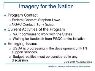
Imagery for the StateThe Missouri leaf-off Orthoimagery Project 2007-2008-2009 Ray Fox USGS Geospatial Liaison to Missouri Chair-MGISAC Data Development Subcommittee rfox@usgs.gov MGISAC North-East Workshop Oct 26, 2009
Two Foot Resolution MGISAC North-East Workshop Oct 26, 2009
What we need to cover(some material courtesy of Surdex) • What is an orthophoto, and a quarter-quadrangle • Imagery for the State, • how it came about • What we got • How to access the data • Buy – Up options still exist • Plans for future state-wide acquisitions MGISAC North-East Workshop Oct 26, 2009
BIG NEWS!!!! • As of October 14, 2009 all deliveries have been accepted. We are done • Thanks to the GIO office for managing the project. • Thanks to the USGS NGTOC and MoDOT for the acceptance work. • Thanks to Surdex for being such a good partner. MGISAC North-East Workshop Oct 26, 2009
What is an Orthoimage? The FGDC “Framework Introduction and Guide” explains that “Orthoimagery provides a positionally correct image of the earth. An orthoimage is a georeferenced image prepared from an aerial photograph or other remotely sensed data from which displacements of images caused by sensor orientation and terrain relief have been removed.”[1] [1] Page 18, “Framework Introduction and Guide,” Federal Geographic Data Committee, Washington D.C., 1997. MGISAC North-East Workshop Oct 26, 2009
What is a DOQQ? A DOQ is an orthoimage fit to the USGS 7.5 minute quadrangle. The DOQQ is a higher resolution image that encompasses ¼ of a 7.5-minute quadrangle (DOQQ means Digital Orthophoto Quarter Quadrangle). The Missouri Imagery for the State Project is in the DOQQ format. MGISAC North-East Workshop Oct 26, 2009
USGS Quarter-Quadrangle MGISAC North-East Workshop Oct 26, 2009
Characteristics of a DOQQ • Digital aerial photos that have been rectified so they can be used like a map • Meet the National Map Accuracy Standards for 1:12,000 scale • Used as a base map for many applications - most accurate, up to date base map readily available MGISAC North-East Workshop Oct 26, 2009
Components Digitally scanned aerial photograph Digital Orthophoto Digital Elevation Model Camera Position/Orientation Data Known Ground Positions Automated Rectification Process MGISAC North-East Workshop Oct 26, 2009
How it all came about • The need for state-wide orthoimagery for Missouri was identified as a primary requirement by the Missouri GIS Advisory Committee (MGISAC). • A Data Development Sub-Committee was formed and held its first open meeting on July 8, 2004 in Rolla. MGISAC North-East Workshop Oct 26, 2009
Orthoimagery in Missouri • Missouri had leaf off black and white digital quarter-quadrangle orthophotos last made in 1995-96 • TheNational Aerial Imagery Program or NAIP has been flown for Missouri since 2003. This imagery is leaf-on, flown for the USDA. • These products are one-meter pixel MGISAC North-East Workshop Oct 26, 2009
State and Federal Requirements • While the State was receiving the NAIP imagery, many agencies needed leaf-off imagery for their work. • The USGS also needed leaf-off imagery. • The one meter imagey is acceptable for both partners but we also wanted to meet the needs of local government if possible MGISAC North-East Workshop Oct 26, 2009
First Efforts • Regional Planning Commissions engaged to help gather requirements from local government. • On line questionnaire developed by MSDIS. RPC’s sent letters and email to local governments asking them to participate in questionnaire MGISAC North-East Workshop Oct 26, 2009
MGISAC North-East Workshop Oct 26, 2009
Desire to meet the needs • The contract was not ready in time for the 2007 flight. • Plan was to allow local government to utilize the contract for their imagery. • Surdex had an existing State contract with MoDOT which was used in 2007. • Surdex proposed a 2 foot product for minimal extra cost. MGISAC North-East Workshop Oct 26, 2009
Moving On • In 2008 a Request for Proposals was let by the state with options for local government to be able to utilize the contract. • Surdex won the award and began flying the western side of the state, again at the two foot resolution. MGISAC North-East Workshop Oct 26, 2009
Promoting the Opportunity • The MGISAC Data Development Committee realized that the word had not gotten out on use of the contract by local government. • Members spoke at meetings across the state and wrote three white papers on the project MGISAC North-East Workshop Oct 26, 2009
The Missouri Orthophotography Project First of a series How to Participate Second in a Series Funding Strategies Third in a Series MGISAC North-East Workshop Oct 26, 2009
Western Side Challenges • We were once again late in having the contract awarded which shortened the flying season • Missouri enjoyed spring floods and an ice storm which made collection even more challenging. • As a result we ran out of time and the project had to be extended to 2009. MGISAC North-East Workshop Oct 26, 2009
Data Availability http://www.msdis.missouri.edu/ MGISAC North-East Workshop Oct 26, 2009
Data Availability, cont. MGISAC North-East Workshop Oct 26, 2009
Other Information • The buy up option has been extended through 2010. Several local governments are taking advantage of this • All buy-up options are handled directly by Surdex. • Please let the GIO office know if you intend on using the State contract MGISAC North-East Workshop Oct 26, 2009
The Future? • Imagery has a short shelf life. Things change quickly and new imagery is needed. • We are working on developing a cyclic program, which is a challenge in these budget times. • Desire was to embark on another round this year but it probably won’t happen that fast. MGISAC North-East Workshop Oct 26, 2009
MGISAC North-East Workshop Oct 26, 2009
How to stay in touch • Go to the MGISAC webpage at http://www.mgisac.org • Contacts: • Tim Haithcoat, GIO for Missouri at haithcoatt@missouri.edu • Ray Fox, USGS Geospatial Liaison to Missouri at rfox@usgs.gov • Mark Duewell, MSDIS GIS Project Manager at duewellm@missouri.edu MGISAC North-East Workshop Oct 26, 2009
State Capital MGISAC North-East Workshop Oct 26, 2009