Download
1 / 28
280 likes | 475 Views
Imagery for the Nation. Alaska Statewide Digital Mapping Initiative Imagery Workshop. Vicki Lukas U.S. Geological Survey March 3, 2009. The Vision.

E N D
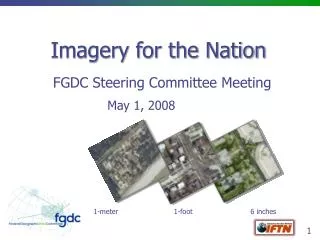
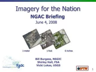
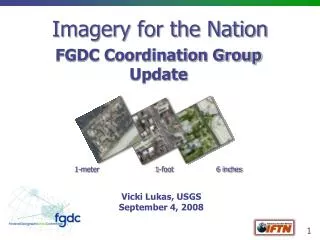
Imagery for the Nation Alaska Statewide Digital Mapping Initiative Imagery Workshop Vicki Lukas U.S. Geological Survey March 3, 2009
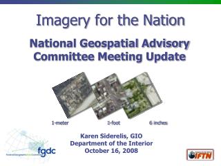
The Vision The Nation will have a sustainable and flexible program to produce multi-resolution imagery of the country that meets the needs of local, state, regional, tribal and Federal agencies.
Imagery for the Nation (IFTN) History Concept proposed in 2004 at NSGIC Annual Conference, proposal unveiled at the NSGIC 2005 Annual Conference FGDC requested the National Digital Orthophoto Program (NDOP) to review IFTN proposal and develop a business plan and funding strategy Joint NDOP/NSGIC Committee began to explore administrative issues related to a national program between federal, state, and local agencies Cost Benefit Analysis was performed; NDOP unanimously agreed upon a program configuration in Oct., 2007
FGDC Executive Level and IFTN April, 2008 First FGDC Executive Committee meeting May, 2008 FGDC Steering Committee agrees to pursue IFTN and defines Executive Champion roles June, 2008 National Geospatial Advisory Committee endorses IFTN with a list of issues June, 2008 First meeting of IFTN Executive Champions to kick off the project August, 2008 DOI Secretary Kempthorne articulates government commitment to IFTN at ESRI Users Conference
IFTN Project Structure Acting Chair Karen Siderelis DOI (FGDC Chair) Project Manager Vicki Lukas USGS Technical Plan Funding Strategy Contracting Strategy Hosting and Archiving Partnership Strategy Guidance and Direction Communi-cation Strategy Executive Champions (FGDC Executive Committee) Jerry Johnston Acting EPA Karen Siderelis Acting DOI Stephen Lowe USDA Steve Wallach NGA Joe Klimavicz DOC Dominic Sale OMB Chuck Gay NASA Kari Craun USGS Geoff Gabbott USDA Doug Binnie USGS Kent Williams USDA Shirley Hall USDA Jim Mauck USGS Vicki Lukas USGS John Mahoney FGDC Pat Phillips FGDC TBD DOI Chairs
IFTN Phase 1 Project Goals • Accomplish a few near-term steps to move existing Federal programs towards IFTN goals while developing a more comprehensive plan for IFTN • Comprehensively document Federal imagery requirements and expenditures • Begin to institutionalize imagery funding – move from the “tin cup” approach of project-based funding to reliable funding at the executive level • Model a process for Federal enterprise geospatial data acquisition efforts • Complete Phase 1 by end of calendar year 2008 (new timeframes being developed to adjust to ExCom guidance and transition)
Phase 1 Outcomes Accomplish a few near-term steps to move existing imagery programs towards IFTN goals • NAIP – Institutionalize funding • STATUS: MOU between USDA and DOI in work • Urban Area Imagery – Broaden the requirements and planning process • STATUS: Being addressed as part of high-resolution strategy
Phase 1 Outcomes Draft a more comprehensive plan for implementing IFTN across the Federal enterprise in partnership with state and local government • STATUS - DRAFT Plan was presented to the ExCom in December • Executives provided additional guidance on high-resolution strategy and governance
Project Assumptions • IFTN is a Federal program conducted in partnership with state and local government • IFTN will address the Federal enterprise, to include all FGDC member agencies • The project builds upon USDA’s National Agriculture Imagery Program (NAIP) and the USGS-NGA Urban Area Imagery Partnership (UAIP) • Depending on the documented requirements, the 1 meter program will be managed by USDA, and high resolution by USGS • IFTN data will be in the public domain (with flexibility for exceptions or new solutions) • Considering both aerial and satellite solutions
High-Resolution Requirements & Strategy • FGDC Steering Committee approved ExCom recommendation to remove Federal funding for 6” imagery and offer it as a buy-up option of 1-foot • ExCom guidance is to develop a process that addresses high-resolution requirements by geography: WHERE? • ExCom directed the Technical Plan Work Group to define a process and initial criteria for prioritizing Federal requirements • Process can be used regardless of funding levels and can be piloted to fulfill Outcome 1 goal to improve high-resolution coordination within existing funding
Governance – Preliminary Concepts • Establish an IFTN governance body to include a delegate of each agency to authoritatively report requirements and specific justifications • Incorporate FGDC 50 States/imagery plans into the process; ensure an open and transparent process and forum to align Federal and State priorities • Annual priorities recommendation would be presented for discussion/approval by the governance body to the ExCom • ExCom asked NDOP to evolve to the IFTN governance body; NDOP agreed to formalize the relationship by modifying the charter to become a FGDC sub-committee
Next Steps • Continue refining high-resolution and governance strategies • Looking at how to refine the plan for Alaska • Present contracting strategy to ExCom at March 10 meeting for review and guidance • Present hosting and archiving strategies to ExCom next • Outreach to incoming executives • Develop new timeframes for completion of Phase 1 • Enhance Funding Strategy and Communications • Plan for Federal and NGAC reviews • Provide detailed overviews to community via WebEx
IFTN and Alaska • Current draft includes estimates as a placeholder, based on aerial costs • Goal is to refine to plan and present it to the ExCom
IFTN and Alaska • Is 1-meter the appropriate resolution for statewide coverage? • Can we establish requirements, by geography? • What are the costs of the full plan? • Is there a phased approach that can be taken? • How do we address the elevation issue?
IFTN and Alaska: Requirements • A primary goal has been to document Federal imagery requirements to either validate or refine the IFTN vision (State and local needs were analyzed by NSGIC in 2006: survey was advertised to NSGIC reps, URISA and in ArcNews) • A Federal IFTN requirements survey was conducted in fall, but received only a small number of AK-based responses • In order to obtain more robust feedback, the survey was recently reopened to collect AK Federal requirements – open 1 week, closed Feb. 17 • Data have not been fully assessed, preliminary results follow
73 Respondents from 24 Agencies • National Park Service = 18 • U.S. Geological Survey • Alcohol, Tobacco, Firearms, and Explosives • Federal Bureau of Investigation • Federal Aviation Administration • Pacific Air Forces • Space Command • Army • U.S. Army Corps of Engineers • Pacific Command • National Geospatial-Intelligence Agency • Advisory Council on Historic Preservation • General Services Administration • Forest Service • Grain Inspection, Packers and Stockyards Administration • Natural Resources Conservation Service • Bureau of Industry and Security • National Marine Fisheries • National Oceanic & Atmospheric Administration • Federal Emergency Management Agency • DHS Preparedness Directorate • U.S. Customs and Border Protection • U.S. Immigration and Customs Enforcement • Bureau of Land Management • Fish & Wildlife Service
What the surveys don’t tell us • Geographic areas for each use case and resolution • Specific justifications • Executives cannot justify expenditures without this information
Next Steps for IFTN for Alaska • Like the national process, more specifically define Federal priorities in terms of geographic areas • State and other needs? • Define the tiered approach holistically, how to meet 1-meter and higher needs while providing statewide coverage • Consider elevation
Imagery Program that Meets the Needs of Multiple Users: LESSONS LEARNED • Governance is critical – inclusive body to develop an enterprise approach, advisory and executive committees to review and approve • Requirements need to be comprehensive (survey with uneven reporting will not hold up to scrutiny for a long-term program) • Design solution to meet the requirements, not the other way around • Balance near-term goals and documenting the larger overall plan
THANK YOU Discussion / Questions?